Property Record
621 De Votie Ave, Cincinnati, OH 45225
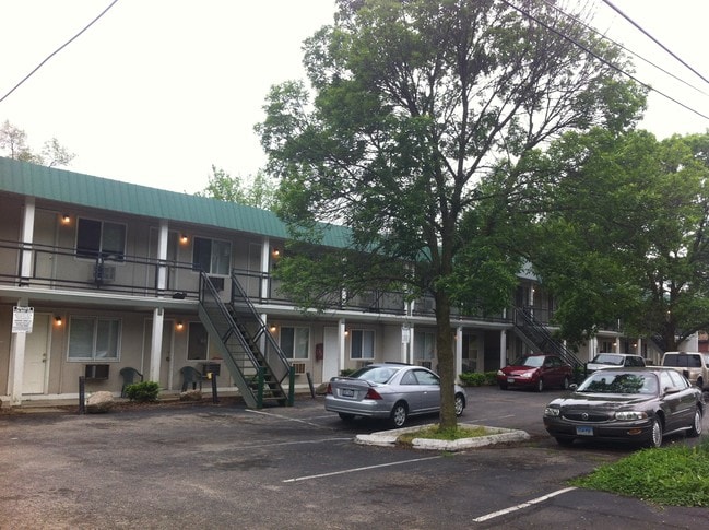

Property Detail
621 De Votie Ave
Cincinnati, OH-KY-IN
DE VOTIE AVE 150 X 150 IRR PT LOT 60 RIDDLES SUB
101-0003-0040
Hamilton
Commercialacreage
Ohio
RM20
60
B and X Area of moderate flood hazard, usually the area between the limits of the 100-year and 500-year floods.
0.52 AC
2025
Clifton
2025
Cincinnati/Dayton
002901
NEARBY LISTINGS FOR SALE OR LEASE
DEMOGRAPHICS near 621 De Votie Ave
1 mile
3 mile
5 mile
2025 Total Population
28,450
152,756
355,339
2030 Population
29,092
157,550
363,556
Pop Growth 2025-2030
+ 2.26%
+ 3.14%
+ 2.31%
Average Age
30
35
37
2025 Total Households
9,930
67,058
156,577
HH Growth 2025-2030
+ 2.80%
+ 3.35%
+ 2.43%
Median Household Inc
$41,491
$47,028
$55,279
Avg Household Size
2.00
2.00
2.10
2025 Avg HH Vehicles
2.00
1.00
1.00
Median Home Value
$274,999
$254,849
$223,946
Median Year Built
1950
1949
1950
Nearby Places
Map Layers
Map Styles
 Street
 Aerial
Transit
 Traffic
 Biking
Places
Listings with unknown addresses are not visible on the map
- Restaurants
- Banks
- Shops
- Fitness
- Groceries
PUBLIC TRANSPORTATION
COMMUTER RAIL
Cincinnati Union Terminal (Cardinal - Amtrak)
Drive
Walk
Distance
Cincinnati Union Terminal (Cardinal - Amtrak)
7 min
2.2 mi
AIRPORT
Cincinnati/Northern Kentucky International
Drive
Walk
Distance
Cincinnati/Northern Kentucky International
31 min
17.5 mi
Freight Ports
Port of Toledo
Drive
Walk
Distance
Port of Toledo
239 min
203.9 mi
SALE & LEASE HISTORY
LISTING DATE
SALE/LEASE

Jun 28, 2018
For Sale
Jun 02, 2022
For Sale
Jul 25, 2018
For Sale
Aug 24, 2018
For Sale
Nearby Properties
Address
Land Use
TOTAL SIZE
Lot Size
Zoning
Address
Land Use
TOTAL SIZE
Lot Size
Zoning
77.73 AC
IR
Address
Land Use
TOTAL SIZE
Lot Size
Zoning
6.35 AC
IR
Address
Land Use
TOTAL SIZE
Lot Size
Zoning
39.99 AC
MG
Address
Land Use
TOTAL SIZE
Lot Size
Zoning
11.82 AC
Address
Land Use
TOTAL SIZE
Lot Size
Zoning
11.62 AC
Address
Land Use
TOTAL SIZE
Lot Size
Zoning
19.36 AC
Address
Land Use
TOTAL SIZE
Lot Size
Zoning
17.10 AC
DD
Address
Land Use
TOTAL SIZE
Lot Size
Zoning
1.97 AC
DD
Address
Land Use
TOTAL SIZE
Lot Size
Zoning
11.41 AC
IR
Address
Land Use
TOTAL SIZE
Lot Size
Zoning
22.45 AC
Address
Land Use
TOTAL SIZE
Lot Size
Zoning
3.09 AC
Address
Land Use
TOTAL SIZE
Lot Size
Zoning
2.80 AC
IR
Address
Land Use
TOTAL SIZE
Lot Size
Zoning
3.40 AC
IR
Address
Land Use
TOTAL SIZE
Lot Size
Zoning
Address
Land Use
TOTAL SIZE
Lot Size
Zoning
3.51 AC
DD
Address
Land Use
TOTAL SIZE
Lot Size
Zoning
Address
Land Use
TOTAL SIZE
Lot Size
Zoning
2.46 AC
Address
Land Use
TOTAL SIZE
Lot Size
Zoning
7.14 AC
Address
Land Use
TOTAL SIZE
Lot Size
Zoning
Address
Land Use
TOTAL SIZE
Lot Size
Zoning
844,128 SF
1.22 AC
DD
Address
Land Use
TOTAL SIZE
Lot Size
Zoning
0.43 AC
DD
Address
Land Use
TOTAL SIZE
Lot Size
Zoning
4.46 AC
DD
Address
Land Use
TOTAL SIZE
Lot Size
Zoning
0.91 AC
DD
Address
Land Use
TOTAL SIZE
Lot Size
Zoning
13.32 AC
Address
Land Use
TOTAL SIZE
Lot Size
Zoning
16.67 AC
IR
Address
Land Use
TOTAL SIZE
Lot Size
Zoning
28,160 SF
1 AC
DD
Address
Land Use
TOTAL SIZE
Lot Size
Zoning
1.17 AC
Address
Land Use
TOTAL SIZE
Lot Size
Zoning
9.38 AC
PR
Address
Land Use
TOTAL SIZE
Lot Size
Zoning
1.21 AC
DD
Address
Land Use
TOTAL SIZE
Lot Size
Zoning
2.16 AC
DD
The World's #1 Commercial Real Estate Marketplace
Connect with us
© 2026 CoStar Group
The information above has been obtained from sources believed reliable. While we do not doubt its accuracy we have not verified it and make no guarantee, warranty or representation about it. It is your responsibility to independently confirm its accuracy and completeness. Any projections, opinions, assumptions, or estimates used are for example only and do not represent the current or future performance of the property. The value of this transaction to you depends on tax and other factors which should be evaluated by your tax, financial, and legal advisors. You and your advisors should conduct a careful, independent investigation of the property to determine to your satisfaction the suitability of the property for your needs.