Property Record
621 Dyer Bridge Rd, Ringgold, GA 30736
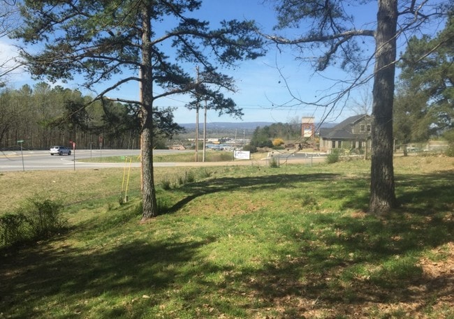

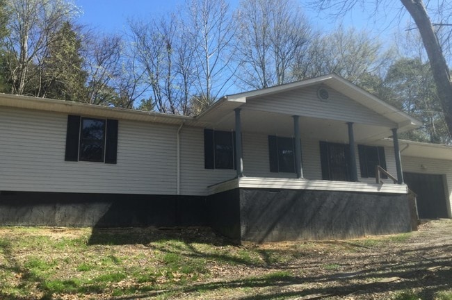

Property Detail
621 Dyer Bridge Rd
0013B-034-00A
TRACT 2 BUTLER PROPERTY SURVEY
Residentialacreage
Catoosa
FOR C-1
Georgia
B and X Area of moderate flood hazard, usually the area between the limits of the 100-year and 500-year floods.
tr 2
2025
0.62 AC
2025
Catoosa County
030404
Chattanooga
2,054 SF
Chattanooga, TN-GA
NEARBY LISTINGS FOR SALE OR LEASE
DEMOGRAPHICS near 621 Dyer Bridge Rd
1 mile
3 mile
5 mile
2025 Total Population
2,147
23,098
71,210
2030 Population
2,198
23,273
72,362
Pop Growth 2025-2030
+ 2.38%
+ 0.76%
+ 1.62%
Average Age
43
42
41
2025 Total Households
827
9,192
28,604
HH Growth 2025-2030
+ 2.42%
+ 0.72%
+ 1.69%
Median Household Inc
$71,785
$65,979
$65,499
Avg Household Size
2.60
2.50
2.40
2025 Avg HH Vehicles
2.00
2.00
2.00
Median Home Value
$275,640
$243,480
$235,880
Median Year Built
1995
1990
1983
Nearby Places
Map Layers
Map Styles
 Street
 Aerial
Layers
 Traffic
 Biking
Places
Listings with unknown addresses are not visible on the map
- Restaurants
- Banks
- Shops
- Fitness
- Groceries
PUBLIC TRANSPORTATION
AIRPORT
Lovell Field
Drive
Walk
Distance
Lovell Field
21 min
10.2 mi
Freight Ports
Georgia Ports - Savannah
Drive
Walk
Distance
Georgia Ports - Savannah
394 min
353.9 mi
SALE & LEASE HISTORY
LISTING DATE
SALE/LEASE

Sep 24, 2016
For Sale
Dec 13, 2018
For Sale
Nearby Properties
Address
Land Use
TOTAL SIZE
Lot Size
Zoning
Address
Land Use
TOTAL SIZE
Lot Size
Zoning
72,340 SF
105.70 AC
FOR R-1
Address
Land Use
TOTAL SIZE
Lot Size
Zoning
158,769 SF
116.55 AC
A-1
Address
Land Use
TOTAL SIZE
Lot Size
Zoning
31,510 SF
49.16 AC
PUD
Address
Land Use
TOTAL SIZE
Lot Size
Zoning
34,862 SF
63.85 AC
A-1
Address
Land Use
TOTAL SIZE
Lot Size
Zoning
233,109 SF
18.99 AC
FOR C-1
Address
Land Use
TOTAL SIZE
Lot Size
Zoning
133,447 SF
17.65 AC
FOR C-2
Address
Land Use
TOTAL SIZE
Lot Size
Zoning
2,299 SF
7.03 AC
C-R
Address
Land Use
TOTAL SIZE
Lot Size
Zoning
2,210 SF
11.33 AC
FOR R-5
Address
Land Use
TOTAL SIZE
Lot Size
Zoning
139,638 SF
16.69 AC
FOR C-2
Address
Land Use
TOTAL SIZE
Lot Size
Zoning
58,911 SF
12.37 AC
FOR C-2
Address
Land Use
TOTAL SIZE
Lot Size
Zoning
130,515 SF
18.78 AC
FOR C-1
Address
Land Use
TOTAL SIZE
Lot Size
Zoning
101,298 SF
14 AC
FOR C-2
Address
Land Use
TOTAL SIZE
Lot Size
Zoning
196,132 SF
25.97 AC
FOR C-2
Address
Land Use
TOTAL SIZE
Lot Size
Zoning
87,796 SF
3.15 AC
FOR C-2
Address
Land Use
TOTAL SIZE
Lot Size
Zoning
2,172 SF
13.95 AC
FOR R-3
Address
Land Use
TOTAL SIZE
Lot Size
Zoning
67,304 SF
0.63 AC
C-1
Address
Land Use
TOTAL SIZE
Lot Size
Zoning
4,700 SF
9.80 AC
R-1
Address
Land Use
TOTAL SIZE
Lot Size
Zoning
31,891 SF
25.91 AC
C-1
Address
Land Use
TOTAL SIZE
Lot Size
Zoning
5,040 SF
6.29 AC
RIN C-2
Address
Land Use
TOTAL SIZE
Lot Size
Zoning
72,123 SF
13.84 AC
RIN I-1
Address
Land Use
TOTAL SIZE
Lot Size
Zoning
67,897 SF
12 AC
R-1
Address
Land Use
TOTAL SIZE
Lot Size
Zoning
87,524 SF
10.22 AC
C-R
Address
Land Use
TOTAL SIZE
Lot Size
Zoning
5,100 SF
13.10 AC
FOR R-5
Address
Land Use
TOTAL SIZE
Lot Size
Zoning
63,406 SF
9.81 AC
SZ
Address
Land Use
TOTAL SIZE
Lot Size
Zoning
4,096 SF
4.96 AC
FOR PM
Address
Land Use
TOTAL SIZE
Lot Size
Zoning
2,400 SF
6.25 AC
FOR PM
Address
Land Use
TOTAL SIZE
Lot Size
Zoning
51,309 SF
5.77 AC
FOR C-2
Address
Land Use
TOTAL SIZE
Lot Size
Zoning
46,288 SF
2.40 AC
RIN C-2
Address
Land Use
TOTAL SIZE
Lot Size
Zoning
85,800 SF
1.34 AC
FOR C-1
Address
Land Use
TOTAL SIZE
Lot Size
Zoning
67,739 SF
8.90 AC
FOR C-2
The World's #1 Commercial Real Estate Marketplace
Connect with us
© 2026 CoStar Group
The information above has been obtained from sources believed reliable. While we do not doubt its accuracy we have not verified it and make no guarantee, warranty or representation about it. It is your responsibility to independently confirm its accuracy and completeness. Any projections, opinions, assumptions, or estimates used are for example only and do not represent the current or future performance of the property. The value of this transaction to you depends on tax and other factors which should be evaluated by your tax, financial, and legal advisors. You and your advisors should conduct a careful, independent investigation of the property to determine to your satisfaction the suitability of the property for your needs.