Property Record
621 E Oglethorpe Blvd, Albany, GA 31705
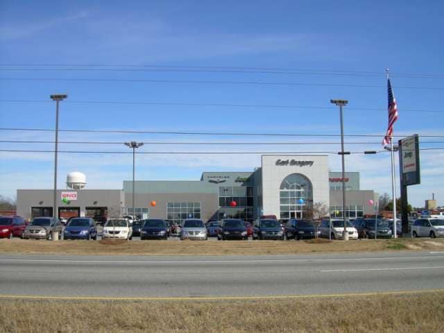

Property Detail
621 E Oglethorpe Blvd
0000C-00041-002
LOT 2 A D P D A SUBDIVISION
Vehiclerentalsvehiclesales
DOUGHERTY
C-3
Georgia
B and X Area of moderate flood hazard, usually the area between the limits of the 100-year and 500-year floods.
2
2025
9.96 AC
2025
Albany/Southwest
011600
Other Market Areas
28,713 SF
Albany, GA
NEARBY LISTINGS FOR SALE OR LEASE
DEMOGRAPHICS near 621 E Oglethorpe Blvd
1 mile
3 mile
5 mile
2025 Total Population
4,955
32,469
63,201
2030 Population
4,933
32,215
62,415
Pop Growth 2025-2030
(0.44%)
(0.78%)
(1.24%)
Average Age
33
37
38
2025 Total Households
1,766
12,936
25,828
HH Growth 2025-2030
(0.45%)
(0.76%)
(1.32%)
Median Household Inc
$17,327
$30,013
$41,721
Avg Household Size
2.40
2.30
2.30
2025 Avg HH Vehicles
1.00
1.00
1.00
Median Home Value
$59,018
$78,418
$129,435
Median Year Built
1969
1966
1971
Nearby Places
Map Layers
Map Styles
 Street
 Aerial
Transit
 Traffic
 Biking
Places
Listings with unknown addresses are not visible on the map
- Restaurants
- Banks
- Shops
- Fitness
- Groceries
PUBLIC TRANSPORTATION
AIRPORT
Southwest Georgia Regional
Drive
Walk
Distance
Southwest Georgia Regional
13 min
5.7 mi
Freight Ports
Port of Panama City
Drive
Walk
Distance
Port of Panama City
233 min
159.9 mi
Nearby Properties
Address
Land Use
TOTAL SIZE
Lot Size
Zoning
Address
Land Use
TOTAL SIZE
Lot Size
Zoning
Address
Land Use
TOTAL SIZE
Lot Size
Zoning
34,888 SF
164.47 AC
M-2
Address
Land Use
TOTAL SIZE
Lot Size
Zoning
58.86 AC
C-3
Address
Land Use
TOTAL SIZE
Lot Size
Zoning
51,008 SF
19.48 AC
C-5
Address
Land Use
TOTAL SIZE
Lot Size
Zoning
1.77 AC
C-2
Address
Land Use
TOTAL SIZE
Lot Size
Zoning
15.20 AC
C-2
Address
Land Use
TOTAL SIZE
Lot Size
Zoning
2.53 AC
C-2
Address
Land Use
TOTAL SIZE
Lot Size
Zoning
1.75 AC
C-2
Address
Land Use
TOTAL SIZE
Lot Size
Zoning
0.83 AC
C-2
Address
Land Use
TOTAL SIZE
Lot Size
Zoning
141,600 SF
45.43 AC
C-1
Address
Land Use
TOTAL SIZE
Lot Size
Zoning
77,688 SF
2.93 AC
C-3
Address
Land Use
TOTAL SIZE
Lot Size
Zoning
70,596 SF
2.38 AC
C-2
Address
Land Use
TOTAL SIZE
Lot Size
Zoning
232,840 SF
49.88 AC
M-1
Address
Land Use
TOTAL SIZE
Lot Size
Zoning
9,000 SF
184.88 AC
M-2
Address
Land Use
TOTAL SIZE
Lot Size
Zoning
382,331 SF
30.50 AC
M-1
Address
Land Use
TOTAL SIZE
Lot Size
Zoning
87,288 SF
1.22 AC
C-5
Address
Land Use
TOTAL SIZE
Lot Size
Zoning
155,970 SF
20.89 AC
C-3
Address
Land Use
TOTAL SIZE
Lot Size
Zoning
0.54 AC
C-2
Address
Land Use
TOTAL SIZE
Lot Size
Zoning
9.37 AC
C-3
Address
Land Use
TOTAL SIZE
Lot Size
Zoning
8 AC
M-1
Address
Land Use
TOTAL SIZE
Lot Size
Zoning
475,976 SF
51.30 AC
M-1
Address
Land Use
TOTAL SIZE
Lot Size
Zoning
23,040 SF
10.59 AC
C-R
Address
Land Use
TOTAL SIZE
Lot Size
Zoning
0.52 AC
C-2
Address
Land Use
TOTAL SIZE
Lot Size
Zoning
98,560 SF
19.64 AC
C-R
Address
Land Use
TOTAL SIZE
Lot Size
Zoning
13,958 SF
15 AC
M-1
Address
Land Use
TOTAL SIZE
Lot Size
Zoning
30,336 SF
19.19 AC
C-R
Address
Land Use
TOTAL SIZE
Lot Size
Zoning
10,608 SF
45.66 AC
M-1
Address
Land Use
TOTAL SIZE
Lot Size
Zoning
127,194 SF
15.01 AC
C-2
Address
Land Use
TOTAL SIZE
Lot Size
Zoning
89,370 SF
7.78 AC
C-5
The World's #1 Commercial Real Estate Marketplace
Connect with us
© 2026 CoStar Group
The information above has been obtained from sources believed reliable. While we do not doubt its accuracy we have not verified it and make no guarantee, warranty or representation about it. It is your responsibility to independently confirm its accuracy and completeness. Any projections, opinions, assumptions, or estimates used are for example only and do not represent the current or future performance of the property. The value of this transaction to you depends on tax and other factors which should be evaluated by your tax, financial, and legal advisors. You and your advisors should conduct a careful, independent investigation of the property to determine to your satisfaction the suitability of the property for your needs.