Property Record
621 Highway 71 N, Alma, AR 72921
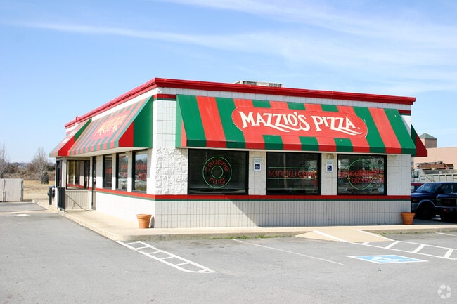

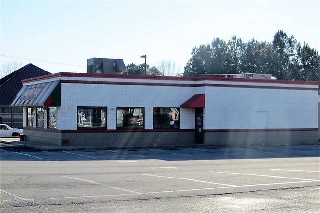
Property Detail
621 Highway 71 N
710-01797-004-C
PER DOC #2018005580 FILED 6/12/18 PART OF THE SOUTHWEST QUARTER OF THE SOUTHEAST QUARTER OF SECTION 31, TOWNSHIP 10 NORTH, RA
Restaurantdrivein
Crawford
B and X Area of moderate flood hazard, usually the area between the limits of the 100-year and 500-year floods.
Arkansas
2025
0.86 AC
2025
Crawford County
020602
Fort Smith
2,261 SF
Fort Smith, AR-OK
NEARBY LISTINGS FOR SALE OR LEASE
-
-
View all Alma listings for sale on LoopNet.com
DEMOGRAPHICS near 621 Highway 71 N
1 mile
3 mile
5 mile
2025 Total Population
3,201
9,377
16,218
2030 Population
3,311
9,670
16,710
Pop Growth 2025-2030
+ 3.44%
+ 3.12%
+ 3.03%
Average Age
37
39
40
2025 Total Households
1,154
3,594
6,191
HH Growth 2025-2030
+ 3.38%
+ 3.09%
+ 3.00%
Median Household Inc
$68,175
$59,386
$60,755
Avg Household Size
2.60
2.60
2.60
2025 Avg HH Vehicles
2.00
2.00
2.00
Median Home Value
$213,441
$195,071
$193,615
Median Year Built
1997
1993
1990
Nearby Places
Map Layers
Map Styles
 Street
 Aerial
Layers
 Traffic
 Biking
Places
Listings with unknown addresses are not visible on the map
- Restaurants
- Banks
- Shops
- Fitness
- Groceries
PUBLIC TRANSPORTATION
AIRPORT
Fort Smith Regional
Drive
Walk
Distance
Fort Smith Regional
25 min
16.4 mi
SALE & LEASE HISTORY
LISTING DATE
SALE/LEASE

Feb 28, 2018
For Sale
Nearby Properties
Address
Land Use
TOTAL SIZE
Lot Size
Zoning
Address
Land Use
TOTAL SIZE
Lot Size
Zoning
39,880 SF
11.62 AC
Address
Land Use
TOTAL SIZE
Lot Size
Zoning
104,782 SF
11.42 AC
Address
Land Use
TOTAL SIZE
Lot Size
Zoning
115,798 SF
8.10 AC
Address
Land Use
TOTAL SIZE
Lot Size
Zoning
11,477 SF
4.71 AC
Address
Land Use
TOTAL SIZE
Lot Size
Zoning
61,486 SF
5 AC
Address
Land Use
TOTAL SIZE
Lot Size
Zoning
14,400 SF
Address
Land Use
TOTAL SIZE
Lot Size
Zoning
34,266 SF
2.82 AC
Address
Land Use
TOTAL SIZE
Lot Size
Zoning
48,682 SF
5.70 AC
Address
Land Use
TOTAL SIZE
Lot Size
Zoning
36,552 SF
15.79 AC
Address
Land Use
TOTAL SIZE
Lot Size
Zoning
42,770 SF
7.16 AC
Address
Land Use
TOTAL SIZE
Lot Size
Zoning
47,250 SF
5.09 AC
Address
Land Use
TOTAL SIZE
Lot Size
Zoning
69,000 SF
4.31 AC
Address
Land Use
TOTAL SIZE
Lot Size
Zoning
2,960 SF
47.69 AC
Address
Land Use
TOTAL SIZE
Lot Size
Zoning
79,926 SF
4.76 AC
Address
Land Use
TOTAL SIZE
Lot Size
Zoning
51,100 SF
8 AC
Address
Land Use
TOTAL SIZE
Lot Size
Zoning
13,696 SF
0.84 AC
Address
Land Use
TOTAL SIZE
Lot Size
Zoning
10,335 SF
9.66 AC
Address
Land Use
TOTAL SIZE
Lot Size
Zoning
20,656 SF
2.97 AC
Address
Land Use
TOTAL SIZE
Lot Size
Zoning
5,733 SF
9.50 AC
Address
Land Use
TOTAL SIZE
Lot Size
Zoning
26,510 SF
2.89 AC
Address
Land Use
TOTAL SIZE
Lot Size
Zoning
61,350 SF
3.85 AC
Address
Land Use
TOTAL SIZE
Lot Size
Zoning
8,880 SF
3 AC
Address
Land Use
TOTAL SIZE
Lot Size
Zoning
20,460 SF
5.68 AC
Address
Land Use
TOTAL SIZE
Lot Size
Zoning
19,600 SF
5.52 AC
Address
Land Use
TOTAL SIZE
Lot Size
Zoning
9,830 SF
0.73 AC
Address
Land Use
TOTAL SIZE
Lot Size
Zoning
10,374 SF
3 AC
Address
Land Use
TOTAL SIZE
Lot Size
Zoning
28,300 SF
1.90 AC
Address
Land Use
TOTAL SIZE
Lot Size
Zoning
27,122 SF
2.62 AC
Address
Land Use
TOTAL SIZE
Lot Size
Zoning
4,116 SF
34.48 AC
Address
Land Use
TOTAL SIZE
Lot Size
Zoning
14,528 SF
5.88 AC
The World's #1 Commercial Real Estate Marketplace
Connect with us
© 2026 CoStar Group
The information above has been obtained from sources believed reliable. While we do not doubt its accuracy we have not verified it and make no guarantee, warranty or representation about it. It is your responsibility to independently confirm its accuracy and completeness. Any projections, opinions, assumptions, or estimates used are for example only and do not represent the current or future performance of the property. The value of this transaction to you depends on tax and other factors which should be evaluated by your tax, financial, and legal advisors. You and your advisors should conduct a careful, independent investigation of the property to determine to your satisfaction the suitability of the property for your needs.