Property Record
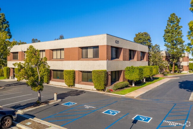
6215 Ferris Sq, San Diego, CA 92121

Current Lease Availabilities
NEARBY LISTINGS FOR SALE OR LEASE
Property Detail
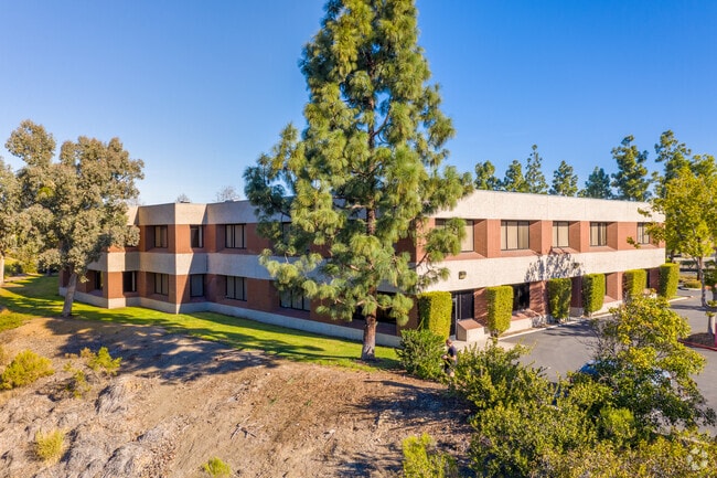
6215 Ferris Sq
San Diego-Carlsbad, CA
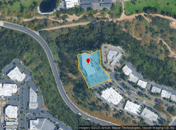
Parcel Map No. 13589
343-350-08
PAR 5 TR PM13589
Storesoffices
San Diego
X
California
06073C1343G
8
2024
2.25 AC
2025
Mira Mesa/Miramar
008350
San Diego
49,000 SF
DEMOGRAPHICS near 6215 Ferris Sq
1 Mile
3 Mile
5 Mile
2024 Total Population
95
82,556
255,610
2029 Population
94
82,436
254,344
Pop Growth 2024-2029
(1.05%)
(0.15%)
(0.50%)
Average Age
42
37
38
2024 Total Households
31
31,304
90,108
HH Growth 2024-2029
0.00%
+ 0.02%
(0.46%)
Median Household Inc
$122,499
$107,145
$115,078
Avg Household Size
2.90
2.50
2.60
2024 Avg HH Vehicles
2.00
2.00
2.00
Median Home Value
$734,375
$827,587
$847,503
Median Year Built
1986
1988
1985
Nearby Places
- Restaurants
- Banks
- Shops
- Fitness
- Groceries
PUBLIC TRANSPORTATION
COMMUTER RAIL
Sorrento Valley (Coaster - San Diego North County Transit District (Coaster/Sprinter/Breeze))
DRIVE
WALK
Distance
Sorrento Valley (Coaster - San Diego North County Transit District (Coaster/Sprinter/Breeze))
9 min
4.3 mi
AIRPORT
San Diego International
DRIVE
WALK
Distance
San Diego International
26 min
16.3 mi
Freight Ports
Port of San Diego
DRIVE
WALK
Distance
Port of San Diego
29 min
17.8 mi
Nearby Properties
Address
Land Use
TOTAL SIZE
Lot Size
Zoning
Address
Land Use
TOTAL SIZE
Lot Size
Zoning
40.28 AC
CR-1-1
Address
Land Use
TOTAL SIZE
Lot Size
Zoning
28.94 AC
IL-2-1
Address
Land Use
TOTAL SIZE
Lot Size
Zoning
15.78 AC
IL-2-1
Address
Land Use
TOTAL SIZE
Lot Size
Zoning
224,589 SF
7.23 AC
IL-2-1
Address
Land Use
TOTAL SIZE
Lot Size
Zoning
18.02 AC
IL-2-1
Address
Land Use
TOTAL SIZE
Lot Size
Zoning
1.67 AC
C
Address
Land Use
TOTAL SIZE
Lot Size
Zoning
3.88 AC
CC-1-3
Address
Land Use
TOTAL SIZE
Lot Size
Zoning
1.31 AC
RS-1-14
Address
Land Use
TOTAL SIZE
Lot Size
Zoning
1.24 AC
C
Address
Land Use
TOTAL SIZE
Lot Size
Zoning
5.04 AC
IL-2-1
Address
Land Use
TOTAL SIZE
Lot Size
Zoning
2.49 AC
IP-1-1
Address
Land Use
TOTAL SIZE
Lot Size
Zoning
3.51 AC
RS-1-14
Address
Land Use
TOTAL SIZE
Lot Size
Zoning
7.36 AC
RM-3-9
Address
Land Use
TOTAL SIZE
Lot Size
Zoning
1.59 AC
C
Address
Land Use
TOTAL SIZE
Lot Size
Zoning
4.81 AC
C-6
Address
Land Use
TOTAL SIZE
Lot Size
Zoning
10.68 AC
IL-2-1
Address
Land Use
TOTAL SIZE
Lot Size
Zoning
5.51 AC
RS-1-14
Address
Land Use
TOTAL SIZE
Lot Size
Zoning
41.66 AC
IP-1-1
Address
Land Use
TOTAL SIZE
Lot Size
Zoning
4.31 AC
IL-3-1
Address
Land Use
TOTAL SIZE
Lot Size
Zoning
16.52 AC
IP-1-1
Address
Land Use
TOTAL SIZE
Lot Size
Zoning
1.34 AC
IL-2-1
Address
Land Use
TOTAL SIZE
Lot Size
Zoning
4.07 AC
RM-3-9
Address
Land Use
TOTAL SIZE
Lot Size
Zoning
4.58 AC
IP-2-1
Address
Land Use
TOTAL SIZE
Lot Size
Zoning
10.79 AC
IL-2-1
Address
Land Use
TOTAL SIZE
Lot Size
Zoning
4.40 AC
IL-3-1
Address
Land Use
TOTAL SIZE
Lot Size
Zoning
10.53 AC
IP-2-1
Address
Land Use
TOTAL SIZE
Lot Size
Zoning
3.07 AC
IL-2-1
Address
Land Use
TOTAL SIZE
Lot Size
Zoning
24.03 AC
IP-1-1
Address
Land Use
TOTAL SIZE
Lot Size
Zoning
1.40 AC
C
Address
Land Use
TOTAL SIZE
Lot Size
Zoning
1.50 AC
CO-1-2
The World's #1 Commercial Real Estate Marketplace
Connect with us
© 2025 CoStar Group
The information above has been obtained from sources believed reliable. While we do not doubt its accuracy we have not verified it and make no guarantee, warranty or representation about it. It is your responsibility to independently confirm its accuracy and completeness. Any projections, opinions, assumptions, or estimates used are for example only and do not represent the current or future performance of the property. The value of this transaction to you depends on tax and other factors which should be evaluated by your tax, financial, and legal advisors. You and your advisors should conduct a careful, independent investigation of the property to determine to your satisfaction the suitability of the property for your needs.