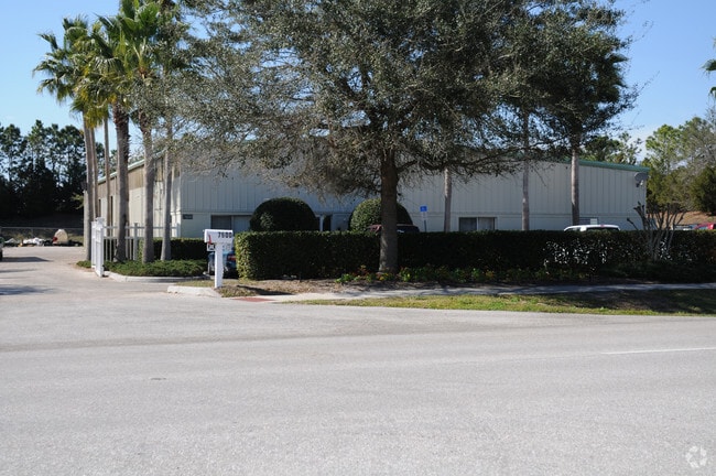
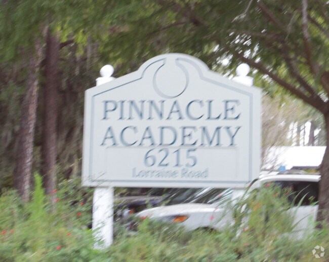
Property Record
6215 Lorraine Rd, Lakewood Ranch, FL 34202

NEARBY LISTINGS FOR SALE OR LEASE
Property Detail
6215 Lorraine Rd
5845-0092-9
BEING AND LYING IN SEC 22, TWN 35S, RNG 19E: COM AT NW COR OF SEC 22, TWN 35S, RNG 19E; TH S 89 DEG 16 MIN 51 SEC E, ALG N LN OF SD SEC 22, A DIST OF 1397.82 FT; TH S 00 DEG 43
Privateschool
Manatee
X
Florida
12115C0070F
6.08 AC
0
Manatee Outlying
2025
Tampa/St Petersburg
002023
North Port-Sarasota-Bradenton, FL
22,412 SF
DEMOGRAPHICS near 6215 Lorraine Rd
1 Mile
3 Mile
5 Mile
2024 Total Population
5,889
33,714
68,887
2029 Population
6,810
39,832
81,380
Pop Growth 2024-2029
+ 15.64%
+ 18.15%
+ 18.14%
Average Age
41
49
48
2024 Total Households
2,080
14,058
28,459
HH Growth 2024-2029
+ 14.90%
+ 17.35%
+ 17.26%
Median Household Inc
$110,165
$116,929
$112,481
Avg Household Size
2.70
2.40
2.40
2024 Avg HH Vehicles
2.00
2.00
2.00
Median Home Value
$454,202
$497,406
$469,661
Median Year Built
2008
2010
2010
Nearby Places
Map Layers
Map Styles
 Street
 Aerial
- Restaurants
- Banks
- Shops
- Fitness
- Groceries
PUBLIC TRANSPORTATION
AIRPORT
Sarasota/Bradenton International
DRIVE
WALK
Distance
Sarasota/Bradenton International
26 min
15.3 mi
Freight Ports
Port Manatee
DRIVE
WALK
Distance
Port Manatee
31 min
21.2 mi
Nearby Properties
Address
Land Use
TOTAL SIZE
Lot Size
Zoning
Address
Land Use
TOTAL SIZE
Lot Size
Zoning
602,710 SF
36.57 AC
PD-MU
Address
Land Use
TOTAL SIZE
Lot Size
Zoning
512,380 SF
11.24 AC
PD-MU
Address
Land Use
TOTAL SIZE
Lot Size
Zoning
409,825 SF
23.98 AC
PD-MU
Address
Land Use
TOTAL SIZE
Lot Size
Zoning
349,151 SF
16.70 AC
PD-MU
Address
Land Use
TOTAL SIZE
Lot Size
Zoning
384,346 SF
56.41 AC
PD-PI
Address
Land Use
TOTAL SIZE
Lot Size
Zoning
405,307 SF
23.79 AC
PD-MU
Address
Land Use
TOTAL SIZE
Lot Size
Zoning
422,013 SF
11 AC
PD-MU
Address
Land Use
TOTAL SIZE
Lot Size
Zoning
125,972 SF
24.18 AC
PD-PI
Address
Land Use
TOTAL SIZE
Lot Size
Zoning
206,326 SF
5.01 AC
VPD
Address
Land Use
TOTAL SIZE
Lot Size
Zoning
235,732 SF
49.34 AC
PD-PI
Address
Land Use
TOTAL SIZE
Lot Size
Zoning
175,410 SF
39.05 AC
PD-MU
Address
Land Use
TOTAL SIZE
Lot Size
Zoning
112,961 SF
19.44 AC
Address
Land Use
TOTAL SIZE
Lot Size
Zoning
345,812 SF
37 AC
PD-R
Address
Land Use
TOTAL SIZE
Lot Size
Zoning
180,574 SF
22 AC
A GENERAL
Address
Land Use
TOTAL SIZE
Lot Size
Zoning
75,712 SF
33.55 AC
PD-MU
Address
Land Use
TOTAL SIZE
Lot Size
Zoning
109,010 SF
7 AC
PD-MU
Address
Land Use
TOTAL SIZE
Lot Size
Zoning
125,678 SF
48.86 AC
Address
Land Use
TOTAL SIZE
Lot Size
Zoning
139,763 SF
6.66 AC
PD-MU
Address
Land Use
TOTAL SIZE
Lot Size
Zoning
78,773 SF
15.34 AC
Address
Land Use
TOTAL SIZE
Lot Size
Zoning
44,216 SF
74.28 AC
A,PD-R
Address
Land Use
TOTAL SIZE
Lot Size
Zoning
76,672 SF
15.39 AC
PD-C
Address
Land Use
TOTAL SIZE
Lot Size
Zoning
70,120 SF
12.23 AC
A,PD-MU
Address
Land Use
TOTAL SIZE
Lot Size
Zoning
35,634 SF
20.68 AC
A GENERAL
Address
Land Use
TOTAL SIZE
Lot Size
Zoning
58,785 SF
5.49 AC
PD-MU
Address
Land Use
TOTAL SIZE
Lot Size
Zoning
47,803 SF
5 AC
PD-MU
Address
Land Use
TOTAL SIZE
Lot Size
Zoning
14,689 SF
1.67 AC
VPD
Address
Land Use
TOTAL SIZE
Lot Size
Zoning
73,894 SF
14.99 AC
A GENERAL
Address
Land Use
TOTAL SIZE
Lot Size
Zoning
55,694 SF
15.93 AC
PD-PI
Address
Land Use
TOTAL SIZE
Lot Size
Zoning
44,330 SF
1.69 AC
PD-MU
Address
Land Use
TOTAL SIZE
Lot Size
Zoning
10,827 SF
124.39 AC
A GENERAL
The World's #1 Commercial Real Estate Marketplace
Connect with us
© 2025 CoStar Group
The information above has been obtained from sources believed reliable. While we do not doubt its accuracy we have not verified it and make no guarantee, warranty or representation about it. It is your responsibility to independently confirm its accuracy and completeness. Any projections, opinions, assumptions, or estimates used are for example only and do not represent the current or future performance of the property. The value of this transaction to you depends on tax and other factors which should be evaluated by your tax, financial, and legal advisors. You and your advisors should conduct a careful, independent investigation of the property to determine to your satisfaction the suitability of the property for your needs.