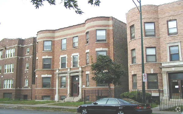
Property Record
6218 S King Dr, Chicago, IL 60637

NEARBY LISTINGS FOR SALE OR LEASE
-
-
-
-
-
-
-
-
-
-
-
-
-
-
-
-
-
-
-
-
-
No Photo
-
-
-
-
-
-
-
-
-
-
View all Chicago listings for sale on LoopNet.com
Property Detail
6218 S King Dr
Chicago-Naperville-Elgin, IL-IN-WI
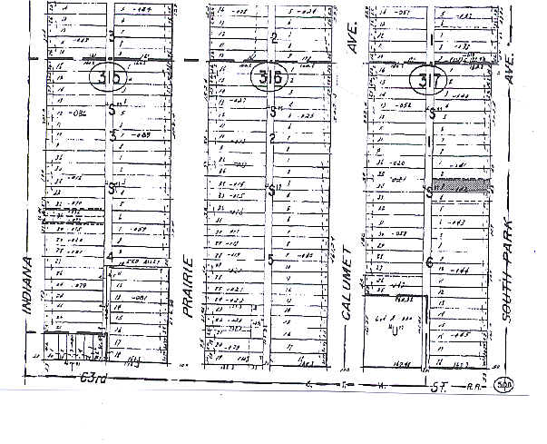
Davidsons Sub
20-15-317-056-0000
Cook
Vacantlandnec
Illinois
X
3,4
17031C0536K
0.19 AC
2023
Washington Park
2024
Chicago
400800
DEMOGRAPHICS near 6218 S King Dr
1 Mile
3 Mile
5 Mile
2024 Total Population
35,075
287,036
633,341
2029 Population
34,234
277,933
605,569
Pop Growth 2024-2029
(2.40%)
(3.17%)
(4.38%)
Average Age
35
39
39
2024 Total Households
14,323
124,856
251,493
HH Growth 2024-2029
(2.68%)
(3.40%)
(4.42%)
Median Household Inc
$23,952
$34,922
$40,603
Avg Household Size
2.30
2.20
2.40
2024 Avg HH Vehicles
1.00
1.00
1.00
Median Home Value
$210,300
$220,145
$200,854
Median Year Built
1949
1949
1949
Nearby Places
Map Layers
Map Styles
 Street
 Aerial
- Restaurants
- Banks
- Shops
- Fitness
- Groceries
PUBLIC TRANSPORTATION
TRANSIT/SUBWAY
King Drive Station (Green Line - Chicago Transit Authority "L" Trains (The "L"))
DRIVE
WALK
Distance
King Drive Station (Green Line - Chicago Transit Authority "L" Trains (The "L"))
0 min
3 min
0.1 mi
Cottage Grove Station (Green Line - Chicago Transit Authority "L" Trains (The "L"))
DRIVE
WALK
Distance
Cottage Grove Station (Green Line - Chicago Transit Authority "L" Trains (The "L"))
1 min
11 min
0.6 mi
63Rd Street Station (Red Line - Chicago Transit Authority "L" Trains (The "L"))
DRIVE
WALK
Distance
63Rd Street Station (Red Line - Chicago Transit Authority "L" Trains (The "L"))
7 min
17 min
0.9 mi
Garfield Station (Green Line) (Green Line - Chicago Transit Authority "L" Trains (The "L"))
DRIVE
WALK
Distance
Garfield Station (Green Line) (Green Line - Chicago Transit Authority "L" Trains (The "L"))
4 min
20 min
1.1 mi
COMMUTER RAIL
63Rd Street Station (Metra Electric Line - Northeast Illinois Regional Commuter Railroad (Metra), South Shore Line - Northeast Illinois Regional Commuter Railroad (Metra))
DRIVE
WALK
Distance
63Rd Street Station (Metra Electric Line - Northeast Illinois Regional Commuter Railroad (Metra), South Shore Line - Northeast Illinois Regional Commuter Railroad (Metra))
3 min
1.5 mi
59Th Street (University Of Chicago) Station (Metra Electric Line - Northeast Illinois Regional Commuter Railroad (Metra))
DRIVE
WALK
Distance
59Th Street (University Of Chicago) Station (Metra Electric Line - Northeast Illinois Regional Commuter Railroad (Metra))
5 min
2.2 mi
AIRPORT
Chicago Midway International
DRIVE
WALK
Distance
Chicago Midway International
16 min
8.2 mi
Chicago O'Hare International
DRIVE
WALK
Distance
Chicago O'Hare International
39 min
25.2 mi
Freight Ports
Port Milwaukee
DRIVE
WALK
Distance
Port Milwaukee
117 min
93.5 mi
Nearby Properties
Address
Land Use
TOTAL SIZE
Lot Size
Zoning
Address
Land Use
TOTAL SIZE
Lot Size
Zoning
10.73 AC
PD 1243
Address
Land Use
TOTAL SIZE
Lot Size
Zoning
1,302,463 SF
3.14 AC
PD 1211
Address
Land Use
TOTAL SIZE
Lot Size
Zoning
3.14 AC
PD 1211
Address
Land Use
TOTAL SIZE
Lot Size
Zoning
115,000 SF
1.97 AC
C1-2
Address
Land Use
TOTAL SIZE
Lot Size
Zoning
0.91 AC
PD 1177
Address
Land Use
TOTAL SIZE
Lot Size
Zoning
2.65 AC
PD 38
Address
Land Use
TOTAL SIZE
Lot Size
Zoning
304,685 SF
1.11 AC
PD 1218
Address
Land Use
TOTAL SIZE
Lot Size
Zoning
115,000 SF
1.12 AC
C1-2
Address
Land Use
TOTAL SIZE
Lot Size
Zoning
7,200 SF
0.22 AC
B3-3
Address
Land Use
TOTAL SIZE
Lot Size
Zoning
156,800 SF
2.65 AC
PD 38
Address
Land Use
TOTAL SIZE
Lot Size
Zoning
PD 43
Address
Land Use
TOTAL SIZE
Lot Size
Zoning
451,349 SF
1.62 AC
PD 1062
Address
Land Use
TOTAL SIZE
Lot Size
Zoning
0.73 AC
PD 1072
Address
Land Use
TOTAL SIZE
Lot Size
Zoning
1.65 AC
B2-3
Address
Land Use
TOTAL SIZE
Lot Size
Zoning
PD 43
Address
Land Use
TOTAL SIZE
Lot Size
Zoning
769,600 SF
PD 282
Address
Land Use
TOTAL SIZE
Lot Size
Zoning
78,000 SF
0.62 AC
RM-5
Address
Land Use
TOTAL SIZE
Lot Size
Zoning
7.47 AC
RT-4
Address
Land Use
TOTAL SIZE
Lot Size
Zoning
134,655 SF
2.40 AC
B3-3
Address
Land Use
TOTAL SIZE
Lot Size
Zoning
0.84 AC
RM-5
Address
Land Use
TOTAL SIZE
Lot Size
Zoning
283,228 SF
14.47 AC
PMD 8
Address
Land Use
TOTAL SIZE
Lot Size
Zoning
130,785 SF
2.27 AC
PD 1174
Address
Land Use
TOTAL SIZE
Lot Size
Zoning
156,249 SF
0.57 AC
B3-5
Address
Land Use
TOTAL SIZE
Lot Size
Zoning
293,461 SF
1.19 AC
PD 282
Address
Land Use
TOTAL SIZE
Lot Size
Zoning
13,700 SF
0.33 AC
B3-2
Address
Land Use
TOTAL SIZE
Lot Size
Zoning
117,557 SF
2.69 AC
B3-3
Address
Land Use
TOTAL SIZE
Lot Size
Zoning
258,000 SF
13.22 AC
PMD 8
Address
Land Use
TOTAL SIZE
Lot Size
Zoning
141,165 SF
7.82 AC
PD 966
Address
Land Use
TOTAL SIZE
Lot Size
Zoning
15,052 SF
1.03 AC
PQ
Address
Land Use
TOTAL SIZE
Lot Size
Zoning
214,720 SF
0.92 AC
RM-6.5
The World's #1 Commercial Real Estate Marketplace
Connect with us
© 2025 CoStar Group
The information above has been obtained from sources believed reliable. While we do not doubt its accuracy we have not verified it and make no guarantee, warranty or representation about it. It is your responsibility to independently confirm its accuracy and completeness. Any projections, opinions, assumptions, or estimates used are for example only and do not represent the current or future performance of the property. The value of this transaction to you depends on tax and other factors which should be evaluated by your tax, financial, and legal advisors. You and your advisors should conduct a careful, independent investigation of the property to determine to your satisfaction the suitability of the property for your needs.