Property Record
622 E Myers Blvd, Mascotte, FL 34753


NEARBY LISTINGS FOR SALE OR LEASE
Property Detail
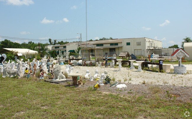
622 E Myers Blvd
Orlando-Kissimmee-Sanford, FL
Groveland Farms
01-22-24-0500-037-00000
GROVELAND FARMS 14-22-24 FROM SW COR OF SW 1/4 OF NE 1/4 OF SEC 14-22-24 SAID SW COR ALSO BEING NW COR OF TRACT 37 RUN E ALONG S LINE OF SW 1/4 OF NE 1/4 A DIST OF 256.20 FT FOR POB RUN N 49-48-0 E 146.68 FT TO SLY R/W LINE OF ACL RR R/W THENCE S 56-
Lightindustrial
Lake
X
Florida
12069C0535E
37
2024
3.27 AC
2026
Lake County
031206
Orlando
13,346 SF
DEMOGRAPHICS near 622 E Myers Blvd
1 Mile
3 Mile
5 Mile
2024 Total Population
4,731
16,668
28,801
2029 Population
5,529
19,605
33,836
Pop Growth 2024-2029
+ 16.87%
+ 17.62%
+ 17.48%
Average Age
36
37
38
2024 Total Households
1,492
5,351
9,614
HH Growth 2024-2029
+ 16.62%
+ 17.36%
+ 17.24%
Median Household Inc
$66,870
$63,952
$66,938
Avg Household Size
3.20
3.00
2.90
2024 Avg HH Vehicles
2.00
2.00
2.00
Median Home Value
$227,448
$240,901
$260,820
Median Year Built
2001
2001
2003
Nearby Places
Map Layers
Map Styles
 Street
 Aerial
- Restaurants
- Banks
- Shops
- Fitness
- Groceries
PUBLIC TRANSPORTATION
AIRPORT
Orlando International
DRIVE
WALK
Distance
Orlando International
59 min
41.4 mi
Freight Ports
Port of Tampa Bay
DRIVE
WALK
Distance
Port of Tampa Bay
93 min
72.3 mi
Nearby Properties
Address
Land Use
TOTAL SIZE
Lot Size
Zoning
Address
Land Use
TOTAL SIZE
Lot Size
Zoning
92,400 SF
2.60 AC
Address
Land Use
TOTAL SIZE
Lot Size
Zoning
2,000 SF
19.48 AC
SFLD
Address
Land Use
TOTAL SIZE
Lot Size
Zoning
175.01 AC
A
Address
Land Use
TOTAL SIZE
Lot Size
Zoning
92,250 SF
6.03 AC
C1
Address
Land Use
TOTAL SIZE
Lot Size
Zoning
151.43 AC
Address
Land Use
TOTAL SIZE
Lot Size
Zoning
95,060 SF
18.34 AC
M1
Address
Land Use
TOTAL SIZE
Lot Size
Zoning
34,619 SF
8.68 AC
CBD
Address
Land Use
TOTAL SIZE
Lot Size
Zoning
49,052 SF
14.29 AC
R2
Address
Land Use
TOTAL SIZE
Lot Size
Zoning
2,000 SF
18.03 AC
R1
Address
Land Use
TOTAL SIZE
Lot Size
Zoning
13,358 SF
4.03 AC
C1
Address
Land Use
TOTAL SIZE
Lot Size
Zoning
2,000 SF
21.84 AC
R2
Address
Land Use
TOTAL SIZE
Lot Size
Zoning
86,065 SF
10.27 AC
M1
Address
Land Use
TOTAL SIZE
Lot Size
Zoning
29,820 SF
3.21 AC
M1
Address
Land Use
TOTAL SIZE
Lot Size
Zoning
29,200 SF
6 AC
CFD
Address
Land Use
TOTAL SIZE
Lot Size
Zoning
29.08 AC
AG
Address
Land Use
TOTAL SIZE
Lot Size
Zoning
18,240 SF
3.61 AC
C1
Address
Land Use
TOTAL SIZE
Lot Size
Zoning
19,430 SF
1.45 AC
Address
Land Use
TOTAL SIZE
Lot Size
Zoning
40,864 SF
5.33 AC
Address
Land Use
TOTAL SIZE
Lot Size
Zoning
121,270 SF
19.74 AC
M1
Address
Land Use
TOTAL SIZE
Lot Size
Zoning
5,907 SF
1.12 AC
Address
Land Use
TOTAL SIZE
Lot Size
Zoning
18,840 SF
2.84 AC
Address
Land Use
TOTAL SIZE
Lot Size
Zoning
36,654 SF
120.55 AC
A
Address
Land Use
TOTAL SIZE
Lot Size
Zoning
20,666 SF
5.05 AC
A
Address
Land Use
TOTAL SIZE
Lot Size
Zoning
5,036 SF
8.68 AC
R2
Address
Land Use
TOTAL SIZE
Lot Size
Zoning
2,000 SF
13.50 AC
SFMD
Address
Land Use
TOTAL SIZE
Lot Size
Zoning
25,410 SF
2.73 AC
C1
Address
Land Use
TOTAL SIZE
Lot Size
Zoning
4,578 SF
2.43 AC
Address
Land Use
TOTAL SIZE
Lot Size
Zoning
23.10 AC
R2
Address
Land Use
TOTAL SIZE
Lot Size
Zoning
Address
Land Use
TOTAL SIZE
Lot Size
Zoning
2,920 SF
6.89 AC
CBD
The World's #1 Commercial Real Estate Marketplace
Connect with us
© 2026 CoStar Group
The information above has been obtained from sources believed reliable. While we do not doubt its accuracy we have not verified it and make no guarantee, warranty or representation about it. It is your responsibility to independently confirm its accuracy and completeness. Any projections, opinions, assumptions, or estimates used are for example only and do not represent the current or future performance of the property. The value of this transaction to you depends on tax and other factors which should be evaluated by your tax, financial, and legal advisors. You and your advisors should conduct a careful, independent investigation of the property to determine to your satisfaction the suitability of the property for your needs.