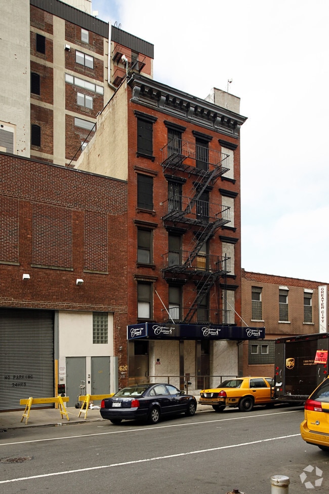
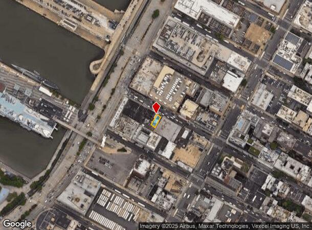
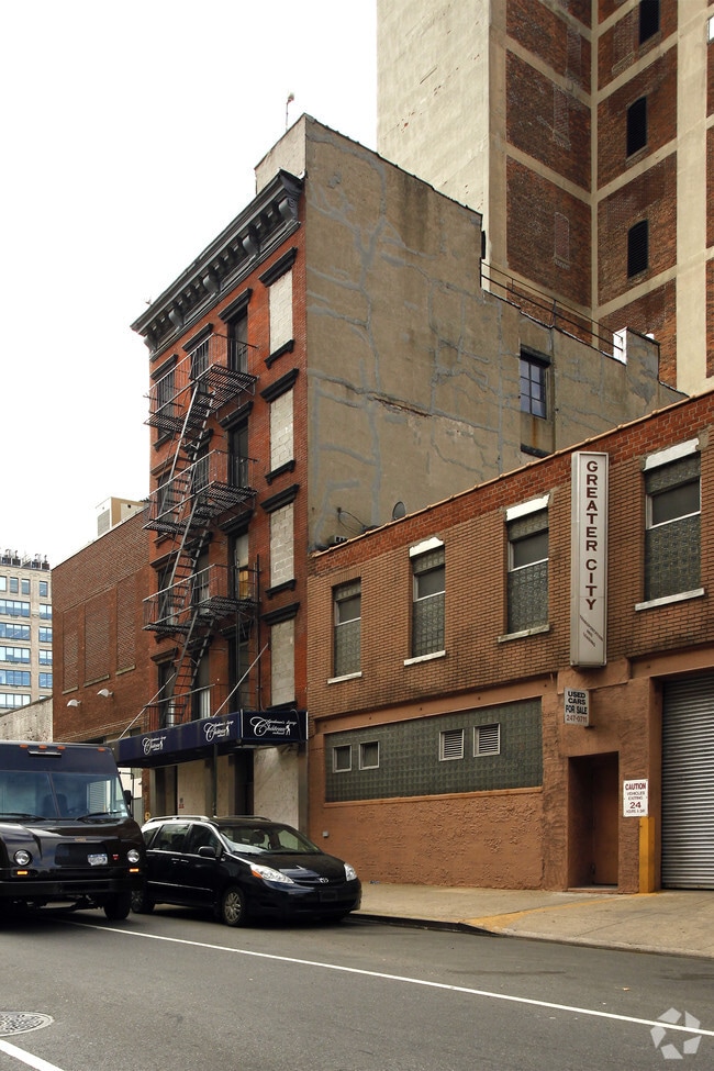
Property Record
622 W 47Th St, New York, NY 10036

Current Lease Availabilities
NEARBY LISTINGS FOR SALE OR LEASE
Property Detail
622 W 47Th St
1094-0046
Manhattan
Storebuilding
New York
X
46
3604970088F
0.04 AC
2024
Times Square
2025
New York City
012902
New York-Jersey City-White Plains, NY-NJ
8,500 SF
DEMOGRAPHICS near 622 W 47Th St
1 Mile
3 Mile
5 Mile
2024 Total Population
122,328
1,200,505
2,434,242
2029 Population
114,158
1,121,764
2,294,542
Pop Growth 2024-2029
(6.68%)
(6.56%)
(5.74%)
Average Age
41
41
40
2024 Total Households
67,245
598,605
1,126,924
HH Growth 2024-2029
(6.82%)
(6.89%)
(6.08%)
Median Household Inc
$97,926
$107,937
$93,683
Avg Household Size
1.70
1.90
2.10
2024 Avg HH Vehicles
.00
.00
.00
Median Home Value
$1,012,220
$921,852
$867,224
Median Year Built
1985
1958
1958
Nearby Places
- Restaurants
- Banks
- Shops
- Fitness
- Groceries
PUBLIC TRANSPORTATION
TRANSIT/SUBWAY
50 Street (A,C,E Line) (A - New York MTA Subway (The Subway), C - New York MTA Subway (The Subway), E - New York MTA Subway (The Subway))
DRIVE
WALK
Distance
50 Street (A,C,E Line) (A - New York MTA Subway (The Subway), C - New York MTA Subway (The Subway), E - New York MTA Subway (The Subway))
2 min
14 min
0.7 mi
34 St-Hudson Yards (7 - New York MTA Subway (The Subway))
DRIVE
WALK
Distance
34 St-Hudson Yards (7 - New York MTA Subway (The Subway))
4 min
15 min
0.8 mi
42 Street-Port Authority Bus Terminal (A - New York MTA Subway (The Subway), C - New York MTA Subway (The Subway), E - New York MTA Subway (The Subway))
DRIVE
WALK
Distance
42 Street-Port Authority Bus Terminal (A - New York MTA Subway (The Subway), C - New York MTA Subway (The Subway), E - New York MTA Subway (The Subway))
4 min
16 min
0.8 mi
50 Street (1,2 Line) (1 - New York MTA Subway (The Subway), 2 - New York MTA Subway (The Subway))
DRIVE
WALK
Distance
50 Street (1,2 Line) (1 - New York MTA Subway (The Subway), 2 - New York MTA Subway (The Subway))
2 min
17 min
0.9 mi
Times Square-42 Street (1 - New York MTA Subway (The Subway), 2 - New York MTA Subway (The Subway), 3 - New York MTA Subway (The Subway), 42 St Shuttle - New York MTA Subway (The Subway), 7 - New York MTA Subway (The Subway), N - New York MTA Subway (The Subway), Q - New York MTA Subway (The Subway), R - New York MTA Subway (The Subway))
DRIVE
WALK
Distance
Times Square-42 Street (1 - New York MTA Subway (The Subway), 2 - New York MTA Subway (The Subway), 3 - New York MTA Subway (The Subway), 42 St Shuttle - New York MTA Subway (The Subway), 7 - New York MTA Subway (The Subway), N - New York MTA Subway (The Subway), Q - New York MTA Subway (The Subway), R - New York MTA Subway (The Subway))
4 min
19 min
1.0 mi
COMMUTER RAIL
DRIVE
WALK
Distance
4 min
1.6 mi
Grand Central Terminal (Harlem Line - Metro-North Commuter Railroad Company (Metro-North), Hudson Line - Metro-North Commuter Railroad Company (Metro-North), New Haven Line - Metro-North Commuter Railroad Company (Metro-North))
DRIVE
WALK
Distance
Grand Central Terminal (Harlem Line - Metro-North Commuter Railroad Company (Metro-North), Hudson Line - Metro-North Commuter Railroad Company (Metro-North), New Haven Line - Metro-North Commuter Railroad Company (Metro-North))
5 min
1.9 mi
AIRPORT
LaGuardia
DRIVE
WALK
Distance
LaGuardia
20 min
8.4 mi
Newark Liberty International
DRIVE
WALK
Distance
Newark Liberty International
21 min
14.0 mi
John F Kennedy International
DRIVE
WALK
Distance
John F Kennedy International
32 min
18.5 mi
Freight Ports
NY - Red Hook Container Terminal
DRIVE
WALK
Distance
NY - Red Hook Container Terminal
19 min
7.5 mi
Nearby Properties
Address
Land Use
TOTAL SIZE
Lot Size
Zoning
Address
Land Use
TOTAL SIZE
Lot Size
Zoning
4,060,596 SF
22.09 AC
M2-3
Address
Land Use
TOTAL SIZE
Lot Size
Zoning
2,245,112 SF
2.02 AC
C6-6
Address
Land Use
TOTAL SIZE
Lot Size
Zoning
1,783,434 SF
1.94 AC
C5-3
Address
Land Use
TOTAL SIZE
Lot Size
Zoning
2,521,850 SF
1.59 AC
C6-4
Address
Land Use
TOTAL SIZE
Lot Size
Zoning
8,462,176 SF
61.41 AC
R7-2
Address
Land Use
TOTAL SIZE
Lot Size
Zoning
1,445,092 SF
3.10 AC
C6-4
Address
Land Use
TOTAL SIZE
Lot Size
Zoning
2,221,336 SF
1.55 AC
C6-4
Address
Land Use
TOTAL SIZE
Lot Size
Zoning
2,636,182 SF
2.35 AC
C65.5
Address
Land Use
TOTAL SIZE
Lot Size
Zoning
2,161,994 SF
3.79 AC
M1-5
Address
Land Use
TOTAL SIZE
Lot Size
Zoning
2,734,038 SF
4.24 AC
C52.5
Address
Land Use
TOTAL SIZE
Lot Size
Zoning
1,678,135 SF
1.01 AC
C5-3
Address
Land Use
TOTAL SIZE
Lot Size
Zoning
1,897,491 SF
2.06 AC
C52.5
Address
Land Use
TOTAL SIZE
Lot Size
Zoning
1,233,684 SF
16.94 AC
PARK
Address
Land Use
TOTAL SIZE
Lot Size
Zoning
1,638,259 SF
1.43 AC
C52.5
Address
Land Use
TOTAL SIZE
Lot Size
Zoning
2,360,627 SF
2.08 AC
C6-7
Address
Land Use
TOTAL SIZE
Lot Size
Zoning
1,642,675 SF
1.05 AC
C6-7
Address
Land Use
TOTAL SIZE
Lot Size
Zoning
1,984,228 SF
1.95 AC
C65.5
Address
Land Use
TOTAL SIZE
Lot Size
Zoning
1,048,620 SF
5.67 AC
C6-4
Address
Land Use
TOTAL SIZE
Lot Size
Zoning
1,586,876 SF
1.87 AC
C5-3
Address
Land Use
TOTAL SIZE
Lot Size
Zoning
1,962,900 SF
1.89 AC
C66.5
Address
Land Use
TOTAL SIZE
Lot Size
Zoning
1,946,157 SF
1.49 AC
C6-4
Address
Land Use
TOTAL SIZE
Lot Size
Zoning
1,842,991 SF
2.08 AC
C66.5
Address
Land Use
TOTAL SIZE
Lot Size
Zoning
2,535,958 SF
2.94 AC
C6-4
Address
Land Use
TOTAL SIZE
Lot Size
Zoning
1,178,640 SF
0.92 AC
C6-4
Address
Land Use
TOTAL SIZE
Lot Size
Zoning
1,751,641 SF
1.84 AC
C6-4
Address
Land Use
TOTAL SIZE
Lot Size
Zoning
6,877 SF
27.74 AC
UD
Address
Land Use
TOTAL SIZE
Lot Size
Zoning
1,613,847 SF
1.84 AC
C66.5
Address
Land Use
TOTAL SIZE
Lot Size
Zoning
2,215,000 SF
6.43 AC
R9
Address
Land Use
TOTAL SIZE
Lot Size
Zoning
1,596,521 SF
1.34 AC
C6-4
Address
Land Use
TOTAL SIZE
Lot Size
Zoning
2,344,406 SF
1.84 AC
C5-3
The World's #1 Commercial Real Estate Marketplace
Connect with us
© 2025 CoStar Group
The information above has been obtained from sources believed reliable. While we do not doubt its accuracy we have not verified it and make no guarantee, warranty or representation about it. It is your responsibility to independently confirm its accuracy and completeness. Any projections, opinions, assumptions, or estimates used are for example only and do not represent the current or future performance of the property. The value of this transaction to you depends on tax and other factors which should be evaluated by your tax, financial, and legal advisors. You and your advisors should conduct a careful, independent investigation of the property to determine to your satisfaction the suitability of the property for your needs.