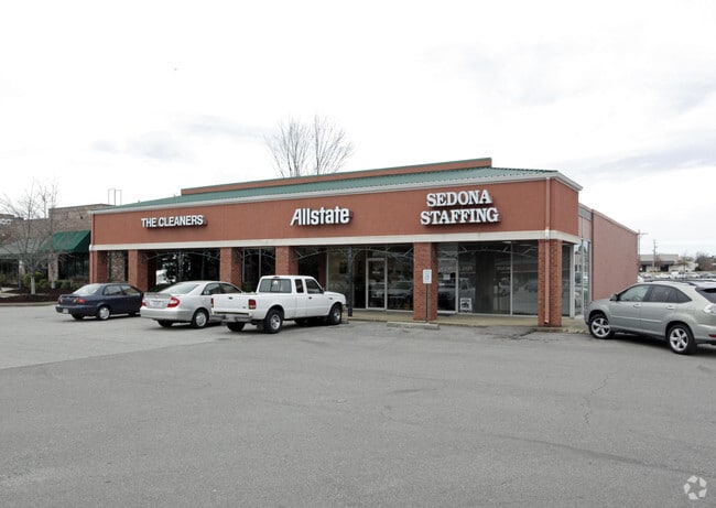
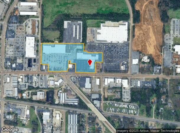
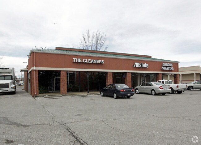
Property Record
622 W Poplar Ave, Collierville, TN 38017
NEARBY LISTINGS FOR SALE OR LEASE
Property Detail
622 W Poplar Ave
C0-244-A-00458
NS HWY 57 COR BYHALIA RD (NE) SEE MAP 202 I
Regionalshoppingcenterormallwithanchorstore
Shelby
X
Tennessee
47157C0495G
15.39 AC
2023
Collierville
2025
Memphis
021611
Memphis, TN-MS-AR
180,755 SF
DEMOGRAPHICS near 622 W Poplar Ave
1 Mile
3 Mile
5 Mile
2024 Total Population
4,379
42,126
62,627
2029 Population
4,283
41,243
61,672
Pop Growth 2024-2029
(2.19%)
(2.10%)
(1.52%)
Average Age
40
40
40
2024 Total Households
1,528
14,861
22,738
HH Growth 2024-2029
(2.36%)
(2.23%)
(1.51%)
Median Household Inc
$117,093
$123,394
$126,526
Avg Household Size
2.80
2.80
2.70
2024 Avg HH Vehicles
2.00
2.00
2.00
Median Home Value
$378,672
$375,824
$408,251
Median Year Built
1983
1995
1997
Nearby Places
Map Layers
Map Styles
 Street
 Aerial
- Restaurants
- Banks
- Shops
- Fitness
- Groceries
PUBLIC TRANSPORTATION
AIRPORT
Memphis International
DRIVE
WALK
Distance
Memphis International
31 min
19.6 mi
Freight Ports
Port of Shreveport
DRIVE
WALK
Distance
Port of Shreveport
433 min
393.3 mi
Nearby Properties
Address
Land Use
TOTAL SIZE
Lot Size
Zoning
Address
Land Use
TOTAL SIZE
Lot Size
Zoning
221,465 SF
63.45 AC
R-3
Address
Land Use
TOTAL SIZE
Lot Size
Zoning
103,960 SF
47.52 AC
R-3
Address
Land Use
TOTAL SIZE
Lot Size
Zoning
468,574 SF
8.30 AC
GC
Address
Land Use
TOTAL SIZE
Lot Size
Zoning
88,989 SF
6.91 AC
PD
Address
Land Use
TOTAL SIZE
Lot Size
Zoning
60,992 SF
12 AC
MPO
Address
Land Use
TOTAL SIZE
Lot Size
Zoning
241,626 SF
19.59 AC
Address
Land Use
TOTAL SIZE
Lot Size
Zoning
252,092 SF
13.77 AC
GC
Address
Land Use
TOTAL SIZE
Lot Size
Zoning
70,030 SF
8.03 AC
GC
Address
Land Use
TOTAL SIZE
Lot Size
Zoning
81,518 SF
4.22 AC
R-3
Address
Land Use
TOTAL SIZE
Lot Size
Zoning
115,753 SF
21.54 AC
R-1
Address
Land Use
TOTAL SIZE
Lot Size
Zoning
40,257 SF
24.68 AC
R-1
Address
Land Use
TOTAL SIZE
Lot Size
Zoning
98,107 SF
10.09 AC
RI
Address
Land Use
TOTAL SIZE
Lot Size
Zoning
167,121 SF
13.56 AC
AG
Address
Land Use
TOTAL SIZE
Lot Size
Zoning
28,280 SF
3.47 AC
R-1
Address
Land Use
TOTAL SIZE
Lot Size
Zoning
67,592 SF
18.31 AC
PD
Address
Land Use
TOTAL SIZE
Lot Size
Zoning
223,103 SF
19.25 AC
SCC
Address
Land Use
TOTAL SIZE
Lot Size
Zoning
65,713 SF
29.06 AC
R-3
Address
Land Use
TOTAL SIZE
Lot Size
Zoning
17,812 SF
25 AC
R-3
Address
Land Use
TOTAL SIZE
Lot Size
Zoning
16,655 SF
5.69 AC
SCC
Address
Land Use
TOTAL SIZE
Lot Size
Zoning
40,170 SF
23.21 AC
AG
Address
Land Use
TOTAL SIZE
Lot Size
Zoning
68,175 SF
20.58 AC
R-1
Address
Land Use
TOTAL SIZE
Lot Size
Zoning
916,949 SF
100.43 AC
GI
Address
Land Use
TOTAL SIZE
Lot Size
Zoning
108,234 SF
13.48 AC
SCC
Address
Land Use
TOTAL SIZE
Lot Size
Zoning
114,611 SF
9.84 AC
GC
Address
Land Use
TOTAL SIZE
Lot Size
Zoning
397,593 SF
62.35 AC
R-1
Address
Land Use
TOTAL SIZE
Lot Size
Zoning
397,593 SF
61.46 AC
R-1
Address
Land Use
TOTAL SIZE
Lot Size
Zoning
72.43 AC
R-1
Address
Land Use
TOTAL SIZE
Lot Size
Zoning
75,975 SF
13.09 AC
SCC
Address
Land Use
TOTAL SIZE
Lot Size
Zoning
91,006 SF
7.97 AC
PD
Address
Land Use
TOTAL SIZE
Lot Size
Zoning
29,635 SF
4.60 AC
MPO
The World's #1 Commercial Real Estate Marketplace
Connect with us
© 2026 CoStar Group
The information above has been obtained from sources believed reliable. While we do not doubt its accuracy we have not verified it and make no guarantee, warranty or representation about it. It is your responsibility to independently confirm its accuracy and completeness. Any projections, opinions, assumptions, or estimates used are for example only and do not represent the current or future performance of the property. The value of this transaction to you depends on tax and other factors which should be evaluated by your tax, financial, and legal advisors. You and your advisors should conduct a careful, independent investigation of the property to determine to your satisfaction the suitability of the property for your needs.