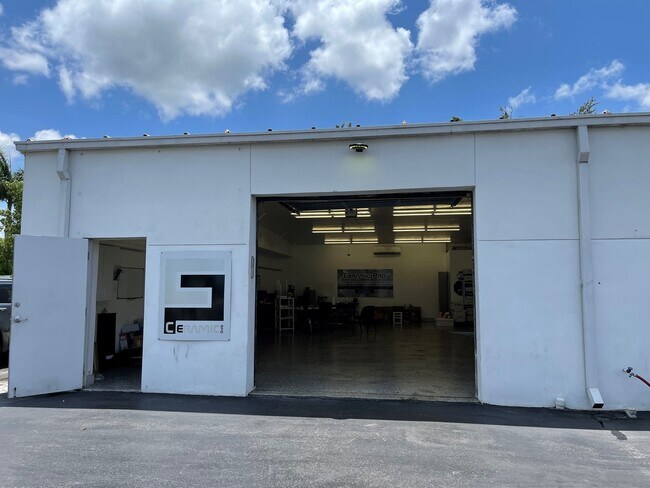
Property Record
6220 Collier Blvd, Naples, FL 34114

NEARBY LISTINGS FOR SALE OR LEASE
Property Detail
6220 Collier Blvd
00731840005
Acreage Header
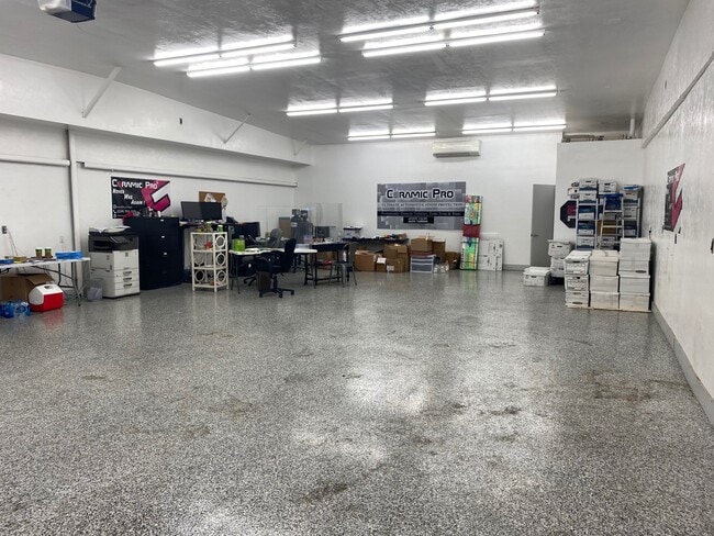
Retailwithmorethanonenonretailuse
10 51 26 COMM SW CNR NE1/4 OF NW1/4, E 100FT TO ELY R/W (SR 951) N 300FT ALG ELY R/W (SR 951) TO POB, CONT NLY 502.05, NELY ALG SLY LINE OF RIVERWOOD RD FOR 221.16FT, SELY & SLY 579.70FT, WLY 285.14FT TO POB LESS PROPOSED REALIGNMENT OF SR 951 OR 133
AE
Collier
12021C0612J
Florida
2024
1.43 AC
2025
Outlying Collier County
011108
Southwest Florida
12,800 SF
Naples-Immokalee-Marco Island, FL
DEMOGRAPHICS near 6220 Collier Blvd
1 Mile
3 Mile
5 Mile
2024 Total Population
6,525
31,827
58,638
2029 Population
7,593
37,324
68,309
Pop Growth 2024-2029
+ 16.37%
+ 17.27%
+ 16.49%
Average Age
52
53
52
2024 Total Households
2,951
13,935
25,946
HH Growth 2024-2029
+ 16.16%
+ 17.09%
+ 16.38%
Median Household Inc
$47,080
$74,865
$72,513
Avg Household Size
2.10
2.10
2.10
2024 Avg HH Vehicles
1.00
2.00
2.00
Median Home Value
$180,765
$379,748
$369,551
Median Year Built
1996
2005
2004
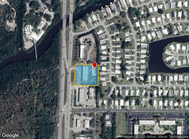
Nearby Places
Map Layers
Map Styles
 Street
 Aerial
- Restaurants
- Banks
- Shops
- Fitness
- Groceries
SALE & LEASE HISTORY
LISTING DATE
SALE/LEASE

Nov 18, 2020
For Lease
May 18, 2021
For Lease
Jan 11, 2022
For Lease
Nearby Properties
Address
Land Use
TOTAL SIZE
Lot Size
Zoning
Address
Land Use
TOTAL SIZE
Lot Size
Zoning
285,739 SF
50 AC
A
Address
Land Use
TOTAL SIZE
Lot Size
Zoning
224,217 SF
89.07 AC
A
Address
Land Use
TOTAL SIZE
Lot Size
Zoning
228,696 SF
27.40 AC
Address
Land Use
TOTAL SIZE
Lot Size
Zoning
212,093 SF
22.23 AC
PUD
Address
Land Use
TOTAL SIZE
Lot Size
Zoning
122,803 SF
27.48 AC
PUD
Address
Land Use
TOTAL SIZE
Lot Size
Zoning
100,588 SF
24 AC
PUD
Address
Land Use
TOTAL SIZE
Lot Size
Zoning
201,783 SF
28.36 AC
PUD
Address
Land Use
TOTAL SIZE
Lot Size
Zoning
65,846 SF
8.80 AC
PUD
Address
Land Use
TOTAL SIZE
Lot Size
Zoning
123,201 SF
20.59 AC
Address
Land Use
TOTAL SIZE
Lot Size
Zoning
75,658 SF
2.36 AC
PUD
Address
Land Use
TOTAL SIZE
Lot Size
Zoning
124,919 SF
13.28 AC
C4
Address
Land Use
TOTAL SIZE
Lot Size
Zoning
41,657 SF
13.33 AC
PUD
Address
Land Use
TOTAL SIZE
Lot Size
Zoning
71,938 SF
8.31 AC
C-4
Address
Land Use
TOTAL SIZE
Lot Size
Zoning
43,780 SF
6.21 AC
Address
Land Use
TOTAL SIZE
Lot Size
Zoning
104,760 SF
3.57 AC
Address
Land Use
TOTAL SIZE
Lot Size
Zoning
136.47 AC
A
Address
Land Use
TOTAL SIZE
Lot Size
Zoning
35,024 SF
2.61 AC
Address
Land Use
TOTAL SIZE
Lot Size
Zoning
94,958 SF
2.28 AC
Address
Land Use
TOTAL SIZE
Lot Size
Zoning
55,048 SF
6.45 AC
Address
Land Use
TOTAL SIZE
Lot Size
Zoning
20,541 SF
32.91 AC
P
Address
Land Use
TOTAL SIZE
Lot Size
Zoning
29,381 SF
243.53 AC
PUD
Address
Land Use
TOTAL SIZE
Lot Size
Zoning
46,535 SF
4.46 AC
C-3
Address
Land Use
TOTAL SIZE
Lot Size
Zoning
9.14 AC
PUD
Address
Land Use
TOTAL SIZE
Lot Size
Zoning
68,149 SF
3.58 AC
PUD
Address
Land Use
TOTAL SIZE
Lot Size
Zoning
13,001 SF
3.68 AC
C-3
Address
Land Use
TOTAL SIZE
Lot Size
Zoning
69,900 SF
3.99 AC
C-5
Address
Land Use
TOTAL SIZE
Lot Size
Zoning
16,605 SF
8.30 AC
C-3
Address
Land Use
TOTAL SIZE
Lot Size
Zoning
400 SF
2,116.46 AC
CON-ST
Address
Land Use
TOTAL SIZE
Lot Size
Zoning
28,321 SF
4.59 AC
A
Address
Land Use
TOTAL SIZE
Lot Size
Zoning
12,051 SF
25 AC
A
The World's #1 Commercial Real Estate Marketplace
Connect with us
© 2026 CoStar Group
The information above has been obtained from sources believed reliable. While we do not doubt its accuracy we have not verified it and make no guarantee, warranty or representation about it. It is your responsibility to independently confirm its accuracy and completeness. Any projections, opinions, assumptions, or estimates used are for example only and do not represent the current or future performance of the property. The value of this transaction to you depends on tax and other factors which should be evaluated by your tax, financial, and legal advisors. You and your advisors should conduct a careful, independent investigation of the property to determine to your satisfaction the suitability of the property for your needs.