Property Record
6220 Winter Hawk Dr Ne, Rio Rancho, NM 87144

Property Detail
6220 Winter Hawk Dr Ne
Albuquerque
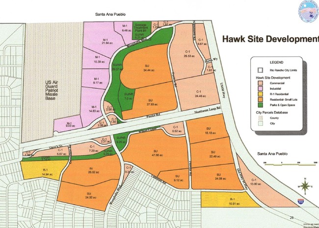
SUBD: RIO RANCHO HAWKSITE TRACT: 40 S: 9 T: 13N R: 3E
Albuquerque, NM
SANDOVAL
1-015-077-065-013
New Mexico
Vacantlandnec
tr 40
2022
7.87 AC
2022
Rio Rancho
0107172029
NEARBY LISTINGS FOR SALE OR LEASE
-
-
View all Rio Rancho listings for sale on LoopNet.com
DEMOGRAPHICS near 6220 Winter Hawk Dr Ne
1 mile
3 mile
5 mile
2025 Total Population
1,988
9,703
22,750
2030 Population
2,202
10,323
24,303
Pop Growth 2025-2030
+ 10.76%
+ 6.39%
+ 6.83%
Average Age
37
39
41
2025 Total Households
679
3,338
8,253
HH Growth 2025-2030
+ 10.90%
+ 6.59%
+ 6.91%
Median Household Inc
$80,208
$97,266
$102,462
Avg Household Size
2.90
2.80
2.70
2025 Avg HH Vehicles
2.00
2.00
2.00
Median Home Value
$333,548
$335,794
$368,781
Median Year Built
2011
2006
2007
Nearby Places
Map Layers
Map Styles
 Street
 Aerial
Layers
 Traffic
 Biking
Places
Listings with unknown addresses are not visible on the map
- Restaurants
- Banks
- Shops
- Fitness
- Groceries
PUBLIC TRANSPORTATION
COMMUTER RAIL
Sandoval County/U.S. 550 Rail Runner Station (NMRX - Rio Metro Regional Transit District)
Drive
Walk
Distance
Sandoval County/U.S. 550 Rail Runner Station (NMRX - Rio Metro Regional Transit District)
14 min
8.1 mi
Downtown Bernalillo Rail Runner Station (NMRX - Rio Metro Regional Transit District)
Drive
Walk
Distance
Downtown Bernalillo Rail Runner Station (NMRX - Rio Metro Regional Transit District)
15 min
8.8 mi
AIRPORT
Albuquerque International Sunport
Drive
Walk
Distance
Albuquerque International Sunport
54 min
31.0 mi
Freight Ports
Tulsa Port Of Catoosa
Drive
Walk
Distance
Tulsa Port Of Catoosa
718 min
682.4 mi
Nearby Properties
Address
Land Use
TOTAL SIZE
Lot Size
Zoning
Address
Land Use
TOTAL SIZE
Lot Size
Zoning
70,109 SF
27.28 AC
Address
Land Use
TOTAL SIZE
Lot Size
Zoning
13,975 SF
0.90 AC
Address
Land Use
TOTAL SIZE
Lot Size
Zoning
11,028 SF
1.11 AC
Address
Land Use
TOTAL SIZE
Lot Size
Zoning
Address
Land Use
TOTAL SIZE
Lot Size
Zoning
2,500 SF
1.04 AC
Address
Land Use
TOTAL SIZE
Lot Size
Zoning
6,664 SF
1.14 AC
Address
Land Use
TOTAL SIZE
Lot Size
Zoning
2,544 SF
0.99 AC
Address
Land Use
TOTAL SIZE
Lot Size
Zoning
5,368 SF
1.50 AC
Address
Land Use
TOTAL SIZE
Lot Size
Zoning
Address
Land Use
TOTAL SIZE
Lot Size
Zoning
21.26 AC
Address
Land Use
TOTAL SIZE
Lot Size
Zoning
23.48 AC
Address
Land Use
TOTAL SIZE
Lot Size
Zoning
Address
Land Use
TOTAL SIZE
Lot Size
Zoning
Address
Land Use
TOTAL SIZE
Lot Size
Zoning
2,267 SF
0.11 AC
Address
Land Use
TOTAL SIZE
Lot Size
Zoning
2,189 SF
0.10 AC
Address
Land Use
TOTAL SIZE
Lot Size
Zoning
2,186 SF
0.14 AC
Address
Land Use
TOTAL SIZE
Lot Size
Zoning
2,288 SF
0.21 AC
Address
Land Use
TOTAL SIZE
Lot Size
Zoning
1,745 SF
0.14 AC
Address
Land Use
TOTAL SIZE
Lot Size
Zoning
1,989 SF
0.13 AC
Address
Land Use
TOTAL SIZE
Lot Size
Zoning
1,920 SF
0.14 AC
Address
Land Use
TOTAL SIZE
Lot Size
Zoning
2,122 SF
0.10 AC
Address
Land Use
TOTAL SIZE
Lot Size
Zoning
1,910 SF
0.12 AC
Address
Land Use
TOTAL SIZE
Lot Size
Zoning
1,910 SF
0.11 AC
Address
Land Use
TOTAL SIZE
Lot Size
Zoning
1,957 SF
0.10 AC
Address
Land Use
TOTAL SIZE
Lot Size
Zoning
1,989 SF
0.09 AC
Address
Land Use
TOTAL SIZE
Lot Size
Zoning
1,989 SF
0.25 AC
Address
Land Use
TOTAL SIZE
Lot Size
Zoning
1,939 SF
0.10 AC
Address
Land Use
TOTAL SIZE
Lot Size
Zoning
1,692 SF
0.14 AC
Address
Land Use
TOTAL SIZE
Lot Size
Zoning
1,661 SF
0.11 AC
Address
Land Use
TOTAL SIZE
Lot Size
Zoning
1,649 SF
0.11 AC
The World's #1 Commercial Real Estate Marketplace
Connect with us
© 2026 CoStar Group
The information above has been obtained from sources believed reliable. While we do not doubt its accuracy we have not verified it and make no guarantee, warranty or representation about it. It is your responsibility to independently confirm its accuracy and completeness. Any projections, opinions, assumptions, or estimates used are for example only and do not represent the current or future performance of the property. The value of this transaction to you depends on tax and other factors which should be evaluated by your tax, financial, and legal advisors. You and your advisors should conduct a careful, independent investigation of the property to determine to your satisfaction the suitability of the property for your needs.