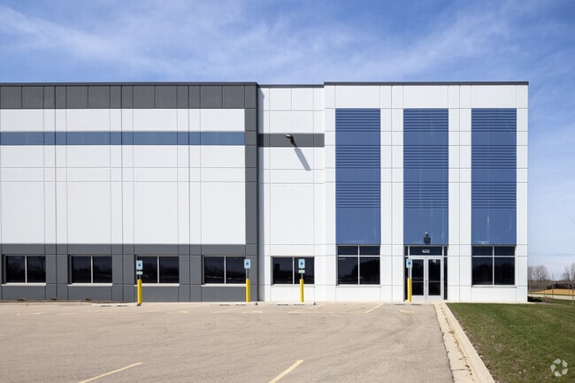
Property Record
6222 77Th Ave, Kenosha, WI 53142


NEARBY LISTINGS FOR SALE OR LEASE
Property Detail
6222 77Th Ave
Chicago-Naperville-Elgin, IL-IN-WI
LOT 2 CSM #2914 DOC#1851277 PT NE 1/4 & SE 1/4 SEC 4 T1 R22 14.596 (2020 SPLIT/COMB 03-122-04-126-030, -126-019, -126-018, -1
03-122-04-126-032
Kenosha
Commercialnec
Wisconsin
X
2
55059C0184E
14.60 AC
2024
Kenosha East
2024
Chicago
002604
DEMOGRAPHICS near 6222 77Th Ave
1 Mile
3 Mile
5 Mile
2024 Total Population
3,193
50,361
116,216
2029 Population
3,259
50,067
115,215
Pop Growth 2024-2029
+ 2.07%
(0.58%)
(0.86%)
Average Age
39
39
39
2024 Total Households
1,147
19,628
46,021
HH Growth 2024-2029
+ 2.18%
(0.63%)
(0.85%)
Median Household Inc
$82,589
$73,083
$67,920
Avg Household Size
2.60
2.50
2.40
2024 Avg HH Vehicles
2.00
2.00
2.00
Median Home Value
$304,610
$226,109
$217,824
Median Year Built
2003
1979
1972
Nearby Places
Map Layers
Map Styles
 Street
 Aerial
- Restaurants
- Banks
- Shops
- Fitness
- Groceries
PUBLIC TRANSPORTATION
COMMUTER RAIL
Kenosha Station (Union Pacific North Line - Northeast Illinois Regional Commuter Railroad (Metra))
DRIVE
WALK
Distance
Kenosha Station (Union Pacific North Line - Northeast Illinois Regional Commuter Railroad (Metra))
12 min
5.9 mi
AIRPORT
General Mitchell International
DRIVE
WALK
Distance
General Mitchell International
39 min
30.0 mi
Freight Ports
Port Milwaukee
DRIVE
WALK
Distance
Port Milwaukee
43 min
33.9 mi
SALE & LEASE HISTORY
LISTING DATE
SALE/LEASE

Sep 24, 2016
For Sale
Oct 28, 2024
For Sale
Nov 04, 2021
For Lease
Nov 04, 2021
For Sale
Jun 07, 2023
For Lease
Jul 03, 2017
For Sale
Jan 20, 2023
For Lease
Nearby Properties
Address
Land Use
TOTAL SIZE
Lot Size
Zoning
Address
Land Use
TOTAL SIZE
Lot Size
Zoning
271,533 SF
125.41 AC
Address
Land Use
TOTAL SIZE
Lot Size
Zoning
176,386 SF
58.38 AC
Address
Land Use
TOTAL SIZE
Lot Size
Zoning
731,186 SF
81.94 AC
M2
Address
Land Use
TOTAL SIZE
Lot Size
Zoning
3,886 SF
20.04 AC
Address
Land Use
TOTAL SIZE
Lot Size
Zoning
12,876 SF
30.13 AC
Address
Land Use
TOTAL SIZE
Lot Size
Zoning
77.22 AC
Address
Land Use
TOTAL SIZE
Lot Size
Zoning
481,854 SF
84.10 AC
FW
Address
Land Use
TOTAL SIZE
Lot Size
Zoning
69,139 SF
12.40 AC
Address
Land Use
TOTAL SIZE
Lot Size
Zoning
57.67 AC
Address
Land Use
TOTAL SIZE
Lot Size
Zoning
606,510 SF
36.02 AC
Address
Land Use
TOTAL SIZE
Lot Size
Zoning
606,510 SF
32.10 AC
Address
Land Use
TOTAL SIZE
Lot Size
Zoning
424,072 SF
29.14 AC
Address
Land Use
TOTAL SIZE
Lot Size
Zoning
30.04 AC
Address
Land Use
TOTAL SIZE
Lot Size
Zoning
47.82 AC
Address
Land Use
TOTAL SIZE
Lot Size
Zoning
850,230 SF
39.46 AC
M2
Address
Land Use
TOTAL SIZE
Lot Size
Zoning
626,520 SF
35.19 AC
M2
Address
Land Use
TOTAL SIZE
Lot Size
Zoning
20.33 AC
M2
Address
Land Use
TOTAL SIZE
Lot Size
Zoning
35,092 SF
26.34 AC
B2
Address
Land Use
TOTAL SIZE
Lot Size
Zoning
31,809 SF
11.36 AC
BASE
Address
Land Use
TOTAL SIZE
Lot Size
Zoning
50,145 SF
12.76 AC
Address
Land Use
TOTAL SIZE
Lot Size
Zoning
4,643 SF
60 AC
Address
Land Use
TOTAL SIZE
Lot Size
Zoning
55,140 SF
21 AC
FW
Address
Land Use
TOTAL SIZE
Lot Size
Zoning
48,284 SF
4.99 AC
Address
Land Use
TOTAL SIZE
Lot Size
Zoning
32,245 SF
22 AC
RM2
Address
Land Use
TOTAL SIZE
Lot Size
Zoning
31.07 AC
Address
Land Use
TOTAL SIZE
Lot Size
Zoning
26,016 SF
14.02 AC
FW
Address
Land Use
TOTAL SIZE
Lot Size
Zoning
2,963 SF
13.16 AC
Address
Land Use
TOTAL SIZE
Lot Size
Zoning
14.40 AC
Address
Land Use
TOTAL SIZE
Lot Size
Zoning
148,330 SF
17.55 AC
Address
Land Use
TOTAL SIZE
Lot Size
Zoning
247,185 SF
18.21 AC
B2
The World's #1 Commercial Real Estate Marketplace
Connect with us
© 2025 CoStar Group
The information above has been obtained from sources believed reliable. While we do not doubt its accuracy we have not verified it and make no guarantee, warranty or representation about it. It is your responsibility to independently confirm its accuracy and completeness. Any projections, opinions, assumptions, or estimates used are for example only and do not represent the current or future performance of the property. The value of this transaction to you depends on tax and other factors which should be evaluated by your tax, financial, and legal advisors. You and your advisors should conduct a careful, independent investigation of the property to determine to your satisfaction the suitability of the property for your needs.