Property Record
6225 Highway 152 Rd E, Rockwell, NC 28138
NEARBY LISTINGS FOR SALE OR LEASE
-
-
View all Rockwell listings for sale on LoopNet.com
Property Detail
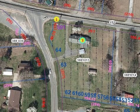
6225 Highway 152 Rd E
388-1013
C A Fisher Prop
Storebuilding
.05AC
X
Rowan
3710566500J
North Carolina
2025
1.64 AC
2025
Rowan County
051101
Charlotte
9,100 SF
Charlotte-Concord-Gastonia, NC-SC
DEMOGRAPHICS near 6225 Highway 152 Rd E
1 mile
3 mile
5 mile
2024 Total Population
855
10,919
24,460
2029 Population
895
11,384
25,579
Pop Growth 2024-2029
+ 4.68%
+ 4.26%
+ 4.57%
Average Age
40
40
41
2024 Total Households
324
4,243
9,506
HH Growth 2024-2029
+ 4.63%
+ 4.24%
+ 4.50%
Median Household Inc
$34,918
$55,445
$61,135
Avg Household Size
2.50
2.50
2.50
2024 Avg HH Vehicles
2.00
2.00
2.00
Median Home Value
$159,905
$180,997
$206,141
Median Year Built
1995
1991
1988
Nearby Places
Map Layers
Map Styles
 Street
 Aerial
Transit
 Traffic
 Biking
Places
Listings with unknown addresses are not visible on the map
- Restaurants
- Banks
- Shops
- Fitness
- Groceries
PUBLIC TRANSPORTATION
COMMUTER RAIL
Salisbury Station (Piedmont - North Carolina by Train (NC Train))
Drive
Walk
Distance
Salisbury Station (Piedmont - North Carolina by Train (NC Train))
18 min
9.0 mi
AIRPORT
Concord-Padgett Regional
Drive
Walk
Distance
Concord-Padgett Regional
35 min
23.5 mi
Freight Ports
Port of Wilmington
Drive
Walk
Distance
Port of Wilmington
257 min
200.8 mi
Nearby Properties
Address
Land Use
TOTAL SIZE
Lot Size
Zoning
Address
Land Use
TOTAL SIZE
Lot Size
Zoning
79,952 SF
25.10 AC
Address
Land Use
TOTAL SIZE
Lot Size
Zoning
52,786 SF
10.30 AC
Address
Land Use
TOTAL SIZE
Lot Size
Zoning
15,772 SF
182.34 AC
OI:OFFICE
Address
Land Use
TOTAL SIZE
Lot Size
Zoning
17,508 SF
35.47 AC
Address
Land Use
TOTAL SIZE
Lot Size
Zoning
50,221 SF
Address
Land Use
TOTAL SIZE
Lot Size
Zoning
21,400 SF
9.99 AC
Address
Land Use
TOTAL SIZE
Lot Size
Zoning
155,925 SF
23.26 AC
I:MANUFACT
Address
Land Use
TOTAL SIZE
Lot Size
Zoning
36,362 SF
3.87 AC
B3:GENERAL
Address
Land Use
TOTAL SIZE
Lot Size
Zoning
39,286 SF
5.14 AC
B3:GENERAL
Address
Land Use
TOTAL SIZE
Lot Size
Zoning
21,913 SF
8.85 AC
Address
Land Use
TOTAL SIZE
Lot Size
Zoning
19,600 SF
5.34 AC
Address
Land Use
TOTAL SIZE
Lot Size
Zoning
14,898 SF
32.43 AC
Address
Land Use
TOTAL SIZE
Lot Size
Zoning
51,780 SF
5.03 AC
I:MANUFACT
Address
Land Use
TOTAL SIZE
Lot Size
Zoning
15,330 SF
10.41 AC
R1:SINGLE
Address
Land Use
TOTAL SIZE
Lot Size
Zoning
22,152 SF
0.55 AC
B2:RETAIL
Address
Land Use
TOTAL SIZE
Lot Size
Zoning
9,150 SF
4.56 AC
B2:RETAIL
Address
Land Use
TOTAL SIZE
Lot Size
Zoning
15,338 SF
2.69 AC
Address
Land Use
TOTAL SIZE
Lot Size
Zoning
42.05 AC
Address
Land Use
TOTAL SIZE
Lot Size
Zoning
2,140 SF
3.51 AC
R2:SINGLE
Address
Land Use
TOTAL SIZE
Lot Size
Zoning
103.34 AC
Address
Land Use
TOTAL SIZE
Lot Size
Zoning
10,512 SF
2.14 AC
Address
Land Use
TOTAL SIZE
Lot Size
Zoning
12,736 SF
2.62 AC
Address
Land Use
TOTAL SIZE
Lot Size
Zoning
13,490 SF
1.96 AC
Address
Land Use
TOTAL SIZE
Lot Size
Zoning
17,600 SF
2.09 AC
Address
Land Use
TOTAL SIZE
Lot Size
Zoning
9,912 SF
0.98 AC
B2:RETAIL
Address
Land Use
TOTAL SIZE
Lot Size
Zoning
3,860 SF
25.83 AC
Address
Land Use
TOTAL SIZE
Lot Size
Zoning
37,570 SF
10.19 AC
Address
Land Use
TOTAL SIZE
Lot Size
Zoning
92,123 SF
12.37 AC
I:MANUFACT
Address
Land Use
TOTAL SIZE
Lot Size
Zoning
5,120 SF
3.04 AC
Address
Land Use
TOTAL SIZE
Lot Size
Zoning
2,888 SF
0.99 AC
The World's #1 Commercial Real Estate Marketplace
Connect with us
© 2026 CoStar Group
The information above has been obtained from sources believed reliable. While we do not doubt its accuracy we have not verified it and make no guarantee, warranty or representation about it. It is your responsibility to independently confirm its accuracy and completeness. Any projections, opinions, assumptions, or estimates used are for example only and do not represent the current or future performance of the property. The value of this transaction to you depends on tax and other factors which should be evaluated by your tax, financial, and legal advisors. You and your advisors should conduct a careful, independent investigation of the property to determine to your satisfaction the suitability of the property for your needs.