Property Record
6225 Oak Tree Blvd, Independence, OH 44131


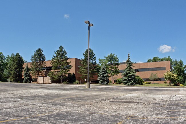
Property Detail
6225 Oak Tree Blvd
562-28-005
23 EST 4.7A
Officebuilding
Cuyahoga
U-5
Ohio
A Areas with a 1% annual chance of flooding and a 26% chance of flooding over the life of a 30-year mortgage.
23
2025
4.70 AC
2025
Rockside Corridor
156101
Cleveland
42,364 SF
Cleveland-Elyria, OH
NEARBY LISTINGS FOR SALE OR LEASE
DEMOGRAPHICS near 6225 Oak Tree Blvd
1 mile
3 mile
5 mile
2025 Total Population
4,422
52,690
207,871
2030 Population
4,399
51,806
204,149
Pop Growth 2025-2030
(0.52%)
(1.68%)
(1.79%)
Average Age
46
44
42
2025 Total Households
1,817
22,422
88,124
HH Growth 2025-2030
(0.66%)
(1.84%)
(1.95%)
Median Household Inc
$110,198
$73,997
$62,840
Avg Household Size
2.40
2.30
2.30
2025 Avg HH Vehicles
2.00
2.00
2.00
Median Home Value
$267,275
$196,214
$165,675
Median Year Built
1965
1958
1955
Nearby Places
Map Layers
Map Styles
 Street
 Aerial
Layers
 Traffic
 Biking
Places
Listings with unknown addresses are not visible on the map
- Restaurants
- Banks
- Shops
- Fitness
- Groceries
PUBLIC TRANSPORTATION
COMMUTER RAIL
Drive
Walk
Distance
8 min
2.6 mi
Drive
Walk
Distance
10 min
4.1 mi
AIRPORT
Cleveland-Hopkins International
Drive
Walk
Distance
Cleveland-Hopkins International
25 min
12.3 mi
Akron-Canton Regional
Drive
Walk
Distance
Akron-Canton Regional
55 min
42.6 mi
SALE & LEASE HISTORY
LISTING DATE
SALE/LEASE

Oct 08, 2020
For Lease
Oct 08, 2020
For Sale
Apr 04, 2017
For Sale
Nearby Properties
Address
Land Use
TOTAL SIZE
Lot Size
Zoning
Address
Land Use
TOTAL SIZE
Lot Size
Zoning
162,711 SF
192.04 AC
IG
Address
Land Use
TOTAL SIZE
Lot Size
Zoning
202,152 SF
21.04 AC
U-1
Address
Land Use
TOTAL SIZE
Lot Size
Zoning
436,164 SF
20.01 AC
U-5
Address
Land Use
TOTAL SIZE
Lot Size
Zoning
384,714 SF
4.75 AC
U-5-HR
Address
Land Use
TOTAL SIZE
Lot Size
Zoning
258,669 SF
12.80 AC
U-5
Address
Land Use
TOTAL SIZE
Lot Size
Zoning
238,500 SF
20.89 AC
SC
Address
Land Use
TOTAL SIZE
Lot Size
Zoning
238,500 SF
20.31 AC
SC
Address
Land Use
TOTAL SIZE
Lot Size
Zoning
102,219 SF
14.01 AC
RB
Address
Land Use
TOTAL SIZE
Lot Size
Zoning
162,134 SF
12.24 AC
CG
Address
Land Use
TOTAL SIZE
Lot Size
Zoning
475,286 SF
5.81 AC
U-5-HR
Address
Land Use
TOTAL SIZE
Lot Size
Zoning
60,989 SF
9.31 AC
U-4
Address
Land Use
TOTAL SIZE
Lot Size
Zoning
205,724 SF
6.54 AC
U-8
Address
Land Use
TOTAL SIZE
Lot Size
Zoning
209,068 SF
23.10 AC
IG
Address
Land Use
TOTAL SIZE
Lot Size
Zoning
239,000 SF
6.29 AC
U-6A
Address
Land Use
TOTAL SIZE
Lot Size
Zoning
277,049 SF
24.15 AC
2F
Address
Land Use
TOTAL SIZE
Lot Size
Zoning
19.48 AC
U5-A
Address
Land Use
TOTAL SIZE
Lot Size
Zoning
124,224 SF
25.99 AC
U-1
Address
Land Use
TOTAL SIZE
Lot Size
Zoning
133,913 SF
18.36 AC
U-11B
Address
Land Use
TOTAL SIZE
Lot Size
Zoning
116,373 SF
13.28 AC
U-3
Address
Land Use
TOTAL SIZE
Lot Size
Zoning
54,055 SF
3.11 AC
U-4
Address
Land Use
TOTAL SIZE
Lot Size
Zoning
141,785 SF
9.13 AC
U-5
Address
Land Use
TOTAL SIZE
Lot Size
Zoning
336,730 SF
38.51 AC
U-11A
Address
Land Use
TOTAL SIZE
Lot Size
Zoning
17,158 SF
20.86 AC
MF-1
Address
Land Use
TOTAL SIZE
Lot Size
Zoning
37.77 AC
U-5A
Address
Land Use
TOTAL SIZE
Lot Size
Zoning
238,500 SF
20.41 AC
SC
Address
Land Use
TOTAL SIZE
Lot Size
Zoning
56,002 SF
6.76 AC
U-5
Address
Land Use
TOTAL SIZE
Lot Size
Zoning
99,916 SF
4.72 AC
U-3
Address
Land Use
TOTAL SIZE
Lot Size
Zoning
100,047 SF
5.34 AC
SF-A
Address
Land Use
TOTAL SIZE
Lot Size
Zoning
51,207 SF
3.96 AC
U3
Address
Land Use
TOTAL SIZE
Lot Size
Zoning
121,720 SF
4.71 AC
U-5
The World's #1 Commercial Real Estate Marketplace
Connect with us
© 2026 CoStar Group
The information above has been obtained from sources believed reliable. While we do not doubt its accuracy we have not verified it and make no guarantee, warranty or representation about it. It is your responsibility to independently confirm its accuracy and completeness. Any projections, opinions, assumptions, or estimates used are for example only and do not represent the current or future performance of the property. The value of this transaction to you depends on tax and other factors which should be evaluated by your tax, financial, and legal advisors. You and your advisors should conduct a careful, independent investigation of the property to determine to your satisfaction the suitability of the property for your needs.