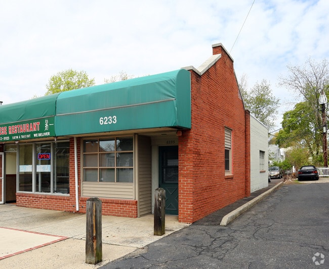
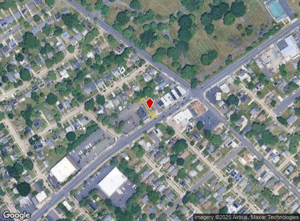
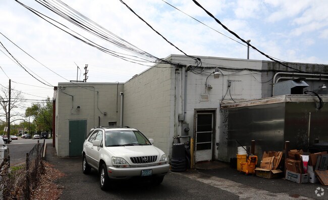
Property Record
6229 Westfield Ave, Pennsauken, NJ 08110
NEARBY LISTINGS FOR SALE OR LEASE
Property Detail
6229 Westfield Ave
27-00608-0000-00011
Camden
Commercialnec
New Jersey
X
11
34007C0033E
0.06 AC
2024
North Camden County
2025
Philadelphia
610500
Philadelphia-Camden-Wilmington, PA-NJ-DE-MD
DEMOGRAPHICS near 6229 Westfield Ave
1 Mile
3 Mile
5 Mile
2024 Total Population
16,078
107,072
513,930
2029 Population
15,982
106,905
507,478
Pop Growth 2024-2029
(0.60%)
(0.16%)
(1.26%)
Average Age
39
39
37
2024 Total Households
5,367
39,160
197,445
HH Growth 2024-2029
(0.61%)
(0.11%)
(1.27%)
Median Household Inc
$81,788
$70,144
$61,557
Avg Household Size
2.90
2.60
2.50
2024 Avg HH Vehicles
2.00
2.00
1.00
Median Home Value
$184,973
$201,168
$221,540
Median Year Built
1951
1954
1951
Nearby Places
Map Layers
Map Styles
 Street
 Aerial
- Restaurants
- Banks
- Shops
- Fitness
- Groceries
PUBLIC TRANSPORTATION
COMMUTER RAIL
Pennsauken Transit Center (Atlantic City Rail Line - NJ TRANSIT RAIL)
DRIVE
WALK
Distance
Pennsauken Transit Center (Atlantic City Rail Line - NJ TRANSIT RAIL)
3 min
1.4 mi
Cherry Hill (Atlantic City Line - NJ Transit Commuter Rail (NJ Transit))
DRIVE
WALK
Distance
Cherry Hill (Atlantic City Line - NJ Transit Commuter Rail (NJ Transit))
8 min
4.2 mi
AIRPORT
Philadelphia International
DRIVE
WALK
Distance
Philadelphia International
27 min
16.0 mi
Trenton Mercer
DRIVE
WALK
Distance
Trenton Mercer
46 min
32.4 mi
Freight Ports
Port of Philadelphia
DRIVE
WALK
Distance
Port of Philadelphia
11 min
6.2 mi
SALE & LEASE HISTORY
LISTING DATE
SALE/LEASE

Nov 23, 2018
For Sale
Nearby Properties
Address
Land Use
TOTAL SIZE
Lot Size
Zoning
Address
Land Use
TOTAL SIZE
Lot Size
Zoning
66.02 AC
Address
Land Use
TOTAL SIZE
Lot Size
Zoning
Address
Land Use
TOTAL SIZE
Lot Size
Zoning
740,701 SF
47.70 AC
I2
Address
Land Use
TOTAL SIZE
Lot Size
Zoning
7.11 AC
Address
Land Use
TOTAL SIZE
Lot Size
Zoning
49.16 AC
Address
Land Use
TOTAL SIZE
Lot Size
Zoning
54.54 AC
Address
Land Use
TOTAL SIZE
Lot Size
Zoning
10,292 SF
21.30 AC
Address
Land Use
TOTAL SIZE
Lot Size
Zoning
8.50 AC
Address
Land Use
TOTAL SIZE
Lot Size
Zoning
50.73 AC
C73A
Address
Land Use
TOTAL SIZE
Lot Size
Zoning
37.60 AC
Address
Land Use
TOTAL SIZE
Lot Size
Zoning
Address
Land Use
TOTAL SIZE
Lot Size
Zoning
12.80 AC
R20
Address
Land Use
TOTAL SIZE
Lot Size
Zoning
17.62 AC
Address
Land Use
TOTAL SIZE
Lot Size
Zoning
227,844 SF
19.82 AC
I2
Address
Land Use
TOTAL SIZE
Lot Size
Zoning
6.30 AC
Address
Land Use
TOTAL SIZE
Lot Size
Zoning
32.46 AC
Address
Land Use
TOTAL SIZE
Lot Size
Zoning
5.35 AC
Address
Land Use
TOTAL SIZE
Lot Size
Zoning
9,300 SF
1.30 AC
I3
Address
Land Use
TOTAL SIZE
Lot Size
Zoning
Address
Land Use
TOTAL SIZE
Lot Size
Zoning
4.93 AC
Address
Land Use
TOTAL SIZE
Lot Size
Zoning
Address
Land Use
TOTAL SIZE
Lot Size
Zoning
160,000 SF
137.74 AC
I3
Address
Land Use
TOTAL SIZE
Lot Size
Zoning
182.25 AC
I2
Address
Land Use
TOTAL SIZE
Lot Size
Zoning
8.85 AC
Address
Land Use
TOTAL SIZE
Lot Size
Zoning
37.39 AC
Address
Land Use
TOTAL SIZE
Lot Size
Zoning
24.24 AC
MW2
Address
Land Use
TOTAL SIZE
Lot Size
Zoning
8,197 SF
51.22 AC
I3
Address
Land Use
TOTAL SIZE
Lot Size
Zoning
110,760 SF
1.10 AC
ICMX
Address
Land Use
TOTAL SIZE
Lot Size
Zoning
35.57 AC
Address
Land Use
TOTAL SIZE
Lot Size
Zoning
26.17 AC
The World's #1 Commercial Real Estate Marketplace
Connect with us
© 2025 CoStar Group
The information above has been obtained from sources believed reliable. While we do not doubt its accuracy we have not verified it and make no guarantee, warranty or representation about it. It is your responsibility to independently confirm its accuracy and completeness. Any projections, opinions, assumptions, or estimates used are for example only and do not represent the current or future performance of the property. The value of this transaction to you depends on tax and other factors which should be evaluated by your tax, financial, and legal advisors. You and your advisors should conduct a careful, independent investigation of the property to determine to your satisfaction the suitability of the property for your needs.