Property Record
6233 Bankers Rd, Mount Pleasant, WI 53403


Current Lease Availabilities
NEARBY LISTINGS FOR SALE OR LEASE
Property Detail
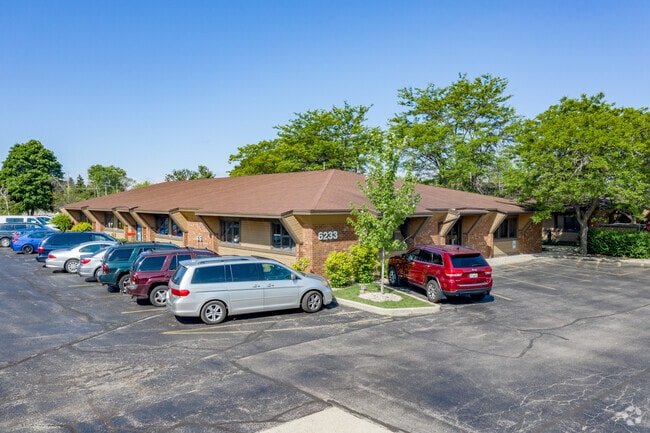
6233 Bankers Rd
Racine, WI
Scattered Commercial - Tier 2
151-032235013040
PT NE1/4 CSM #1503 V4 P636 PCL D EXC #2467474 FROM 008032235013002 IN 90 91 ROLL PT TO 151032235014000 IN 2017 FOR 2018 ROLL
Officebuilding
Racine
X
Wisconsin
55059C0086D
2.05 AC
2024
Racine East
2024
Milwaukee/Madison
000904
DEMOGRAPHICS near 6233 Bankers Rd
1 Mile
3 Mile
5 Mile
2024 Total Population
2,402
36,585
107,363
2029 Population
2,352
36,305
106,677
Pop Growth 2024-2029
(2.08%)
(0.77%)
(0.64%)
Average Age
45
41
40
2024 Total Households
955
14,914
44,014
HH Growth 2024-2029
(2.30%)
(0.87%)
(0.62%)
Median Household Inc
$85,542
$65,098
$62,122
Avg Household Size
2.30
2.30
2.30
2024 Avg HH Vehicles
2.00
2.00
2.00
Median Home Value
$270,282
$195,813
$187,290
Median Year Built
1983
1971
1967
Nearby Places
Map Layers
Map Styles
 Street
 Aerial
- Restaurants
- Banks
- Shops
- Fitness
- Groceries
PUBLIC TRANSPORTATION
COMMUTER RAIL
Sturtevant Amtrak Station (Hiawatha Service - Amtrak)
DRIVE
WALK
Distance
Sturtevant Amtrak Station (Hiawatha Service - Amtrak)
14 min
6.9 mi
Kenosha Station (Union Pacific North Line - Northeast Illinois Regional Commuter Railroad (Metra))
DRIVE
WALK
Distance
Kenosha Station (Union Pacific North Line - Northeast Illinois Regional Commuter Railroad (Metra))
18 min
9.7 mi
AIRPORT
General Mitchell International
DRIVE
WALK
Distance
General Mitchell International
35 min
26.4 mi
Freight Ports
Port Milwaukee
DRIVE
WALK
Distance
Port Milwaukee
40 min
30.3 mi
Nearby Properties
Address
Land Use
TOTAL SIZE
Lot Size
Zoning
Address
Land Use
TOTAL SIZE
Lot Size
Zoning
318.64 AC
Address
Land Use
TOTAL SIZE
Lot Size
Zoning
22.34 AC
Address
Land Use
TOTAL SIZE
Lot Size
Zoning
241.29 AC
Address
Land Use
TOTAL SIZE
Lot Size
Zoning
773 SF
21.36 AC
Address
Land Use
TOTAL SIZE
Lot Size
Zoning
47.01 AC
M-1
Address
Land Use
TOTAL SIZE
Lot Size
Zoning
9.31 AC
Address
Land Use
TOTAL SIZE
Lot Size
Zoning
22.98 AC
M-1
Address
Land Use
TOTAL SIZE
Lot Size
Zoning
19.77 AC
B-3
Address
Land Use
TOTAL SIZE
Lot Size
Zoning
6.77 AC
PUL
Address
Land Use
TOTAL SIZE
Lot Size
Zoning
15.81 AC
Address
Land Use
TOTAL SIZE
Lot Size
Zoning
0.11 AC
B-3
Address
Land Use
TOTAL SIZE
Lot Size
Zoning
33.40 AC
I2
Address
Land Use
TOTAL SIZE
Lot Size
Zoning
15,084 SF
34.20 AC
Address
Land Use
TOTAL SIZE
Lot Size
Zoning
164,201 SF
17 AC
B2
Address
Land Use
TOTAL SIZE
Lot Size
Zoning
Address
Land Use
TOTAL SIZE
Lot Size
Zoning
76.18 AC
Address
Land Use
TOTAL SIZE
Lot Size
Zoning
22.72 AC
Address
Land Use
TOTAL SIZE
Lot Size
Zoning
11.70 AC
M-1
Address
Land Use
TOTAL SIZE
Lot Size
Zoning
11.56 AC
Address
Land Use
TOTAL SIZE
Lot Size
Zoning
102,312 SF
9.92 AC
B2
Address
Land Use
TOTAL SIZE
Lot Size
Zoning
105,550 SF
13.43 AC
Address
Land Use
TOTAL SIZE
Lot Size
Zoning
9,860 SF
14.55 AC
RM2
Address
Land Use
TOTAL SIZE
Lot Size
Zoning
Address
Land Use
TOTAL SIZE
Lot Size
Zoning
Address
Land Use
TOTAL SIZE
Lot Size
Zoning
Address
Land Use
TOTAL SIZE
Lot Size
Zoning
8.01 AC
B-3
Address
Land Use
TOTAL SIZE
Lot Size
Zoning
5.04 AC
B-3
Address
Land Use
TOTAL SIZE
Lot Size
Zoning
3,348 SF
3.21 AC
Address
Land Use
TOTAL SIZE
Lot Size
Zoning
Address
Land Use
TOTAL SIZE
Lot Size
Zoning
13,224 SF
8.88 AC
The World's #1 Commercial Real Estate Marketplace
Connect with us
© 2026 CoStar Group
The information above has been obtained from sources believed reliable. While we do not doubt its accuracy we have not verified it and make no guarantee, warranty or representation about it. It is your responsibility to independently confirm its accuracy and completeness. Any projections, opinions, assumptions, or estimates used are for example only and do not represent the current or future performance of the property. The value of this transaction to you depends on tax and other factors which should be evaluated by your tax, financial, and legal advisors. You and your advisors should conduct a careful, independent investigation of the property to determine to your satisfaction the suitability of the property for your needs.