Property Record
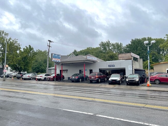
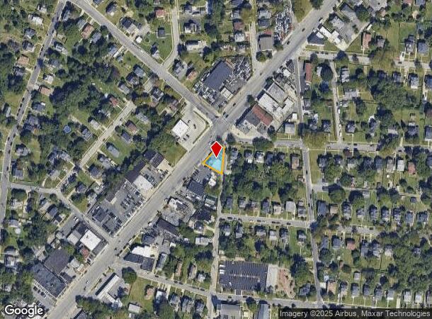
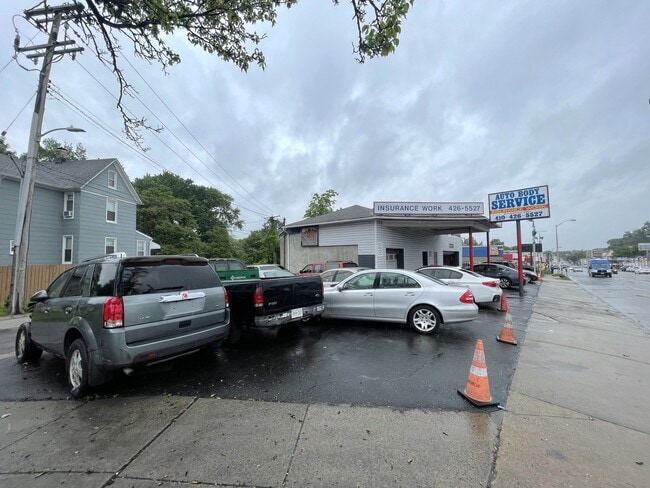
6233 Belair Rd, Baltimore, MD 21206
NEARBY LISTINGS FOR SALE OR LEASE
Property Detail
6233 Belair Rd
5715-009
95-4X25
Autorepair
Baltimore City
X
Maryland
2400100410G
9
2024
0.13 AC
2025
Baltimore Northeast
260101
Baltimore
2,080 SF
Baltimore-Columbia-Towson, MD
DEMOGRAPHICS near 6233 Belair Rd
1 mile
3 mile
5 mile
2024 Total Population
19,193
150,076
436,759
2029 Population
18,264
144,200
424,763
Pop Growth 2024-2029
(4.84%)
(3.92%)
(2.75%)
Average Age
41
40
39
2024 Total Households
7,411
59,831
173,735
HH Growth 2024-2029
(5.03%)
(4.11%)
(2.91%)
Median Household Inc
$77,123
$66,497
$65,172
Avg Household Size
2.50
2.40
2.40
2024 Avg HH Vehicles
2.00
2.00
1.00
Median Home Value
$202,131
$211,309
$229,827
Median Year Built
1952
1956
1955
Nearby Places
Map Layers
Map Styles
 Street
 Aerial
Transit
 Traffic
 Biking
Places
Listings with unknown addresses are not visible on the map
- Restaurants
- Banks
- Shops
- Fitness
- Groceries
PUBLIC TRANSPORTATION
COMMUTER RAIL
Penn Station (Penn Line - Maryland Area Regional Commuter Trains (The MARC))
Drive
Walk
Distance
Penn Station (Penn Line - Maryland Area Regional Commuter Trains (The MARC))
16 min
5.8 mi
Camden Station (Camden Line - Maryland Area Regional Commuter Trains (The MARC))
Drive
Walk
Distance
Camden Station (Camden Line - Maryland Area Regional Commuter Trains (The MARC))
21 min
7.2 mi
AIRPORT
Baltimore/Washington International Thurgood Marshall
Drive
Walk
Distance
Baltimore/Washington International Thurgood Marshall
34 min
18.8 mi
Freight Ports
Port of Baltimore
Drive
Walk
Distance
Port of Baltimore
20 min
6.8 mi
Nearby Properties
Address
Land Use
TOTAL SIZE
Lot Size
Zoning
Address
Land Use
TOTAL SIZE
Lot Size
Zoning
21,312 SF
54.36 AC
EC-2
Address
Land Use
TOTAL SIZE
Lot Size
Zoning
24,993 SF
66.85 AC
EC-2
Address
Land Use
TOTAL SIZE
Lot Size
Zoning
316,273 SF
25.90 AC
H
Address
Land Use
TOTAL SIZE
Lot Size
Zoning
31.22 AC
DR16
Address
Land Use
TOTAL SIZE
Lot Size
Zoning
140,000 SF
9.11 AC
EC-2
Address
Land Use
TOTAL SIZE
Lot Size
Zoning
119,200 SF
57.12 AC
Address
Land Use
TOTAL SIZE
Lot Size
Zoning
46.20 AC
DR105
Address
Land Use
TOTAL SIZE
Lot Size
Zoning
560,700 SF
25.77 AC
Address
Land Use
TOTAL SIZE
Lot Size
Zoning
303,115 SF
7.62 AC
R-3
Address
Land Use
TOTAL SIZE
Lot Size
Zoning
85,474 SF
22.22 AC
Address
Land Use
TOTAL SIZE
Lot Size
Zoning
3.01 AC
EC-2
Address
Land Use
TOTAL SIZE
Lot Size
Zoning
0.01 AC
R-3
Address
Land Use
TOTAL SIZE
Lot Size
Zoning
21.74 AC
DR16
Address
Land Use
TOTAL SIZE
Lot Size
Zoning
287,500 SF
44 SF
R-5
Address
Land Use
TOTAL SIZE
Lot Size
Zoning
19.93 AC
Address
Land Use
TOTAL SIZE
Lot Size
Zoning
101,906 SF
13.54 AC
Address
Land Use
TOTAL SIZE
Lot Size
Zoning
7,718 SF
152.79 AC
OS
Address
Land Use
TOTAL SIZE
Lot Size
Zoning
41,184 SF
93.14 AC
EC-1
Address
Land Use
TOTAL SIZE
Lot Size
Zoning
11.38 AC
Address
Land Use
TOTAL SIZE
Lot Size
Zoning
507,600 SF
21.36 AC
MHIM
Address
Land Use
TOTAL SIZE
Lot Size
Zoning
10.51 AC
DR16
Address
Land Use
TOTAL SIZE
Lot Size
Zoning
105,384 SF
15.41 AC
Address
Land Use
TOTAL SIZE
Lot Size
Zoning
7.38 AC
DR16
Address
Land Use
TOTAL SIZE
Lot Size
Zoning
18 AC
EC-2
Address
Land Use
TOTAL SIZE
Lot Size
Zoning
14.10 AC
DR16
Address
Land Use
TOTAL SIZE
Lot Size
Zoning
10.96 AC
DR16
Address
Land Use
TOTAL SIZE
Lot Size
Zoning
111,000 SF
29.85 AC
BM
Address
Land Use
TOTAL SIZE
Lot Size
Zoning
271,370 SF
20.11 AC
BM
Address
Land Use
TOTAL SIZE
Lot Size
Zoning
117,170 SF
7.84 AC
BM
Address
Land Use
TOTAL SIZE
Lot Size
Zoning
213,272 SF
16.25 AC
R-5
The World's #1 Commercial Real Estate Marketplace
Connect with us
© 2026 CoStar Group
The information above has been obtained from sources believed reliable. While we do not doubt its accuracy we have not verified it and make no guarantee, warranty or representation about it. It is your responsibility to independently confirm its accuracy and completeness. Any projections, opinions, assumptions, or estimates used are for example only and do not represent the current or future performance of the property. The value of this transaction to you depends on tax and other factors which should be evaluated by your tax, financial, and legal advisors. You and your advisors should conduct a careful, independent investigation of the property to determine to your satisfaction the suitability of the property for your needs.