Property Record
6235 Hoffman St, North Port, FL 34287
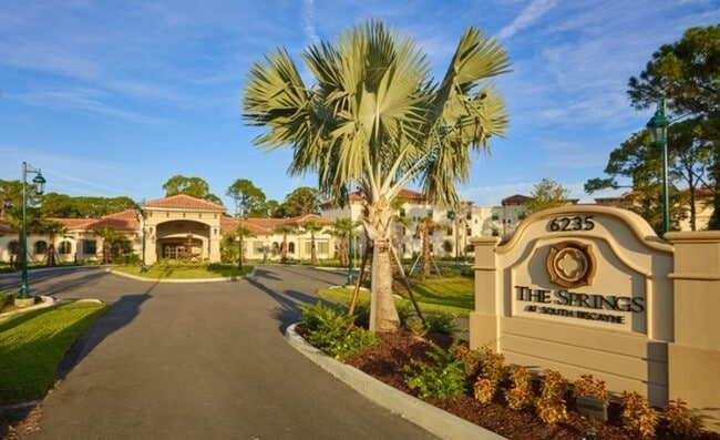


Property Detail
6235 Hoffman St
0997-05-0002
LOT 2, SOUTH BISCAYNE COMMONS, SUBJ TO 14196 C-SF ESMT TO SARASOTA COUNTY AS DESC IN ORI 2015087526, CONTAINING 8.82 AC M/L
Retirementnursinghomecombined
Sarasota
AC1
Florida
AE The base floodplain where base flood elevations are provided. AE Zones are now used on new format FIRMs instead of A1-A30 Zones.
2
2024
8.83 AC
2025
Sarasota Outlying
002723
Tampa/St Petersburg
101,676 SF
North Port-Bradenton-Sarasota, FL
NEARBY LISTINGS FOR SALE OR LEASE
-
-
View all North Port listings for sale on LoopNet.com
DEMOGRAPHICS near 6235 Hoffman St
1 mile
3 mile
5 mile
2025 Total Population
7,140
28,332
64,138
2030 Population
7,558
30,301
69,016
Pop Growth 2025-2030
+ 5.85%
+ 6.95%
+ 7.61%
Average Age
51
52
49
2025 Total Households
3,337
13,056
27,242
HH Growth 2025-2030
+ 5.81%
+ 6.92%
+ 7.58%
Median Household Inc
$50,837
$62,276
$73,152
Avg Household Size
2.10
2.10
2.30
2025 Avg HH Vehicles
1.00
2.00
2.00
Median Home Value
$235,596
$274,930
$358,819
Median Year Built
1979
1989
2001
Nearby Places
Map Layers
Map Styles
 Street
 Aerial
Layers
 Traffic
 Biking
Places
Listings with unknown addresses are not visible on the map
- Restaurants
- Banks
- Shops
- Fitness
- Groceries
PUBLIC TRANSPORTATION
AIRPORT
Punta Gorda
Drive
Walk
Distance
Punta Gorda
36 min
19.8 mi
Freight Ports
Port Manatee
Drive
Walk
Distance
Port Manatee
68 min
52.3 mi
Nearby Properties
Address
Land Use
TOTAL SIZE
Lot Size
Zoning
Address
Land Use
TOTAL SIZE
Lot Size
Zoning
548,781 SF
196.98 AC
GU
Address
Land Use
TOTAL SIZE
Lot Size
Zoning
267,412 SF
23.26 AC
AC1
Address
Land Use
TOTAL SIZE
Lot Size
Zoning
205,624 SF
21.37 AC
AC1
Address
Land Use
TOTAL SIZE
Lot Size
Zoning
103,327 SF
47.54 AC
GU
Address
Land Use
TOTAL SIZE
Lot Size
Zoning
79,944 SF
15.64 AC
AC1
Address
Land Use
TOTAL SIZE
Lot Size
Zoning
155,080 SF
8.96 AC
CG
Address
Land Use
TOTAL SIZE
Lot Size
Zoning
196,163 SF
15.60 AC
AC1
Address
Land Use
TOTAL SIZE
Lot Size
Zoning
142,364 SF
13.87 AC
AC1
Address
Land Use
TOTAL SIZE
Lot Size
Zoning
152.70 AC
AC8
Address
Land Use
TOTAL SIZE
Lot Size
Zoning
40,161 SF
40 AC
GU
Address
Land Use
TOTAL SIZE
Lot Size
Zoning
85,529 SF
11.41 AC
AC1
Address
Land Use
TOTAL SIZE
Lot Size
Zoning
105,046 SF
12.69 AC
AC1
Address
Land Use
TOTAL SIZE
Lot Size
Zoning
115,678 SF
8.58 AC
R3
Address
Land Use
TOTAL SIZE
Lot Size
Zoning
42,923 SF
403.06 AC
R1
Address
Land Use
TOTAL SIZE
Lot Size
Zoning
63,016 SF
2.56 AC
AC1
Address
Land Use
TOTAL SIZE
Lot Size
Zoning
14,714 SF
81.28 AC
AC7B
Address
Land Use
TOTAL SIZE
Lot Size
Zoning
17.48 AC
AC1
Address
Land Use
TOTAL SIZE
Lot Size
Zoning
29,890 SF
7.78 AC
R3
Address
Land Use
TOTAL SIZE
Lot Size
Zoning
55,685 SF
6.15 AC
COR
Address
Land Use
TOTAL SIZE
Lot Size
Zoning
41,054 SF
5.66 AC
CNP
Address
Land Use
TOTAL SIZE
Lot Size
Zoning
54.56 AC
AC1
Address
Land Use
TOTAL SIZE
Lot Size
Zoning
50,032 SF
10.06 AC
AC1
Address
Land Use
TOTAL SIZE
Lot Size
Zoning
26,467 SF
5.02 AC
GU
Address
Land Use
TOTAL SIZE
Lot Size
Zoning
37,448 SF
4.15 AC
AC1
Address
Land Use
TOTAL SIZE
Lot Size
Zoning
15.45 AC
AC9
Address
Land Use
TOTAL SIZE
Lot Size
Zoning
19,360 SF
2.28 AC
AC1
Address
Land Use
TOTAL SIZE
Lot Size
Zoning
49,406 SF
9.24 AC
AC1
Address
Land Use
TOTAL SIZE
Lot Size
Zoning
4,013 SF
12.03 AC
AC1
Address
Land Use
TOTAL SIZE
Lot Size
Zoning
67,477 SF
7.88 AC
AC1
The World's #1 Commercial Real Estate Marketplace
Connect with us
© 2026 CoStar Group
The information above has been obtained from sources believed reliable. While we do not doubt its accuracy we have not verified it and make no guarantee, warranty or representation about it. It is your responsibility to independently confirm its accuracy and completeness. Any projections, opinions, assumptions, or estimates used are for example only and do not represent the current or future performance of the property. The value of this transaction to you depends on tax and other factors which should be evaluated by your tax, financial, and legal advisors. You and your advisors should conduct a careful, independent investigation of the property to determine to your satisfaction the suitability of the property for your needs.