Property Record
625 E Main St, El Dorado, AR 71730
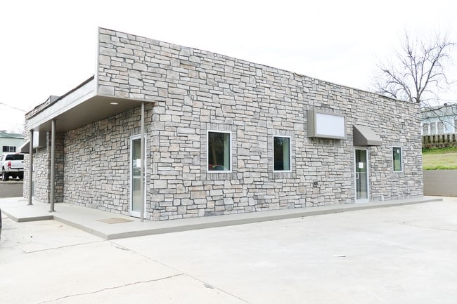

Property Detail
625 E Main St
El Dorado, AR
ORIGINAL ELDORADO (100X100) E PT #994867 #14R009202 190
0020-00183-000
Union
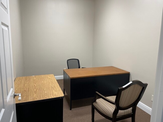
Officebuilding
Arkansas
B and X Area of moderate flood hazard, usually the area between the limits of the 100-year and 500-year floods.
93
2025
0.23 AC
2025
Arkansas South Area
950900
Other Market Areas
2,274 SF
NEARBY LISTINGS FOR SALE OR LEASE
DEMOGRAPHICS near 625 E Main St
1 mile
3 mile
5 mile
2025 Total Population
5,367
17,831
21,928
2030 Population
5,323
17,384
21,348
Pop Growth 2025-2030
(0.82%)
(2.51%)
(2.65%)
Average Age
40
40
40
2025 Total Households
2,278
7,363
9,038
HH Growth 2025-2030
(0.70%)
(2.39%)
(2.52%)
Median Household Inc
$26,991
$42,604
$45,689
Avg Household Size
2.20
2.30
2.30
2025 Avg HH Vehicles
2.00
2.00
2.00
Median Home Value
$88,302
$127,661
$138,274
Median Year Built
1965
1968
1970
Nearby Places
Map Layers
Map Styles
 Street
 Aerial
Transit
 Traffic
 Biking
Places
Listings with unknown addresses are not visible on the map
- Restaurants
- Banks
- Shops
- Fitness
- Groceries
SALE & LEASE HISTORY
LISTING DATE
SALE/LEASE

Sep 17, 2024
For Sale
May 14, 2021
For Lease
Jul 29, 2021
For Lease
Jul 20, 2022
For Lease
Apr 25, 2017
For Lease
Nearby Properties
Address
Land Use
TOTAL SIZE
Lot Size
Zoning
Address
Land Use
TOTAL SIZE
Lot Size
Zoning
Address
Land Use
TOTAL SIZE
Lot Size
Zoning
Address
Land Use
TOTAL SIZE
Lot Size
Zoning
80,620 SF
4.28 AC
Address
Land Use
TOTAL SIZE
Lot Size
Zoning
85,156 SF
0.83 AC
Address
Land Use
TOTAL SIZE
Lot Size
Zoning
20,504 SF
32.70 AC
Address
Land Use
TOTAL SIZE
Lot Size
Zoning
119,923 SF
2.89 AC
Address
Land Use
TOTAL SIZE
Lot Size
Zoning
210,108 SF
31.27 AC
Address
Land Use
TOTAL SIZE
Lot Size
Zoning
25,058 SF
2.06 AC
Address
Land Use
TOTAL SIZE
Lot Size
Zoning
109,350 SF
64.70 AC
Address
Land Use
TOTAL SIZE
Lot Size
Zoning
68,861 SF
0.99 AC
Address
Land Use
TOTAL SIZE
Lot Size
Zoning
246,000 SF
10.53 AC
Address
Land Use
TOTAL SIZE
Lot Size
Zoning
54,204 SF
6.39 AC
Address
Land Use
TOTAL SIZE
Lot Size
Zoning
44,772 SF
0.38 AC
Address
Land Use
TOTAL SIZE
Lot Size
Zoning
24,398 SF
22 AC
Address
Land Use
TOTAL SIZE
Lot Size
Zoning
44,300 SF
0.92 AC
Address
Land Use
TOTAL SIZE
Lot Size
Zoning
4,496 SF
18.83 AC
Address
Land Use
TOTAL SIZE
Lot Size
Zoning
44,374 SF
1.98 AC
Address
Land Use
TOTAL SIZE
Lot Size
Zoning
105,379 SF
13.61 AC
Address
Land Use
TOTAL SIZE
Lot Size
Zoning
106,502 SF
14.34 AC
Address
Land Use
TOTAL SIZE
Lot Size
Zoning
43,908 SF
2.35 AC
Address
Land Use
TOTAL SIZE
Lot Size
Zoning
13,300 SF
11.76 AC
Address
Land Use
TOTAL SIZE
Lot Size
Zoning
148,568 SF
10 AC
Address
Land Use
TOTAL SIZE
Lot Size
Zoning
200,611 SF
8.31 AC
Address
Land Use
TOTAL SIZE
Lot Size
Zoning
2,478 SF
5.79 AC
Address
Land Use
TOTAL SIZE
Lot Size
Zoning
12,972 SF
Address
Land Use
TOTAL SIZE
Lot Size
Zoning
61,612 SF
3.40 AC
Address
Land Use
TOTAL SIZE
Lot Size
Zoning
180,463 SF
16.35 AC
Address
Land Use
TOTAL SIZE
Lot Size
Zoning
42,993 SF
2.75 AC
Address
Land Use
TOTAL SIZE
Lot Size
Zoning
58,189 SF
0.23 AC
Address
Land Use
TOTAL SIZE
Lot Size
Zoning
14,220 SF
3.33 AC
The World's #1 Commercial Real Estate Marketplace
Connect with us
© 2026 CoStar Group
The information above has been obtained from sources believed reliable. While we do not doubt its accuracy we have not verified it and make no guarantee, warranty or representation about it. It is your responsibility to independently confirm its accuracy and completeness. Any projections, opinions, assumptions, or estimates used are for example only and do not represent the current or future performance of the property. The value of this transaction to you depends on tax and other factors which should be evaluated by your tax, financial, and legal advisors. You and your advisors should conduct a careful, independent investigation of the property to determine to your satisfaction the suitability of the property for your needs.