Property Record
625 N Segoe Rd, Madison, WI 53705

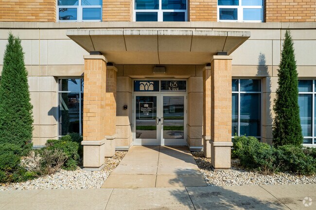
Property Detail
625 N Segoe Rd
0709-202-1908-1
WESTON PLACE CONDOMINIUM, PARKING UNIT 1559 & A % INTEREST IN THE COMMON AREA AS DECLARED AND RECORDED IN DANE COUNTY REGISTER OF DEEDS AS DOCUMENT 4067286.
Commercialnec
DANE
PD
Wisconsin
B and X Area of moderate flood hazard, usually the area between the limits of the 100-year and 500-year floods.
1.31 AC
0
West Madison
2025
Milwaukee/Madison
000301
Madison, WI
NEARBY LISTINGS FOR SALE OR LEASE
DEMOGRAPHICS near 625 N Segoe Rd
1 mile
3 mile
5 mile
2025 Total Population
12,432
130,273
255,809
2030 Population
12,976
141,299
271,503
Pop Growth 2025-2030
+ 4.38%
+ 8.46%
+ 6.14%
Average Age
39
37
36
2025 Total Households
6,427
55,314
113,775
HH Growth 2025-2030
+ 4.68%
+ 9.11%
+ 6.49%
Median Household Inc
$67,302
$70,307
$71,006
Avg Household Size
1.90
2.10
2.10
2025 Avg HH Vehicles
1.00
1.00
1.00
Median Home Value
$461,723
$449,662
$439,092
Median Year Built
1966
1982
1986
Nearby Places
Map Layers
Map Styles
 Street
 Aerial
Transit
 Traffic
 Biking
Places
Listings with unknown addresses are not visible on the map
- Restaurants
- Banks
- Shops
- Fitness
- Groceries
PUBLIC TRANSPORTATION
AIRPORT
Dane County Regional/Truax Field
Drive
Walk
Distance
Dane County Regional/Truax Field
23 min
9.0 mi
SALE & LEASE HISTORY
LISTING DATE
SALE/LEASE

Sep 17, 2018
For Sale
Oct 13, 2023
For Lease
May 03, 2024
For Lease
Jan 05, 2017
For Lease
Jan 04, 2021
For Lease
Nearby Properties
Address
Land Use
TOTAL SIZE
Lot Size
Zoning
Address
Land Use
TOTAL SIZE
Lot Size
Zoning
408,311 SF
9.26 AC
SE
Address
Land Use
TOTAL SIZE
Lot Size
Zoning
501,997 SF
26.90 AC
SE
Address
Land Use
TOTAL SIZE
Lot Size
Zoning
324,916 SF
1.08 AC
PD
Address
Land Use
TOTAL SIZE
Lot Size
Zoning
466,790 SF
761.23 AC
PD
Address
Land Use
TOTAL SIZE
Lot Size
Zoning
393,708 SF
2.89 AC
PD
Address
Land Use
TOTAL SIZE
Lot Size
Zoning
530,774 SF
37.40 AC
RMX
Address
Land Use
TOTAL SIZE
Lot Size
Zoning
210,515 SF
0.80 AC
UMX
Address
Land Use
TOTAL SIZE
Lot Size
Zoning
526,685 SF
23.94 AC
SR-V2
Address
Land Use
TOTAL SIZE
Lot Size
Zoning
156,908 SF
23.87 AC
SE
Address
Land Use
TOTAL SIZE
Lot Size
Zoning
262,260 SF
6.28 AC
TR-U2
Address
Land Use
TOTAL SIZE
Lot Size
Zoning
317,128 SF
10.14 AC
PD
Address
Land Use
TOTAL SIZE
Lot Size
Zoning
557,272 SF
28.49 AC
PD
Address
Land Use
TOTAL SIZE
Lot Size
Zoning
217,664 SF
1.43 AC
TE
Address
Land Use
TOTAL SIZE
Lot Size
Zoning
350,550 SF
6.17 AC
TR-U2
Address
Land Use
TOTAL SIZE
Lot Size
Zoning
242,105 SF
2.23 AC
TSS
Address
Land Use
TOTAL SIZE
Lot Size
Zoning
51,205 SF
9.32 AC
SE
Address
Land Use
TOTAL SIZE
Lot Size
Zoning
174,113 SF
2.71 AC
PD
Address
Land Use
TOTAL SIZE
Lot Size
Zoning
181,893 SF
0.64 AC
PD
Address
Land Use
TOTAL SIZE
Lot Size
Zoning
104,936 SF
1.19 AC
PD
Address
Land Use
TOTAL SIZE
Lot Size
Zoning
2.91 AC
CC-T
Address
Land Use
TOTAL SIZE
Lot Size
Zoning
360,223 SF
PD
Address
Land Use
TOTAL SIZE
Lot Size
Zoning
170,606 SF
1.08 AC
PD
Address
Land Use
TOTAL SIZE
Lot Size
Zoning
180,250 SF
0.58 AC
PD
Address
Land Use
TOTAL SIZE
Lot Size
Zoning
181,766 SF
1.84 AC
PD
Address
Land Use
TOTAL SIZE
Lot Size
Zoning
151,983 SF
8.50 AC
SR-V2
Address
Land Use
TOTAL SIZE
Lot Size
Zoning
164,268 SF
14.37 AC
PD
Address
Land Use
TOTAL SIZE
Lot Size
Zoning
222,406 SF
0.01 AC
PD
Address
Land Use
TOTAL SIZE
Lot Size
Zoning
95,530 SF
0.45 AC
PD
Address
Land Use
TOTAL SIZE
Lot Size
Zoning
121,671 SF
3.70 AC
PD
Address
Land Use
TOTAL SIZE
Lot Size
Zoning
48,807 SF
2.89 AC
PD
The World's #1 Commercial Real Estate Marketplace
Connect with us
© 2026 CoStar Group
The information above has been obtained from sources believed reliable. While we do not doubt its accuracy we have not verified it and make no guarantee, warranty or representation about it. It is your responsibility to independently confirm its accuracy and completeness. Any projections, opinions, assumptions, or estimates used are for example only and do not represent the current or future performance of the property. The value of this transaction to you depends on tax and other factors which should be evaluated by your tax, financial, and legal advisors. You and your advisors should conduct a careful, independent investigation of the property to determine to your satisfaction the suitability of the property for your needs.