Property Record
625 W Bedford Euless Rd, Hurst, TX 76053
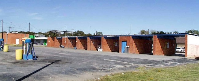

Property Detail
625 W Bedford Euless Rd
Dallas-Fort Worth-Arlington, TX
VALENTINE OAKS ADDITION BLOCK 32 LOT B
03235041
TARRANT
Commercialnec
Texas
AE The base floodplain where base flood elevations are provided. AE Zones are now used on new format FIRMs instead of A1-A30 Zones.
b
2023
4.69 AC
2025
Hurst/Euless/Bedford
113408
Dallas/Ft Worth
9,615 SF
NEARBY LISTINGS FOR SALE OR LEASE
-
-
-
-
-
No Photo
-
-
-
-
-
-
-
-
-
-
-
-
-
-
View all Hurst listings for sale on LoopNet.com
DEMOGRAPHICS near 625 W Bedford Euless Rd
1 mile
3 mile
5 mile
2025 Total Population
14,885
117,723
253,750
2030 Population
15,585
123,808
266,351
Pop Growth 2025-2030
+ 4.70%
+ 5.17%
+ 4.97%
Average Age
39
39
40
2025 Total Households
5,819
46,454
99,231
HH Growth 2025-2030
+ 4.76%
+ 5.32%
+ 5.09%
Median Household Inc
$72,072
$76,832
$84,440
Avg Household Size
2.50
2.50
2.50
2025 Avg HH Vehicles
2.00
2.00
2.00
Median Home Value
$294,923
$337,569
$349,137
Median Year Built
1967
1979
1983
Nearby Places
Map Layers
Map Styles
 Street
 Aerial
Transit
 Traffic
 Biking
Places
Listings with unknown addresses are not visible on the map
- Restaurants
- Banks
- Shops
- Fitness
- Groceries
PUBLIC TRANSPORTATION
AIRPORT
Dallas-Fort Worth International
Drive
Walk
Distance
Dallas-Fort Worth International
18 min
14.2 mi
Dallas Love Field
Drive
Walk
Distance
Dallas Love Field
31 min
22.8 mi
Freight Ports
Port of Shreveport
Drive
Walk
Distance
Port of Shreveport
1 min
209.6 mi
Nearby Properties
Address
Land Use
TOTAL SIZE
Lot Size
Zoning
Address
Land Use
TOTAL SIZE
Lot Size
Zoning
1,300,314 SF
40.15 AC
Address
Land Use
TOTAL SIZE
Lot Size
Zoning
285,754 SF
69.41 AC
Address
Land Use
TOTAL SIZE
Lot Size
Zoning
356,000 SF
39.44 AC
Address
Land Use
TOTAL SIZE
Lot Size
Zoning
521,150 SF
92.05 AC
Address
Land Use
TOTAL SIZE
Lot Size
Zoning
388,447 SF
9.47 AC
Address
Land Use
TOTAL SIZE
Lot Size
Zoning
1,544,748 SF
76.25 AC
Address
Land Use
TOTAL SIZE
Lot Size
Zoning
174,596 SF
11.91 AC
Address
Land Use
TOTAL SIZE
Lot Size
Zoning
231,871 SF
17.08 AC
Address
Land Use
TOTAL SIZE
Lot Size
Zoning
260,590 SF
15.30 AC
Address
Land Use
TOTAL SIZE
Lot Size
Zoning
172,000 SF
6.34 AC
Address
Land Use
TOTAL SIZE
Lot Size
Zoning
318,602 SF
9.90 AC
Address
Land Use
TOTAL SIZE
Lot Size
Zoning
223,131 SF
12.50 AC
Address
Land Use
TOTAL SIZE
Lot Size
Zoning
348,941 SF
22.25 AC
Address
Land Use
TOTAL SIZE
Lot Size
Zoning
240,154 SF
6.92 AC
Address
Land Use
TOTAL SIZE
Lot Size
Zoning
79,244 SF
54.50 AC
Address
Land Use
TOTAL SIZE
Lot Size
Zoning
236,701 SF
15.96 AC
Address
Land Use
TOTAL SIZE
Lot Size
Zoning
237,551 SF
4.39 AC
Address
Land Use
TOTAL SIZE
Lot Size
Zoning
208,238 SF
12.55 AC
Address
Land Use
TOTAL SIZE
Lot Size
Zoning
173,068 SF
15.55 AC
Address
Land Use
TOTAL SIZE
Lot Size
Zoning
232,295 SF
21.49 AC
Address
Land Use
TOTAL SIZE
Lot Size
Zoning
197,964 SF
4.57 AC
Address
Land Use
TOTAL SIZE
Lot Size
Zoning
235,530 SF
13.21 AC
Address
Land Use
TOTAL SIZE
Lot Size
Zoning
194,625 SF
15.07 AC
Address
Land Use
TOTAL SIZE
Lot Size
Zoning
221,591 SF
14.50 AC
Address
Land Use
TOTAL SIZE
Lot Size
Zoning
220,650 SF
3.03 AC
Address
Land Use
TOTAL SIZE
Lot Size
Zoning
187,236 SF
9.85 AC
Address
Land Use
TOTAL SIZE
Lot Size
Zoning
161,332 SF
8.56 AC
Address
Land Use
TOTAL SIZE
Lot Size
Zoning
151,023 SF
5.18 AC
Address
Land Use
TOTAL SIZE
Lot Size
Zoning
445,900 SF
29.07 AC
Address
Land Use
TOTAL SIZE
Lot Size
Zoning
262,233 SF
16.13 AC
The World's #1 Commercial Real Estate Marketplace
Connect with us
© 2026 CoStar Group
The information above has been obtained from sources believed reliable. While we do not doubt its accuracy we have not verified it and make no guarantee, warranty or representation about it. It is your responsibility to independently confirm its accuracy and completeness. Any projections, opinions, assumptions, or estimates used are for example only and do not represent the current or future performance of the property. The value of this transaction to you depends on tax and other factors which should be evaluated by your tax, financial, and legal advisors. You and your advisors should conduct a careful, independent investigation of the property to determine to your satisfaction the suitability of the property for your needs.