Property Record
6250 Telegraph Rd, Ventura, CA 93003


NEARBY LISTINGS FOR SALE OR LEASE
-
-
View all Ventura listings for sale on LoopNet.com
Property Detail
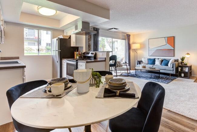
6250 Telegraph Rd
083-0-040-430
Rancho Santa Paula Y Saticoy
Apartment
PR APN 0830040390
X
Ventura
06111C0765E
California
2024
15.40 AC
2025
Ventura
009400
Los Angeles
195,798 SF
Oxnard-Thousand Oaks-Ventura, CA
DEMOGRAPHICS near 6250 Telegraph Rd
1 Mile
3 Mile
5 Mile
2024 Total Population
14,208
76,999
161,491
2029 Population
14,139
76,365
159,990
Pop Growth 2024-2029
(0.49%)
(0.82%)
(0.93%)
Average Age
43
42
41
2024 Total Households
5,522
28,963
56,996
HH Growth 2024-2029
(0.56%)
(0.87%)
(0.92%)
Median Household Inc
$99,101
$100,642
$94,022
Avg Household Size
2.50
2.60
2.70
2024 Avg HH Vehicles
2.00
2.00
2.00
Median Home Value
$680,706
$710,591
$710,367
Median Year Built
1974
1974
1975
Nearby Places
Map Layers
Map Styles
 Street
 Aerial
- Restaurants
- Banks
- Shops
- Fitness
- Groceries
PUBLIC TRANSPORTATION
COMMUTER RAIL
East Ventura Metrolink Station (Metrolink Ventura County Line - Metrolink Trains)
DRIVE
WALK
Distance
East Ventura Metrolink Station (Metrolink Ventura County Line - Metrolink Trains)
5 min
2.3 mi
Ventura Amtrak (Metrolink Ventura County Line - Amtrak, Pacific Surfliner - Amtrak)
DRIVE
WALK
Distance
Ventura Amtrak (Metrolink Ventura County Line - Amtrak, Pacific Surfliner - Amtrak)
11 min
6.7 mi
Freight Ports
The Port of Hueneme
DRIVE
WALK
Distance
The Port of Hueneme
20 min
10.9 mi
Nearby Properties
Address
Land Use
TOTAL SIZE
Lot Size
Zoning
Address
Land Use
TOTAL SIZE
Lot Size
Zoning
1.99 AC
Address
Land Use
TOTAL SIZE
Lot Size
Zoning
4.19 AC
H
Address
Land Use
TOTAL SIZE
Lot Size
Zoning
8.03 AC
CPD
Address
Land Use
TOTAL SIZE
Lot Size
Zoning
480,733 SF
14.26 AC
Address
Land Use
TOTAL SIZE
Lot Size
Zoning
43,284 SF
14.34 AC
RPD28
Address
Land Use
TOTAL SIZE
Lot Size
Zoning
233,168 SF
13.94 AC
RPD-
Address
Land Use
TOTAL SIZE
Lot Size
Zoning
176,598 SF
9.22 AC
Address
Land Use
TOTAL SIZE
Lot Size
Zoning
49,296 SF
11.08 AC
Address
Land Use
TOTAL SIZE
Lot Size
Zoning
24,154 SF
12.67 AC
R3-1
Address
Land Use
TOTAL SIZE
Lot Size
Zoning
110,434 SF
3.81 AC
Address
Land Use
TOTAL SIZE
Lot Size
Zoning
3.01 AC
Address
Land Use
TOTAL SIZE
Lot Size
Zoning
40,110 SF
8.04 AC
MPD
Address
Land Use
TOTAL SIZE
Lot Size
Zoning
138,475 SF
2.77 AC
Address
Land Use
TOTAL SIZE
Lot Size
Zoning
4.76 AC
Address
Land Use
TOTAL SIZE
Lot Size
Zoning
89,643 SF
14.27 AC
Address
Land Use
TOTAL SIZE
Lot Size
Zoning
13,530 SF
10.85 AC
Address
Land Use
TOTAL SIZE
Lot Size
Zoning
25,401 SF
2.74 AC
C1AD
Address
Land Use
TOTAL SIZE
Lot Size
Zoning
81,671 SF
3.54 AC
Address
Land Use
TOTAL SIZE
Lot Size
Zoning
111,421 SF
3.80 AC
Address
Land Use
TOTAL SIZE
Lot Size
Zoning
107,360 SF
5.96 AC
RPD15
Address
Land Use
TOTAL SIZE
Lot Size
Zoning
102,046 SF
3.72 AC
Address
Land Use
TOTAL SIZE
Lot Size
Zoning
36,186 SF
12.16 AC
Address
Land Use
TOTAL SIZE
Lot Size
Zoning
73,272 SF
6.05 AC
C1AD
Address
Land Use
TOTAL SIZE
Lot Size
Zoning
10,765 SF
5.50 AC
0540
Address
Land Use
TOTAL SIZE
Lot Size
Zoning
58,841 SF
6.74 AC
CPD
Address
Land Use
TOTAL SIZE
Lot Size
Zoning
87,804 SF
6.68 AC
RPD-
Address
Land Use
TOTAL SIZE
Lot Size
Zoning
76,449 SF
6.88 AC
CPD
Address
Land Use
TOTAL SIZE
Lot Size
Zoning
65,192 SF
3.20 AC
RPD-
The World's #1 Commercial Real Estate Marketplace
Connect with us
© 2025 CoStar Group
The information above has been obtained from sources believed reliable. While we do not doubt its accuracy we have not verified it and make no guarantee, warranty or representation about it. It is your responsibility to independently confirm its accuracy and completeness. Any projections, opinions, assumptions, or estimates used are for example only and do not represent the current or future performance of the property. The value of this transaction to you depends on tax and other factors which should be evaluated by your tax, financial, and legal advisors. You and your advisors should conduct a careful, independent investigation of the property to determine to your satisfaction the suitability of the property for your needs.