Property Record
626 N Huron St, Ypsilanti, MI 48197

NEARBY LISTINGS FOR SALE OR LEASE
Property Detail
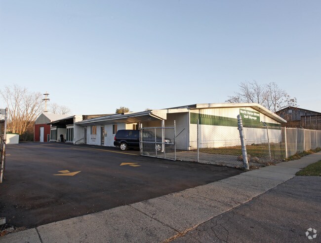
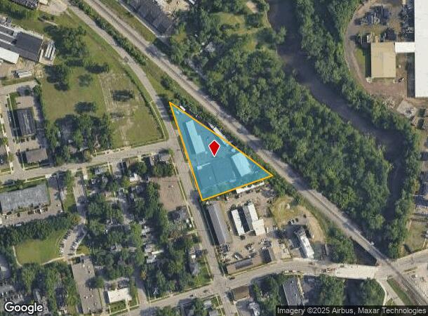
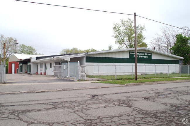
626 N Huron St
11-04-360-003
OLD SID 11-11-010-356-00 YPC 1-W326 COM AT N LN OF FC691 AND E LN OF HURON ST, TH NLY ALONGE LN OF HURON ST 372.24 FT FOR PL OF BEG, TH CONT NLY ALONG THE E LINE OF HURON ST473.82 FT TO A POINT 20 FT SWLY FROM CENT LN OF MAIN TRACK OF MCRRC, TH SELY
Industrialgeneral
Washtenaw
X
Michigan
26161C0288E
1.30 AC
2025
Washtenaw E of 23
2025
Detroit
411000
Ann Arbor, MI
9,730 SF
DEMOGRAPHICS near 626 N Huron St
1 Mile
3 Mile
5 Mile
2024 Total Population
14,964
65,698
122,846
2029 Population
14,855
64,985
121,448
Pop Growth 2024-2029
(0.73%)
(1.09%)
(1.14%)
Average Age
33
37
38
2024 Total Households
6,482
28,227
51,494
HH Growth 2024-2029
(0.99%)
(1.26%)
(1.28%)
Median Household Inc
$44,284
$49,218
$59,634
Avg Household Size
2.00
2.20
2.20
2024 Avg HH Vehicles
1.00
2.00
2.00
Median Home Value
$185,705
$170,165
$223,060
Median Year Built
1957
1969
1975
Nearby Places
Map Layers
Map Styles
 Street
 Aerial
- Restaurants
- Banks
- Shops
- Fitness
- Groceries
PUBLIC TRANSPORTATION
COMMUTER RAIL
Ann Arbor Amtrak Station (Wolverine - Amtrak)
DRIVE
WALK
Distance
Ann Arbor Amtrak Station (Wolverine - Amtrak)
16 min
8.0 mi
AIRPORT
Detroit Metro Wayne County
DRIVE
WALK
Distance
Detroit Metro Wayne County
25 min
18.4 mi
Freight Ports
Port of Toledo
DRIVE
WALK
Distance
Port of Toledo
75 min
60.1 mi
Nearby Properties
Address
Land Use
TOTAL SIZE
Lot Size
Zoning
Address
Land Use
TOTAL SIZE
Lot Size
Zoning
169,963 SF
86.24 AC
P-M
Address
Land Use
TOTAL SIZE
Lot Size
Zoning
36,000 SF
27.61 AC
BI
Address
Land Use
TOTAL SIZE
Lot Size
Zoning
37,500 SF
25.94 AC
BI
Address
Land Use
TOTAL SIZE
Lot Size
Zoning
118,166 SF
P-M
Address
Land Use
TOTAL SIZE
Lot Size
Zoning
361,634 SF
17.09 AC
Address
Land Use
TOTAL SIZE
Lot Size
Zoning
13,720 SF
37.87 AC
Address
Land Use
TOTAL SIZE
Lot Size
Zoning
480 SF
23.64 AC
BI
Address
Land Use
TOTAL SIZE
Lot Size
Zoning
27,306 SF
16.08 AC
BI
Address
Land Use
TOTAL SIZE
Lot Size
Zoning
16,472 SF
29 AC
Address
Land Use
TOTAL SIZE
Lot Size
Zoning
30.77 AC
P-C
Address
Land Use
TOTAL SIZE
Lot Size
Zoning
168,450 SF
8.47 AC
Address
Land Use
TOTAL SIZE
Lot Size
Zoning
1,344 SF
18.17 AC
SPLIT
Address
Land Use
TOTAL SIZE
Lot Size
Zoning
26,146 SF
7.35 AC
BI
Address
Land Use
TOTAL SIZE
Lot Size
Zoning
11,204 SF
28 AC
Address
Land Use
TOTAL SIZE
Lot Size
Zoning
27,060 SF
11.47 AC
SPLIT
Address
Land Use
TOTAL SIZE
Lot Size
Zoning
27,060 SF
5.53 AC
SPLIT
Address
Land Use
TOTAL SIZE
Lot Size
Zoning
12,747 SF
22.86 AC
BA
Address
Land Use
TOTAL SIZE
Lot Size
Zoning
19,692 SF
21.22 AC
BA
Address
Land Use
TOTAL SIZE
Lot Size
Zoning
6,192 SF
19.02 AC
BA
Address
Land Use
TOTAL SIZE
Lot Size
Zoning
32,974 SF
29.96 AC
BA
Address
Land Use
TOTAL SIZE
Lot Size
Zoning
11,630 SF
17.36 AC
BA
Address
Land Use
TOTAL SIZE
Lot Size
Zoning
259,778 SF
25.39 AC
Address
Land Use
TOTAL SIZE
Lot Size
Zoning
26,550 SF
5.44 AC
MD
Address
Land Use
TOTAL SIZE
Lot Size
Zoning
15,877 SF
60 AC
Address
Land Use
TOTAL SIZE
Lot Size
Zoning
81,279 SF
24.86 AC
PUD
Address
Land Use
TOTAL SIZE
Lot Size
Zoning
960 SF
15 AC
BA
Address
Land Use
TOTAL SIZE
Lot Size
Zoning
48,756 SF
5 AC
CN
Address
Land Use
TOTAL SIZE
Lot Size
Zoning
12,747 SF
17.90 AC
BA
Address
Land Use
TOTAL SIZE
Lot Size
Zoning
29,502 SF
11.29 AC
BA
Address
Land Use
TOTAL SIZE
Lot Size
Zoning
124,513 SF
3.79 AC
GC
The World's #1 Commercial Real Estate Marketplace
Connect with us
© 2025 CoStar Group
The information above has been obtained from sources believed reliable. While we do not doubt its accuracy we have not verified it and make no guarantee, warranty or representation about it. It is your responsibility to independently confirm its accuracy and completeness. Any projections, opinions, assumptions, or estimates used are for example only and do not represent the current or future performance of the property. The value of this transaction to you depends on tax and other factors which should be evaluated by your tax, financial, and legal advisors. You and your advisors should conduct a careful, independent investigation of the property to determine to your satisfaction the suitability of the property for your needs.