Property Record
6263 Mcneil Dr, Austin, TX 78729
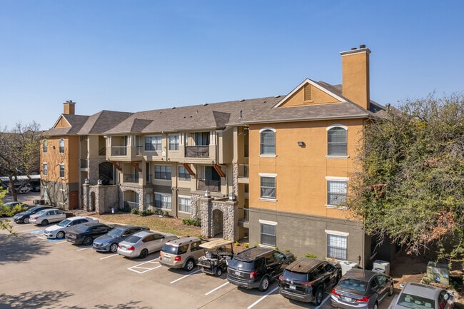

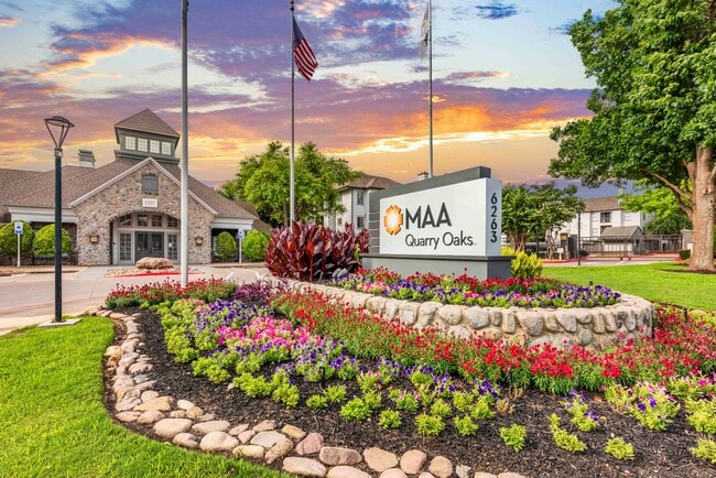

Property Detail
6263 Mcneil Dr
Austin-Round Rock-San Marcos, TX
LOT 1 BLK A JEFFERSON AT MCNEIL/PARMER SUBD REPLAT OF
375891
Travis
Multifamilydwelling
Texas
B and X Area of moderate flood hazard, usually the area between the limits of the 100-year and 500-year floods.
1
2025
23.59 AC
2025
Milwood
034100
Austin
492,227 SF
NEARBY LISTINGS FOR SALE OR LEASE
-
-
View all Austin listings for sale on LoopNet.com
DEMOGRAPHICS near 6263 Mcneil Dr
1 mile
3 mile
5 mile
2025 Total Population
16,521
89,877
264,240
2030 Population
17,562
96,636
285,438
Pop Growth 2025-2030
+ 6.30%
+ 7.52%
+ 8.02%
Average Age
36
39
38
2025 Total Households
7,669
41,394
117,954
HH Growth 2025-2030
+ 6.62%
+ 8.18%
+ 8.49%
Median Household Inc
$96,258
$99,904
$98,369
Avg Household Size
2.10
2.10
2.20
2025 Avg HH Vehicles
1.00
2.00
2.00
Median Home Value
$458,333
$618,185
$595,141
Median Year Built
1994
1992
1996
Nearby Places
Map Layers
Map Styles
 Street
 Aerial
Layers
 Traffic
 Biking
Places
Listings with unknown addresses are not visible on the map
- Restaurants
- Banks
- Shops
- Fitness
- Groceries
PUBLIC TRANSPORTATION
AIRPORT
Austin-Bergstrom International
Drive
Walk
Distance
Austin-Bergstrom International
38 min
25.0 mi
Nearby Properties
Address
Land Use
TOTAL SIZE
Lot Size
Zoning
Address
Land Use
TOTAL SIZE
Lot Size
Zoning
3,601,391 SF
159.61 AC
Address
Land Use
TOTAL SIZE
Lot Size
Zoning
13,523 SF
128.82 AC
Address
Land Use
TOTAL SIZE
Lot Size
Zoning
830,637 SF
23.22 AC
Address
Land Use
TOTAL SIZE
Lot Size
Zoning
462,651 SF
81.77 AC
Address
Land Use
TOTAL SIZE
Lot Size
Zoning
371,269 SF
27.63 AC
Address
Land Use
TOTAL SIZE
Lot Size
Zoning
750,565 SF
65.25 AC
Address
Land Use
TOTAL SIZE
Lot Size
Zoning
295,320 SF
2.99 AC
Address
Land Use
TOTAL SIZE
Lot Size
Zoning
172,307 SF
11.95 AC
Address
Land Use
TOTAL SIZE
Lot Size
Zoning
381,408 SF
22.17 AC
Address
Land Use
TOTAL SIZE
Lot Size
Zoning
1,179,402 SF
92.28 AC
Address
Land Use
TOTAL SIZE
Lot Size
Zoning
364,130 SF
42.45 AC
Address
Land Use
TOTAL SIZE
Lot Size
Zoning
451,564 SF
25 AC
Address
Land Use
TOTAL SIZE
Lot Size
Zoning
293,217 SF
22.34 AC
Address
Land Use
TOTAL SIZE
Lot Size
Zoning
285,120 SF
15.60 AC
Address
Land Use
TOTAL SIZE
Lot Size
Zoning
365,399 SF
11.50 AC
Address
Land Use
TOTAL SIZE
Lot Size
Zoning
277,020 SF
1.41 AC
Address
Land Use
TOTAL SIZE
Lot Size
Zoning
687,401 SF
20.47 AC
Address
Land Use
TOTAL SIZE
Lot Size
Zoning
400,536 SF
31.68 AC
Address
Land Use
TOTAL SIZE
Lot Size
Zoning
331,086 SF
17.23 AC
Address
Land Use
TOTAL SIZE
Lot Size
Zoning
323,148 SF
20.57 AC
Address
Land Use
TOTAL SIZE
Lot Size
Zoning
397,968 SF
21.69 AC
Address
Land Use
TOTAL SIZE
Lot Size
Zoning
381,556 SF
21.50 AC
Address
Land Use
TOTAL SIZE
Lot Size
Zoning
303,280 SF
16.96 AC
Address
Land Use
TOTAL SIZE
Lot Size
Zoning
1,152,630 SF
23.29 AC
Address
Land Use
TOTAL SIZE
Lot Size
Zoning
369,126 SF
29.50 AC
Address
Land Use
TOTAL SIZE
Lot Size
Zoning
410,378 SF
21.43 AC
Address
Land Use
TOTAL SIZE
Lot Size
Zoning
277,022 SF
14.10 AC
Address
Land Use
TOTAL SIZE
Lot Size
Zoning
288,750 SF
15.38 AC
Address
Land Use
TOTAL SIZE
Lot Size
Zoning
327,733 SF
12.96 AC
The World's #1 Commercial Real Estate Marketplace
Connect with us
© 2026 CoStar Group
The information above has been obtained from sources believed reliable. While we do not doubt its accuracy we have not verified it and make no guarantee, warranty or representation about it. It is your responsibility to independently confirm its accuracy and completeness. Any projections, opinions, assumptions, or estimates used are for example only and do not represent the current or future performance of the property. The value of this transaction to you depends on tax and other factors which should be evaluated by your tax, financial, and legal advisors. You and your advisors should conduct a careful, independent investigation of the property to determine to your satisfaction the suitability of the property for your needs.