Property Record
6266 Hurt Rd, Horn Lake, MS 38637


NEARBY LISTINGS FOR SALE OR LEASE
Property Detail
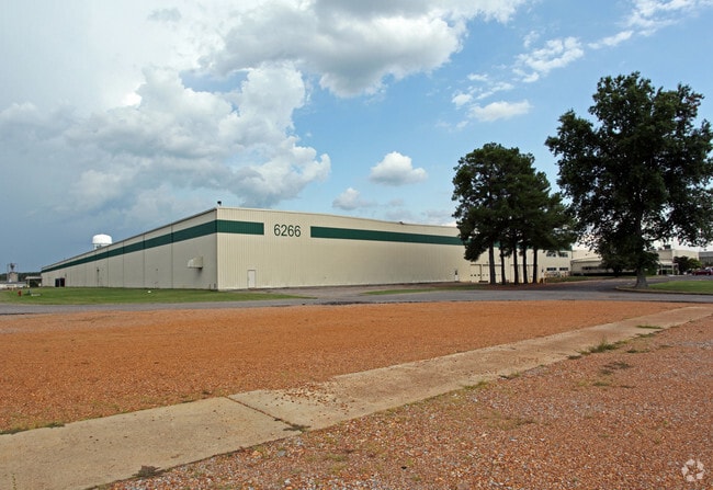
6266 Hurt Rd
Memphis, TN-MS-AR
Hurt Road S/D
1088340800000100
HURT ROAD S/D LOT 1
Warehouse
DeSoto
X
Mississippi
47157C0560F
1
2025
47.18 AC
2025
DeSoto
070322
Memphis
368,500 SF
DEMOGRAPHICS near 6266 Hurt Rd
1 Mile
3 Mile
5 Mile
2024 Total Population
7,367
47,966
100,818
2029 Population
7,977
52,528
107,763
Pop Growth 2024-2029
+ 8.28%
+ 9.51%
+ 6.89%
Average Age
36
36
38
2024 Total Households
2,635
18,539
38,103
HH Growth 2024-2029
+ 8.39%
+ 9.70%
+ 6.99%
Median Household Inc
$50,066
$44,639
$51,020
Avg Household Size
2.70
2.50
2.60
2024 Avg HH Vehicles
2.00
2.00
2.00
Median Home Value
$126,470
$138,488
$154,418
Median Year Built
1984
1991
1987
Nearby Places
Map Layers
Map Styles
 Street
 Aerial
- Restaurants
- Banks
- Shops
- Fitness
- Groceries
PUBLIC TRANSPORTATION
AIRPORT
Memphis International
DRIVE
WALK
Distance
Memphis International
19 min
11.1 mi
Freight Ports
Port of Shreveport
DRIVE
WALK
Distance
Port of Shreveport
420 min
384.7 mi
SALE & LEASE HISTORY
LISTING DATE
SALE/LEASE

Sep 25, 2016
For Lease
Sep 24, 2016
For Sale
Nearby Properties
Address
Land Use
TOTAL SIZE
Lot Size
Zoning
Address
Land Use
TOTAL SIZE
Lot Size
Zoning
1,021,440 SF
57.67 AC
M-1
Address
Land Use
TOTAL SIZE
Lot Size
Zoning
1,197,486 SF
59.47 AC
PBP
Address
Land Use
TOTAL SIZE
Lot Size
Zoning
906,200 SF
73.05 AC
PBP
Address
Land Use
TOTAL SIZE
Lot Size
Zoning
864,024 SF
51.02 AC
PBP
Address
Land Use
TOTAL SIZE
Lot Size
Zoning
23,183 SF
33.02 AC
PUD
Address
Land Use
TOTAL SIZE
Lot Size
Zoning
810,225 SF
47.71 AC
M-1
Address
Land Use
TOTAL SIZE
Lot Size
Zoning
842,678 SF
51 AC
PBP
Address
Land Use
TOTAL SIZE
Lot Size
Zoning
412,218 SF
37.80 AC
PBP
Address
Land Use
TOTAL SIZE
Lot Size
Zoning
581,346 SF
39.98 AC
PUD
Address
Land Use
TOTAL SIZE
Lot Size
Zoning
62,561 SF
33.01 AC
PUD
Address
Land Use
TOTAL SIZE
Lot Size
Zoning
864,160 SF
44.14 AC
PBP
Address
Land Use
TOTAL SIZE
Lot Size
Zoning
18,830 SF
25.45 AC
PUD
Address
Land Use
TOTAL SIZE
Lot Size
Zoning
473,820 SF
56.29 AC
PBP
Address
Land Use
TOTAL SIZE
Lot Size
Zoning
15,472 SF
25.97 AC
PUD
Address
Land Use
TOTAL SIZE
Lot Size
Zoning
581,530 SF
51.64 AC
PBP
Address
Land Use
TOTAL SIZE
Lot Size
Zoning
601,700 SF
29.51 AC
PBP
Address
Land Use
TOTAL SIZE
Lot Size
Zoning
14,122 SF
24 AC
PUD
Address
Land Use
TOTAL SIZE
Lot Size
Zoning
408,580 SF
31.28 AC
M-1
Address
Land Use
TOTAL SIZE
Lot Size
Zoning
553,179 SF
36.77 AC
PBP
Address
Land Use
TOTAL SIZE
Lot Size
Zoning
454,272 SF
22.28 AC
PBP
Address
Land Use
TOTAL SIZE
Lot Size
Zoning
12,775 SF
26.29 AC
PUD
Address
Land Use
TOTAL SIZE
Lot Size
Zoning
328,440 SF
24.49 AC
PBP
Address
Land Use
TOTAL SIZE
Lot Size
Zoning
34,358 SF
26.89 AC
C-4
Address
Land Use
TOTAL SIZE
Lot Size
Zoning
20,588 SF
14 AC
PUD
Address
Land Use
TOTAL SIZE
Lot Size
Zoning
70,434 SF
25 AC
C-4
Address
Land Use
TOTAL SIZE
Lot Size
Zoning
344,190 SF
15.98 AC
PBP
Address
Land Use
TOTAL SIZE
Lot Size
Zoning
13,129 SF
12 AC
PUD
Address
Land Use
TOTAL SIZE
Lot Size
Zoning
186,757 SF
29 AC
C-4
Address
Land Use
TOTAL SIZE
Lot Size
Zoning
300,764 SF
22.13 AC
PBP
Address
Land Use
TOTAL SIZE
Lot Size
Zoning
9,684 SF
13.06 AC
R-6
The World's #1 Commercial Real Estate Marketplace
Connect with us
© 2026 CoStar Group
The information above has been obtained from sources believed reliable. While we do not doubt its accuracy we have not verified it and make no guarantee, warranty or representation about it. It is your responsibility to independently confirm its accuracy and completeness. Any projections, opinions, assumptions, or estimates used are for example only and do not represent the current or future performance of the property. The value of this transaction to you depends on tax and other factors which should be evaluated by your tax, financial, and legal advisors. You and your advisors should conduct a careful, independent investigation of the property to determine to your satisfaction the suitability of the property for your needs.