Property Record
6269 El Fuerte St, Carlsbad, CA 92009


NEARBY LISTINGS FOR SALE OR LEASE
Property Detail
6269 El Fuerte St
San Diego-Carlsbad, CA
City Of Carlsbad
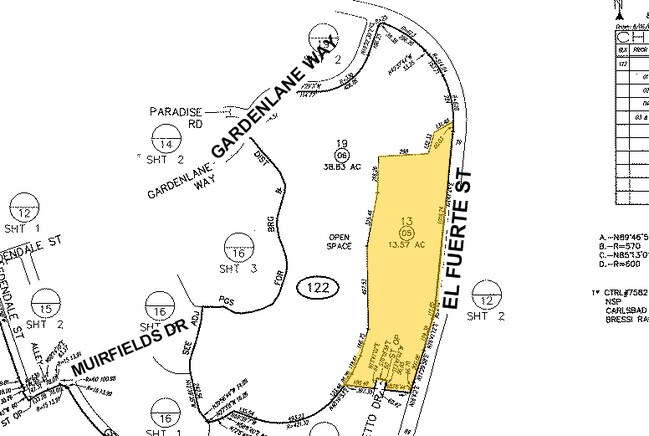
213-122-18
PAR A TR PM21190
Privateschool
San Diego
X
California
06073C1055G
12.49 AC
2024
Carlsbad
2025
San Diego
020030
DEMOGRAPHICS near 6269 El Fuerte St
1 Mile
3 Mile
5 Mile
2024 Total Population
7,489
74,758
236,383
2029 Population
7,427
74,167
234,489
Pop Growth 2024-2029
(0.83%)
(0.79%)
(0.80%)
Average Age
39
44
41
2024 Total Households
2,541
28,596
85,318
HH Growth 2024-2029
(1.10%)
(0.90%)
(0.95%)
Median Household Inc
$157,452
$121,429
$117,126
Avg Household Size
2.90
2.50
2.70
2024 Avg HH Vehicles
2.00
2.00
2.00
Median Home Value
$1,090,576
$898,532
$897,744
Median Year Built
2003
1990
1989
Nearby Places
Map Layers
Map Styles
 Street
 Aerial
- Restaurants
- Banks
- Shops
- Fitness
- Groceries
PUBLIC TRANSPORTATION
COMMUTER RAIL
Carlsbad Poinsettia (Coaster - San Diego North County Transit District (Coaster/Sprinter/Breeze))
DRIVE
WALK
Distance
Carlsbad Poinsettia (Coaster - San Diego North County Transit District (Coaster/Sprinter/Breeze))
11 min
5.4 mi
Encinitas (Coaster - San Diego North County Transit District (Coaster/Sprinter/Breeze))
DRIVE
WALK
Distance
Encinitas (Coaster - San Diego North County Transit District (Coaster/Sprinter/Breeze))
15 min
8.5 mi
AIRPORT
San Diego International
DRIVE
WALK
Distance
San Diego International
43 min
31.9 mi
Freight Ports
Port of San Diego
DRIVE
WALK
Distance
Port of San Diego
48 min
36.2 mi
Nearby Properties
Address
Land Use
TOTAL SIZE
Lot Size
Zoning
Address
Land Use
TOTAL SIZE
Lot Size
Zoning
55.06 AC
P-C
Address
Land Use
TOTAL SIZE
Lot Size
Zoning
13.92 AC
P-M
Address
Land Use
TOTAL SIZE
Lot Size
Zoning
12.62 AC
P-C
Address
Land Use
TOTAL SIZE
Lot Size
Zoning
8.76 AC
P-C
Address
Land Use
TOTAL SIZE
Lot Size
Zoning
14.32 AC
P-M
Address
Land Use
TOTAL SIZE
Lot Size
Zoning
7.31 AC
P-C
Address
Land Use
TOTAL SIZE
Lot Size
Zoning
28.15 AC
C-M
Address
Land Use
TOTAL SIZE
Lot Size
Zoning
10.96 AC
C-M
Address
Land Use
TOTAL SIZE
Lot Size
Zoning
13.86 AC
C-M
Address
Land Use
TOTAL SIZE
Lot Size
Zoning
13.07 AC
P-M
Address
Land Use
TOTAL SIZE
Lot Size
Zoning
18.34 AC
P-C
Address
Land Use
TOTAL SIZE
Lot Size
Zoning
28.45 AC
O-S
Address
Land Use
TOTAL SIZE
Lot Size
Zoning
11.87 AC
R-M
Address
Land Use
TOTAL SIZE
Lot Size
Zoning
9.41 AC
SPI
Address
Land Use
TOTAL SIZE
Lot Size
Zoning
69,200 SF
4.52 AC
P-M
Address
Land Use
TOTAL SIZE
Lot Size
Zoning
11.08 AC
SPI
Address
Land Use
TOTAL SIZE
Lot Size
Zoning
11.49 AC
P-M
Address
Land Use
TOTAL SIZE
Lot Size
Zoning
14.91 AC
SPI
Address
Land Use
TOTAL SIZE
Lot Size
Zoning
14.73 AC
C-L
Address
Land Use
TOTAL SIZE
Lot Size
Zoning
4.76 AC
C34
Address
Land Use
TOTAL SIZE
Lot Size
Zoning
10.94 AC
P-M
Address
Land Use
TOTAL SIZE
Lot Size
Zoning
91,431 SF
8.69 AC
C-2
Address
Land Use
TOTAL SIZE
Lot Size
Zoning
11.10 AC
RD-M-Q
Address
Land Use
TOTAL SIZE
Lot Size
Zoning
13.20 AC
P-M
Address
Land Use
TOTAL SIZE
Lot Size
Zoning
7.42 AC
P-M
Address
Land Use
TOTAL SIZE
Lot Size
Zoning
9.80 AC
I
Address
Land Use
TOTAL SIZE
Lot Size
Zoning
7.91 AC
SPI
Address
Land Use
TOTAL SIZE
Lot Size
Zoning
9.74 AC
C-M
Address
Land Use
TOTAL SIZE
Lot Size
Zoning
19.35 AC
P-M
The World's #1 Commercial Real Estate Marketplace
Connect with us
© 2025 CoStar Group
The information above has been obtained from sources believed reliable. While we do not doubt its accuracy we have not verified it and make no guarantee, warranty or representation about it. It is your responsibility to independently confirm its accuracy and completeness. Any projections, opinions, assumptions, or estimates used are for example only and do not represent the current or future performance of the property. The value of this transaction to you depends on tax and other factors which should be evaluated by your tax, financial, and legal advisors. You and your advisors should conduct a careful, independent investigation of the property to determine to your satisfaction the suitability of the property for your needs.