Property Record
627 E Maple Rd, Troy, MI 48083


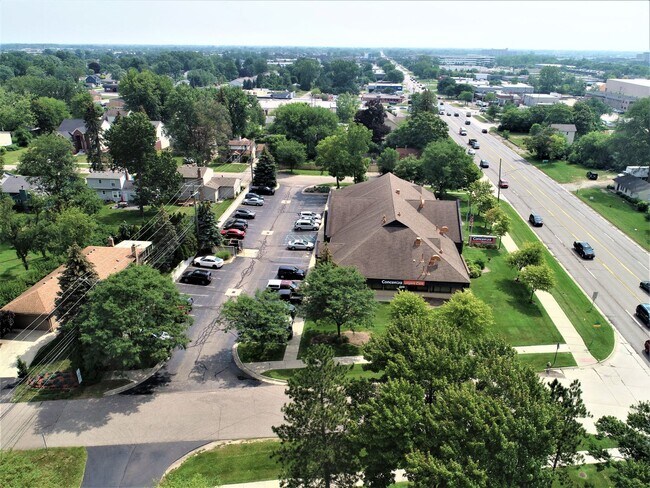

Property Detail
627 E Maple Rd
20-27-403-062
T2N, R11E, SEC 27 SUPERVISOR'S PLAT OF BEECH GROVE HEIGHTS SUB NO. 1 LOTS 46,47 & 48, ALSO LOT 70 8-24-99 FR 044, 045 & 046
Commercialnec
Oakland
O1
Michigan
B and X Area of moderate flood hazard, usually the area between the limits of the 100-year and 500-year floods.
70
2024
0.98 AC
2022
Troy South
197500
Detroit
10,277 SF
Detroit-Warren-Dearborn, MI
NEARBY LISTINGS FOR SALE OR LEASE
DEMOGRAPHICS near 627 E Maple Rd
1 mile
3 mile
5 mile
2024 Total Population
9,795
95,691
294,465
2029 Population
10,044
97,507
298,991
Pop Growth 2024-2029
+ 2.54%
+ 1.90%
+ 1.54%
Average Age
40
41
42
2024 Total Households
4,549
42,599
124,311
HH Growth 2024-2029
+ 2.48%
+ 1.99%
+ 1.71%
Median Household Inc
$79,223
$87,519
$94,945
Avg Household Size
2.10
2.20
2.30
2024 Avg HH Vehicles
2.00
2.00
2.00
Median Home Value
$259,236
$302,979
$318,635
Median Year Built
1972
1970
1967
Nearby Places
Map Layers
Map Styles
 Street
 Aerial
Transit
 Traffic
 Biking
Places
Listings with unknown addresses are not visible on the map
- Restaurants
- Banks
- Shops
- Fitness
- Groceries
PUBLIC TRANSPORTATION
COMMUTER RAIL
Drive
Walk
Distance
7 min
3.3 mi
Drive
Walk
Distance
12 min
4.6 mi
AIRPORT
Windsor International
Drive
Walk
Distance
Windsor International
46 min
26.8 mi
Detroit Metro Wayne County
Drive
Walk
Distance
Detroit Metro Wayne County
50 min
36.3 mi
SALE & LEASE HISTORY
LISTING DATE
SALE/LEASE

Feb 04, 2020
For Sale
Aug 05, 2021
For Sale
Nearby Properties
Address
Land Use
TOTAL SIZE
Lot Size
Zoning
Address
Land Use
TOTAL SIZE
Lot Size
Zoning
399,735 SF
19.71 AC
B2
Address
Land Use
TOTAL SIZE
Lot Size
Zoning
272,233 SF
90.90 AC
Address
Land Use
TOTAL SIZE
Lot Size
Zoning
136,137 SF
12.28 AC
RM2
Address
Land Use
TOTAL SIZE
Lot Size
Zoning
224,766 SF
19.92 AC
B2
Address
Land Use
TOTAL SIZE
Lot Size
Zoning
300,925 SF
10.13 AC
Address
Land Use
TOTAL SIZE
Lot Size
Zoning
512,471 SF
21 AC
Address
Land Use
TOTAL SIZE
Lot Size
Zoning
512,475 SF
20.02 AC
Address
Land Use
TOTAL SIZE
Lot Size
Zoning
21.76 AC
Address
Land Use
TOTAL SIZE
Lot Size
Zoning
476,388 SF
23 AC
Address
Land Use
TOTAL SIZE
Lot Size
Zoning
40.32 AC
RM-2
Address
Land Use
TOTAL SIZE
Lot Size
Zoning
208,296 SF
8.16 AC
OSC
Address
Land Use
TOTAL SIZE
Lot Size
Zoning
157,500 SF
20.79 AC
OM
Address
Land Use
TOTAL SIZE
Lot Size
Zoning
272,233 SF
9.09 AC
OSC
Address
Land Use
TOTAL SIZE
Lot Size
Zoning
399,212 SF
26.18 AC
RM1
Address
Land Use
TOTAL SIZE
Lot Size
Zoning
136,672 SF
32 AC
Address
Land Use
TOTAL SIZE
Lot Size
Zoning
12.16 AC
PUD
Address
Land Use
TOTAL SIZE
Lot Size
Zoning
427,945 SF
18.26 AC
OSC
Address
Land Use
TOTAL SIZE
Lot Size
Zoning
251,735 SF
10.57 AC
RM3
Address
Land Use
TOTAL SIZE
Lot Size
Zoning
250,868 SF
6 AC
OSC
Address
Land Use
TOTAL SIZE
Lot Size
Zoning
362,816 SF
29 AC
Address
Land Use
TOTAL SIZE
Lot Size
Zoning
300,925 SF
10.13 AC
OSC
Address
Land Use
TOTAL SIZE
Lot Size
Zoning
300,924 SF
10.13 AC
Address
Land Use
TOTAL SIZE
Lot Size
Zoning
301,728 SF
2.83 AC
B2
Address
Land Use
TOTAL SIZE
Lot Size
Zoning
119,732 SF
3.77 AC
Address
Land Use
TOTAL SIZE
Lot Size
Zoning
94,228 SF
17.66 AC
Address
Land Use
TOTAL SIZE
Lot Size
Zoning
16,022 SF
4.07 AC
OSC
Address
Land Use
TOTAL SIZE
Lot Size
Zoning
150,240 SF
10.70 AC
OSC
Address
Land Use
TOTAL SIZE
Lot Size
Zoning
206,913 SF
16.99 AC
O1
Address
Land Use
TOTAL SIZE
Lot Size
Zoning
349,226 SF
21.62 AC
RMMUL
Address
Land Use
TOTAL SIZE
Lot Size
Zoning
4.21 AC
The World's #1 Commercial Real Estate Marketplace
Connect with us
© 2026 CoStar Group
The information above has been obtained from sources believed reliable. While we do not doubt its accuracy we have not verified it and make no guarantee, warranty or representation about it. It is your responsibility to independently confirm its accuracy and completeness. Any projections, opinions, assumptions, or estimates used are for example only and do not represent the current or future performance of the property. The value of this transaction to you depends on tax and other factors which should be evaluated by your tax, financial, and legal advisors. You and your advisors should conduct a careful, independent investigation of the property to determine to your satisfaction the suitability of the property for your needs.