Property Record
629 Furys Ferry Rd, Augusta, GA 30907

Save to a Folder
{{folder.Name}}
{{folder.ListingIds.length}} Properties
{{folder.ListingIds.length}} Property
Create a New Folder
Property Detail
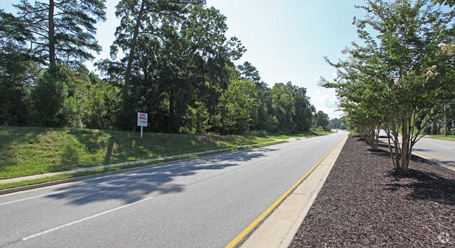
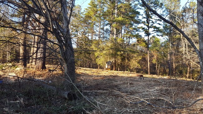
629 Furys Ferry Rd
081A030
0.93 ACS
Realpropertynec
COLUMBIA
P-1;PROFES
Georgia
B and X Area of moderate flood hazard, usually the area between the limits of the 100-year and 500-year floods.
0.93 AC
2025
Evans/Martinez
2025
Augusta/Richmond County
030108
Augusta-Richmond County, GA-SC
3,825 SF
NEARBY LISTINGS FOR SALE OR LEASE
DEMOGRAPHICS near 629 Furys Ferry Rd
1 mile
3 mile
5 mile
2025 Total Population
6,060
45,373
100,961
2030 Population
6,404
47,331
103,725
Pop Growth 2025-2030
+ 5.68%
+ 4.32%
+ 2.74%
Average Age
43
42
41
2025 Total Households
2,182
17,280
41,370
HH Growth 2025-2030
+ 5.68%
+ 4.13%
+ 2.37%
Median Household Inc
$110,672
$101,684
$85,224
Avg Household Size
2.70
2.50
2.40
2025 Avg HH Vehicles
2.00
2.00
2.00
Median Home Value
$377,241
$329,245
$297,081
Median Year Built
1994
1992
1990
Nearby Places
Map Layers
Map Styles
 Street
 Aerial
Layers
 Traffic
 Biking
Places
Listings with unknown addresses are not visible on the map
- Restaurants
- Banks
- Shops
- Fitness
- Groceries
PUBLIC TRANSPORTATION
AIRPORT
Augusta Regional at Bush Field
Drive
Walk
Distance
Augusta Regional at Bush Field
30 min
18.1 mi
Freight Ports
Georgia Ports - Savannah
Drive
Walk
Distance
Georgia Ports - Savannah
164 min
127.2 mi
SALE & LEASE HISTORY
LISTING DATE
SALE/LEASE

Sep 24, 2016
For Sale
Jun 29, 2018
For Sale
Nearby Properties
Address
Land Use
TOTAL SIZE
Lot Size
Zoning
Address
Land Use
TOTAL SIZE
Lot Size
Zoning
2,070 SF
24.68 AC
Address
Land Use
TOTAL SIZE
Lot Size
Zoning
4,077 SF
20.88 AC
C-2;GEN CO
Address
Land Use
TOTAL SIZE
Lot Size
Zoning
13.19 AC
Address
Land Use
TOTAL SIZE
Lot Size
Zoning
7,749 SF
17.02 AC
R2
Address
Land Use
TOTAL SIZE
Lot Size
Zoning
57,341 SF
54.33 AC
Address
Land Use
TOTAL SIZE
Lot Size
Zoning
100 SF
16.05 AC
Address
Land Use
TOTAL SIZE
Lot Size
Zoning
16,323 SF
24.61 AC
Address
Land Use
TOTAL SIZE
Lot Size
Zoning
53,653 SF
11.26 AC
Address
Land Use
TOTAL SIZE
Lot Size
Zoning
2,508 SF
14.61 AC
A-R;APARTM
Address
Land Use
TOTAL SIZE
Lot Size
Zoning
150,807 SF
16.91 AC
R-1A SPEX
Address
Land Use
TOTAL SIZE
Lot Size
Zoning
61,473 SF
PUD
Address
Land Use
TOTAL SIZE
Lot Size
Zoning
997 SF
19.16 AC
Address
Land Use
TOTAL SIZE
Lot Size
Zoning
6,000 SF
Address
Land Use
TOTAL SIZE
Lot Size
Zoning
150,263 SF
18.75 AC
PUD
Address
Land Use
TOTAL SIZE
Lot Size
Zoning
129,068 SF
8.74 AC
Address
Land Use
TOTAL SIZE
Lot Size
Zoning
125,466 SF
15.98 AC
B-2
Address
Land Use
TOTAL SIZE
Lot Size
Zoning
17,977 SF
21.43 AC
Address
Land Use
TOTAL SIZE
Lot Size
Zoning
4,800 SF
24.43 AC
PUD
Address
Land Use
TOTAL SIZE
Lot Size
Zoning
20,736 SF
15.51 AC
R-3B
Address
Land Use
TOTAL SIZE
Lot Size
Zoning
6,960 SF
5.39 AC
S1
Address
Land Use
TOTAL SIZE
Lot Size
Zoning
36.89 AC
Address
Land Use
TOTAL SIZE
Lot Size
Zoning
13,788 SF
55.14 AC
Address
Land Use
TOTAL SIZE
Lot Size
Zoning
2,494 SF
11.76 AC
A-R;APARTM
Address
Land Use
TOTAL SIZE
Lot Size
Zoning
26,965 SF
11.18 AC
Address
Land Use
TOTAL SIZE
Lot Size
Zoning
135,920 SF
16.29 AC
Address
Land Use
TOTAL SIZE
Lot Size
Zoning
37,980 SF
1.81 AC
B-2
Address
Land Use
TOTAL SIZE
Lot Size
Zoning
14,910 SF
12.17 AC
Address
Land Use
TOTAL SIZE
Lot Size
Zoning
9,952 SF
11 AC
C-2;GEN CO
Address
Land Use
TOTAL SIZE
Lot Size
Zoning
89,522 SF
5.83 AC
Address
Land Use
TOTAL SIZE
Lot Size
Zoning
84,414 SF
20.77 AC
The World's #1 Commercial Real Estate Marketplace
Connect with us
© 2026 CoStar Group
The information above has been obtained from sources believed reliable. While we do not doubt its accuracy we have not verified it and make no guarantee, warranty or representation about it. It is your responsibility to independently confirm its accuracy and completeness. Any projections, opinions, assumptions, or estimates used are for example only and do not represent the current or future performance of the property. The value of this transaction to you depends on tax and other factors which should be evaluated by your tax, financial, and legal advisors. You and your advisors should conduct a careful, independent investigation of the property to determine to your satisfaction the suitability of the property for your needs.