Property Record
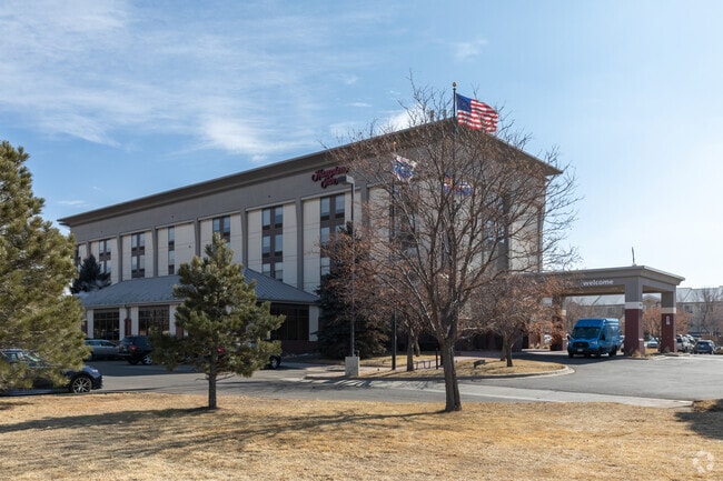
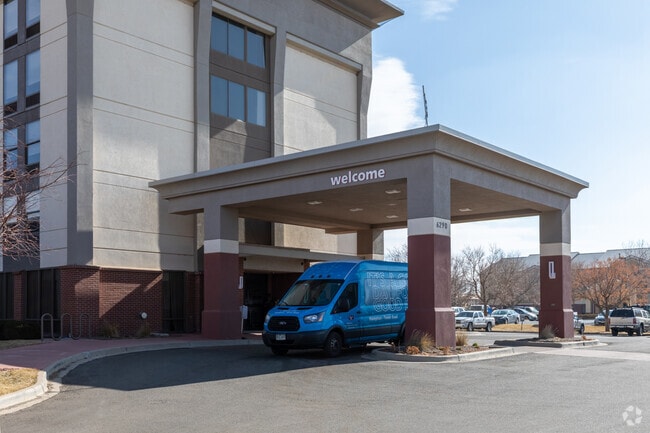
6290 Tower Rd, Denver, CO 80249


Property Detail
6290 Tower Rd
0102-00-141
DENVER GATEWAY CENTER FLG NO 1 B1 L1
Hotel
DENVER
GTWY
Colorado
B and X Area of moderate flood hazard, usually the area between the limits of the 100-year and 500-year floods.
1
2024
2.48 AC
2025
Denver Airport/East
015800
Denver
55,590 SF
Denver-Aurora-Centennial, CO
NEARBY LISTINGS FOR SALE OR LEASE
-
-
View all Denver listings for sale on LoopNet.com
DEMOGRAPHICS near 6290 Tower Rd
1 mile
3 mile
5 mile
2024 Total Population
8,525
62,548
120,377
2029 Population
9,555
65,247
125,739
Pop Growth 2024-2029
+ 12.08%
+ 4.32%
+ 4.45%
Average Age
32
35
35
2024 Total Households
3,188
19,472
35,958
HH Growth 2024-2029
+ 12.30%
+ 4.70%
+ 4.75%
Median Household Inc
$90,473
$100,362
$99,088
Avg Household Size
2.70
3.10
3.20
2024 Avg HH Vehicles
2.00
2.00
2.00
Median Home Value
$438,699
$469,646
$463,442
Median Year Built
2010
2007
2003
Nearby Places
Map Layers
Map Styles
 Street
 Aerial
Transit
 Traffic
 Biking
Places
Listings with unknown addresses are not visible on the map
- Restaurants
- Banks
- Shops
- Fitness
- Groceries
PUBLIC TRANSPORTATION
COMMUTER RAIL
Drive
Walk
Distance
3 min
20 min
1.0 mi
Drive
Walk
Distance
10 min
4.2 mi
AIRPORT
Denver International
Drive
Walk
Distance
Denver International
12 min
8.3 mi
Nearby Properties
Address
Land Use
TOTAL SIZE
Lot Size
Zoning
Address
Land Use
TOTAL SIZE
Lot Size
Zoning
1,996,111 SF
73.07 AC
Address
Land Use
TOTAL SIZE
Lot Size
Zoning
1,214,982 SF
149.04 AC
I-MX-8
Address
Land Use
TOTAL SIZE
Lot Size
Zoning
258,315 SF
16.83 AC
Address
Land Use
TOTAL SIZE
Lot Size
Zoning
999,780 SF
72.36 AC
Address
Land Use
TOTAL SIZE
Lot Size
Zoning
110,192 SF
2.95 AC
C-MU-30
Address
Land Use
TOTAL SIZE
Lot Size
Zoning
200,105 SF
34.54 AC
C-MU-20
Address
Land Use
TOTAL SIZE
Lot Size
Zoning
102,444 SF
3.76 AC
GTWY
Address
Land Use
TOTAL SIZE
Lot Size
Zoning
550,031 SF
37.73 AC
Address
Land Use
TOTAL SIZE
Lot Size
Zoning
185,812 SF
20.93 AC
C-MU-20
Address
Land Use
TOTAL SIZE
Lot Size
Zoning
594,400 SF
33.13 AC
Address
Land Use
TOTAL SIZE
Lot Size
Zoning
108,548 SF
2.98 AC
C-MU-20
Address
Land Use
TOTAL SIZE
Lot Size
Zoning
134,052 SF
6.77 AC
C-MX
Address
Land Use
TOTAL SIZE
Lot Size
Zoning
540,800 SF
38.81 AC
Address
Land Use
TOTAL SIZE
Lot Size
Zoning
99,800 SF
4.03 AC
GTWY
Address
Land Use
TOTAL SIZE
Lot Size
Zoning
172,878 SF
2.46 AC
C-MU-20
Address
Land Use
TOTAL SIZE
Lot Size
Zoning
71,229 SF
2.58 AC
C-MX
Address
Land Use
TOTAL SIZE
Lot Size
Zoning
419,630 SF
24.34 AC
Address
Land Use
TOTAL SIZE
Lot Size
Zoning
217,995 SF
12.31 AC
S-SU-D
Address
Land Use
TOTAL SIZE
Lot Size
Zoning
92,598 SF
2.78 AC
G-TW
Address
Land Use
TOTAL SIZE
Lot Size
Zoning
226,972 SF
20.36 AC
Address
Land Use
TOTAL SIZE
Lot Size
Zoning
90,368 SF
2.86 AC
C-MX
Address
Land Use
TOTAL SIZE
Lot Size
Zoning
60,021 SF
1.86 AC
C-MU-10
Address
Land Use
TOTAL SIZE
Lot Size
Zoning
64,635 SF
2.06 AC
C-MX
Address
Land Use
TOTAL SIZE
Lot Size
Zoning
437,144 SF
11.58 AC
Address
Land Use
TOTAL SIZE
Lot Size
Zoning
347,840 SF
19.95 AC
Address
Land Use
TOTAL SIZE
Lot Size
Zoning
121,970 SF
12.12 AC
C-MU-20
Address
Land Use
TOTAL SIZE
Lot Size
Zoning
57,899 SF
2.52 AC
C-MU-20
Address
Land Use
TOTAL SIZE
Lot Size
Zoning
328,104 SF
18.32 AC
Address
Land Use
TOTAL SIZE
Lot Size
Zoning
82,039 SF
2.60 AC
C-MX
The World's #1 Commercial Real Estate Marketplace
Connect with us
© 2026 CoStar Group
The information above has been obtained from sources believed reliable. While we do not doubt its accuracy we have not verified it and make no guarantee, warranty or representation about it. It is your responsibility to independently confirm its accuracy and completeness. Any projections, opinions, assumptions, or estimates used are for example only and do not represent the current or future performance of the property. The value of this transaction to you depends on tax and other factors which should be evaluated by your tax, financial, and legal advisors. You and your advisors should conduct a careful, independent investigation of the property to determine to your satisfaction the suitability of the property for your needs.