No Photo
Property Record
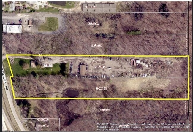
6291 Chittenden Rd, Hudson, OH 44236
Property Detail
6291 Chittenden Rd
Akron, OH
PETTIT FARMS LOT 5 ALL LESS PT FOR HGWY
13-00250
Summit
Commercialnec
Ohio
B and X Area of moderate flood hazard, usually the area between the limits of the 100-year and 500-year floods.
5
2025
4.31 AC
2026
Akron
532600
Cleveland
1,176 SF
NEARBY LISTINGS FOR SALE OR LEASE
DEMOGRAPHICS near 6291 Chittenden Rd
1 mile
3 mile
5 mile
2025 Total Population
947
14,042
52,685
2030 Population
962
14,133
52,759
Pop Growth 2025-2030
+ 1.58%
+ 0.65%
+ 0.14%
Average Age
45
43
42
2025 Total Households
365
5,270
20,417
HH Growth 2025-2030
+ 1.64%
+ 0.78%
+ 0.25%
Median Household Inc
$148,055
$158,321
$124,262
Avg Household Size
2.50
2.60
2.50
2025 Avg HH Vehicles
2.00
2.00
2.00
Median Home Value
$484,285
$462,216
$370,151
Median Year Built
1987
1990
1985
Nearby Places
Map Layers
Map Styles
 Street
 Aerial
Layers
 Traffic
 Biking
Places
Listings with unknown addresses are not visible on the map
- Restaurants
- Banks
- Shops
- Fitness
- Groceries
PUBLIC TRANSPORTATION
COMMUTER RAIL
Drive
Walk
Distance
8 min
4.0 mi
Drive
Walk
Distance
12 min
4.9 mi
AIRPORT
Akron-Canton Regional
Drive
Walk
Distance
Akron-Canton Regional
35 min
25.2 mi
Cleveland-Hopkins International
Drive
Walk
Distance
Cleveland-Hopkins International
43 min
29.7 mi
SALE & LEASE HISTORY
LISTING DATE
SALE/LEASE

Oct 16, 2020
For Sale
Jan 29, 2020
For Sale
Nearby Properties
Address
Land Use
TOTAL SIZE
Lot Size
Zoning
Address
Land Use
TOTAL SIZE
Lot Size
Zoning
Address
Land Use
TOTAL SIZE
Lot Size
Zoning
665.83 AC
Address
Land Use
TOTAL SIZE
Lot Size
Zoning
439,460 SF
146.63 AC
Address
Land Use
TOTAL SIZE
Lot Size
Zoning
193,683 SF
45.24 AC
Address
Land Use
TOTAL SIZE
Lot Size
Zoning
1,020,250 SF
63.69 AC
Address
Land Use
TOTAL SIZE
Lot Size
Zoning
Address
Land Use
TOTAL SIZE
Lot Size
Zoning
Address
Land Use
TOTAL SIZE
Lot Size
Zoning
114,568 SF
11.55 AC
Address
Land Use
TOTAL SIZE
Lot Size
Zoning
44,697 SF
17.83 AC
Address
Land Use
TOTAL SIZE
Lot Size
Zoning
110,681 SF
6.85 AC
Address
Land Use
TOTAL SIZE
Lot Size
Zoning
178.21 AC
Address
Land Use
TOTAL SIZE
Lot Size
Zoning
60,022 SF
3.63 AC
Address
Land Use
TOTAL SIZE
Lot Size
Zoning
258,840 SF
25.62 AC
Address
Land Use
TOTAL SIZE
Lot Size
Zoning
142,251 SF
17.27 AC
Address
Land Use
TOTAL SIZE
Lot Size
Zoning
Address
Land Use
TOTAL SIZE
Lot Size
Zoning
107,836 SF
9.08 AC
Address
Land Use
TOTAL SIZE
Lot Size
Zoning
Address
Land Use
TOTAL SIZE
Lot Size
Zoning
162,479 SF
16.29 AC
Address
Land Use
TOTAL SIZE
Lot Size
Zoning
Address
Land Use
TOTAL SIZE
Lot Size
Zoning
41,480 SF
7.09 AC
Address
Land Use
TOTAL SIZE
Lot Size
Zoning
111,766 SF
32.18 AC
Address
Land Use
TOTAL SIZE
Lot Size
Zoning
21.80 AC
Address
Land Use
TOTAL SIZE
Lot Size
Zoning
Address
Land Use
TOTAL SIZE
Lot Size
Zoning
31,442 SF
6.51 AC
Address
Land Use
TOTAL SIZE
Lot Size
Zoning
11,212 SF
0.93 AC
Address
Land Use
TOTAL SIZE
Lot Size
Zoning
64,212 SF
443.23 AC
Address
Land Use
TOTAL SIZE
Lot Size
Zoning
6.52 AC
Address
Land Use
TOTAL SIZE
Lot Size
Zoning
7.20 AC
Address
Land Use
TOTAL SIZE
Lot Size
Zoning
99,702 SF
10.86 AC
Address
Land Use
TOTAL SIZE
Lot Size
Zoning
41,774 SF
31.40 AC
The World's #1 Commercial Real Estate Marketplace
Connect with us
© 2026 CoStar Group
The information above has been obtained from sources believed reliable. While we do not doubt its accuracy we have not verified it and make no guarantee, warranty or representation about it. It is your responsibility to independently confirm its accuracy and completeness. Any projections, opinions, assumptions, or estimates used are for example only and do not represent the current or future performance of the property. The value of this transaction to you depends on tax and other factors which should be evaluated by your tax, financial, and legal advisors. You and your advisors should conduct a careful, independent investigation of the property to determine to your satisfaction the suitability of the property for your needs.