Property Record
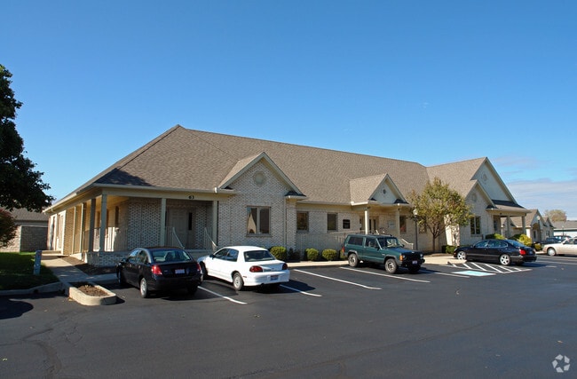
55 Rhoads Center Dr, Dayton, OH 45458
NEARBY LISTINGS FOR SALE OR LEASE
Property Detail
55 Rhoads Center Dr
O67-51444-0001
Rhoads Center Office Condo Ph 1
Officecondo
UNIT 55 RHOADS CENTER OFFICE CONDO PH 1
X
Montgomery
39165C0035E
Ohio
2023
0.03 AC
2024
South Dayton
040306
Cincinnati/Dayton
3,092 SF
Dayton, OH
DEMOGRAPHICS near 55 Rhoads Center Dr
1 Mile
3 Mile
5 Mile
2024 Total Population
7,867
52,692
126,703
2029 Population
7,739
52,407
127,055
Pop Growth 2024-2029
(1.63%)
(0.54%)
+ 0.28%
Average Age
42
43
42
2024 Total Households
3,475
22,172
52,987
HH Growth 2024-2029
(1.81%)
(0.74%)
(0.07%)
Median Household Inc
$73,713
$96,344
$90,409
Avg Household Size
2.30
2.30
2.30
2024 Avg HH Vehicles
2.00
2.00
2.00
Median Home Value
$231,107
$273,306
$262,824
Median Year Built
1979
1985
1982
Nearby Places
- Restaurants
- Banks
- Shops
- Fitness
- Groceries
SALE & LEASE HISTORY
LISTING DATE
SALE/LEASE

May 24, 2019
For Lease
Aug 04, 2025
For Lease
Nearby Properties
Address
Land Use
TOTAL SIZE
Lot Size
Zoning
Address
Land Use
TOTAL SIZE
Lot Size
Zoning
25,715 SF
23.28 AC
Address
Land Use
TOTAL SIZE
Lot Size
Zoning
42.40 AC
Address
Land Use
TOTAL SIZE
Lot Size
Zoning
462,864 SF
38.86 AC
Address
Land Use
TOTAL SIZE
Lot Size
Zoning
191,667 SF
35.98 AC
Address
Land Use
TOTAL SIZE
Lot Size
Zoning
490,354 SF
60 AC
Address
Land Use
TOTAL SIZE
Lot Size
Zoning
59,658 SF
74.94 AC
Address
Land Use
TOTAL SIZE
Lot Size
Zoning
5,461 SF
10.35 AC
Address
Land Use
TOTAL SIZE
Lot Size
Zoning
47,552 SF
47.55 AC
Address
Land Use
TOTAL SIZE
Lot Size
Zoning
64,121 SF
21.21 AC
Address
Land Use
TOTAL SIZE
Lot Size
Zoning
203,122 SF
4.63 AC
Address
Land Use
TOTAL SIZE
Lot Size
Zoning
160,885 SF
22.44 AC
Address
Land Use
TOTAL SIZE
Lot Size
Zoning
162,036 SF
9.83 AC
Address
Land Use
TOTAL SIZE
Lot Size
Zoning
142,887 SF
15.25 AC
Address
Land Use
TOTAL SIZE
Lot Size
Zoning
272,855 SF
29.01 AC
Address
Land Use
TOTAL SIZE
Lot Size
Zoning
81,787 SF
45.38 AC
Address
Land Use
TOTAL SIZE
Lot Size
Zoning
198,030 SF
22.32 AC
Address
Land Use
TOTAL SIZE
Lot Size
Zoning
138,484 SF
23.04 AC
Address
Land Use
TOTAL SIZE
Lot Size
Zoning
89,683 SF
33.45 AC
Address
Land Use
TOTAL SIZE
Lot Size
Zoning
24,928 SF
13.67 AC
Address
Land Use
TOTAL SIZE
Lot Size
Zoning
137,948 SF
4.60 AC
Address
Land Use
TOTAL SIZE
Lot Size
Zoning
Address
Land Use
TOTAL SIZE
Lot Size
Zoning
10,912 SF
15.28 AC
Address
Land Use
TOTAL SIZE
Lot Size
Zoning
148,369 SF
14.69 AC
Address
Land Use
TOTAL SIZE
Lot Size
Zoning
88,556 SF
23.94 AC
Address
Land Use
TOTAL SIZE
Lot Size
Zoning
44,736 SF
18.32 AC
Address
Land Use
TOTAL SIZE
Lot Size
Zoning
54,664 SF
19.37 AC
Address
Land Use
TOTAL SIZE
Lot Size
Zoning
342,352 SF
20 AC
Address
Land Use
TOTAL SIZE
Lot Size
Zoning
158,818 SF
11.28 AC
Address
Land Use
TOTAL SIZE
Lot Size
Zoning
32,032 SF
19.84 AC
Address
Land Use
TOTAL SIZE
Lot Size
Zoning
32,252 SF
2.67 AC
The World's #1 Commercial Real Estate Marketplace
Connect with us
© 2025 CoStar Group
The information above has been obtained from sources believed reliable. While we do not doubt its accuracy we have not verified it and make no guarantee, warranty or representation about it. It is your responsibility to independently confirm its accuracy and completeness. Any projections, opinions, assumptions, or estimates used are for example only and do not represent the current or future performance of the property. The value of this transaction to you depends on tax and other factors which should be evaluated by your tax, financial, and legal advisors. You and your advisors should conduct a careful, independent investigation of the property to determine to your satisfaction the suitability of the property for your needs.