Property Record
63 E Main St, Adamstown, PA 19501


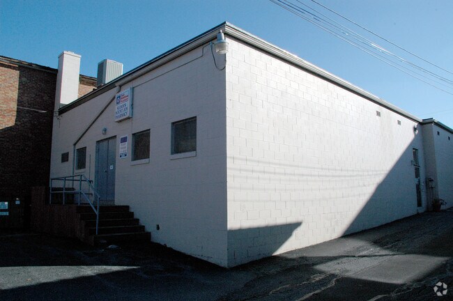

Property Detail
63 E Main St
450-05390-0-0000
63 E MAIN ST
Storebuilding
LANCASTER
CBD
Pennsylvania
B and X Area of moderate flood hazard, usually the area between the limits of the 100-year and 500-year floods.
15
2024
0.31 AC
2025
Lancaster County
012501
Philadelphia
16,380 SF
Lancaster, PA
NEARBY LISTINGS FOR SALE OR LEASE
DEMOGRAPHICS near 63 E Main St
1 mile
3 mile
5 mile
2025 Total Population
6,801
18,099
47,273
2030 Population
6,932
18,442
48,116
Pop Growth 2025-2030
+ 1.93%
+ 1.90%
+ 1.78%
Average Age
44
44
42
2025 Total Households
2,959
7,744
18,744
HH Growth 2025-2030
+ 1.99%
+ 2.00%
+ 1.86%
Median Household Inc
$75,211
$80,074
$86,000
Avg Household Size
2.30
2.30
2.50
2025 Avg HH Vehicles
2.00
2.00
2.00
Median Home Value
$299,428
$314,983
$294,340
Median Year Built
1977
1986
1983
Nearby Places
Map Layers
Map Styles
 Street
 Aerial
Transit
 Traffic
 Biking
Places
Listings with unknown addresses are not visible on the map
- Restaurants
- Banks
- Shops
- Fitness
- Groceries
PUBLIC TRANSPORTATION
COMMUTER RAIL
Drive
Walk
Distance
1 min
4 min
0.2 mi
Drive
Walk
Distance
12 min
7.0 mi
AIRPORT
Harrisburg International
Drive
Walk
Distance
Harrisburg International
29 min
16.8 mi
Freight Ports
Port Newark Container Terminal
Drive
Walk
Distance
Port Newark Container Terminal
94 min
59.7 mi
Nearby Properties
Address
Land Use
TOTAL SIZE
Lot Size
Zoning
Address
Land Use
TOTAL SIZE
Lot Size
Zoning
431,583 SF
24.30 AC
R-2
Address
Land Use
TOTAL SIZE
Lot Size
Zoning
410,000 SF
30.35 AC
I
Address
Land Use
TOTAL SIZE
Lot Size
Zoning
125,610 SF
88.12 AC
A
Address
Land Use
TOTAL SIZE
Lot Size
Zoning
112,675 SF
61.94 AC
Address
Land Use
TOTAL SIZE
Lot Size
Zoning
302,400 SF
32.51 AC
I
Address
Land Use
TOTAL SIZE
Lot Size
Zoning
102,465 SF
17.14 AC
GC
Address
Land Use
TOTAL SIZE
Lot Size
Zoning
128,444 SF
33.65 AC
R-1
Address
Land Use
TOTAL SIZE
Lot Size
Zoning
55,728 SF
2.33 AC
Address
Land Use
TOTAL SIZE
Lot Size
Zoning
181,478 SF
20.96 AC
CI
Address
Land Use
TOTAL SIZE
Lot Size
Zoning
239,448 SF
28.74 AC
Address
Land Use
TOTAL SIZE
Lot Size
Zoning
231,575 SF
21.11 AC
I
Address
Land Use
TOTAL SIZE
Lot Size
Zoning
108,699 SF
65.62 AC
Address
Land Use
TOTAL SIZE
Lot Size
Zoning
120,757 SF
3 AC
TN
Address
Land Use
TOTAL SIZE
Lot Size
Zoning
91,050 SF
30.10 AC
MHDR
Address
Land Use
TOTAL SIZE
Lot Size
Zoning
50,904 SF
Address
Land Use
TOTAL SIZE
Lot Size
Zoning
49,730 SF
14 AC
I
Address
Land Use
TOTAL SIZE
Lot Size
Zoning
4,160 SF
101.10 AC
A
Address
Land Use
TOTAL SIZE
Lot Size
Zoning
70,515 SF
10.60 AC
HC
Address
Land Use
TOTAL SIZE
Lot Size
Zoning
57,780 SF
3.38 AC
R-2
Address
Land Use
TOTAL SIZE
Lot Size
Zoning
46,890 SF
1 AC
MDR
Address
Land Use
TOTAL SIZE
Lot Size
Zoning
61,606 SF
14.60 AC
A
Address
Land Use
TOTAL SIZE
Lot Size
Zoning
71,425 SF
1 AC
TN
Address
Land Use
TOTAL SIZE
Lot Size
Zoning
71,326 SF
1 AC
TN
Address
Land Use
TOTAL SIZE
Lot Size
Zoning
34,753 SF
10 AC
Address
Land Use
TOTAL SIZE
Lot Size
Zoning
99,821 SF
18.10 AC
I
Address
Land Use
TOTAL SIZE
Lot Size
Zoning
90,120 SF
17.92 AC
I
Address
Land Use
TOTAL SIZE
Lot Size
Zoning
40,028 SF
43.40 AC
HC
Address
Land Use
TOTAL SIZE
Lot Size
Zoning
44,696 SF
4.79 AC
R-3
Address
Land Use
TOTAL SIZE
Lot Size
Zoning
23,763 SF
13 AC
Address
Land Use
TOTAL SIZE
Lot Size
Zoning
48,454 SF
89.90 AC
A
The World's #1 Commercial Real Estate Marketplace
Connect with us
© 2026 CoStar Group
The information above has been obtained from sources believed reliable. While we do not doubt its accuracy we have not verified it and make no guarantee, warranty or representation about it. It is your responsibility to independently confirm its accuracy and completeness. Any projections, opinions, assumptions, or estimates used are for example only and do not represent the current or future performance of the property. The value of this transaction to you depends on tax and other factors which should be evaluated by your tax, financial, and legal advisors. You and your advisors should conduct a careful, independent investigation of the property to determine to your satisfaction the suitability of the property for your needs.