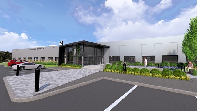
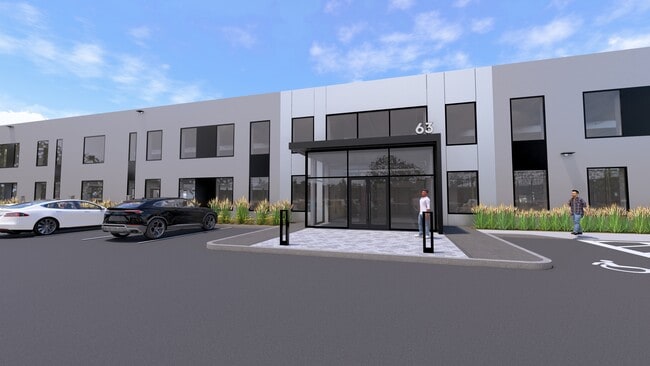
Property Record
63 Kendrick St, Needham Heights, MA 02494

Property Detail
63 Kendrick St
Officebuilding
NORFOLK
I
Massachusetts
B and X Area of moderate flood hazard, usually the area between the limits of the 100-year and 500-year floods.
6 AC
2025
Newton/Dover
2025
Boston
403501
Boston-Cambridge-Newton, MA-NH
118,238 SF
NEED-000300-000006
NEARBY LISTINGS FOR SALE OR LEASE
DEMOGRAPHICS near 63 Kendrick St
1 mile
3 mile
5 mile
2025 Total Population
8,057
97,518
324,592
2030 Population
8,319
100,756
333,181
Pop Growth 2025-2030
+ 3.25%
+ 3.32%
+ 2.65%
Average Age
43
43
41
2025 Total Households
3,217
36,487
122,374
HH Growth 2025-2030
+ 3.89%
+ 3.53%
+ 2.79%
Median Household Inc
$169,569
$187,684
$145,770
Avg Household Size
2.40
2.60
2.40
2025 Avg HH Vehicles
2.00
2.00
2.00
Median Home Value
$1,102,491
$1,057,024
$1,007,540
Median Year Built
1965
1955
1950
Nearby Places
Map Layers
Map Styles
 Street
 Aerial
Layers
 Traffic
 Biking
Places
Listings with unknown addresses are not visible on the map
- Restaurants
- Banks
- Shops
- Fitness
- Groceries
PUBLIC TRANSPORTATION
COMMUTER RAIL
Needham Heights (Needham Line - Massachusetts Bay Transportation Authority Commuter Rail (Purple Line))
Drive
Walk
Distance
Needham Heights (Needham Line - Massachusetts Bay Transportation Authority Commuter Rail (Purple Line))
4 min
1.7 mi
Hersey (Needham Line - Massachusetts Bay Transportation Authority Commuter Rail (Purple Line))
Drive
Walk
Distance
Hersey (Needham Line - Massachusetts Bay Transportation Authority Commuter Rail (Purple Line))
7 min
2.8 mi
AIRPORT
General Edward Lawrence Logan International
Drive
Walk
Distance
General Edward Lawrence Logan International
29 min
14.2 mi
Freight Ports
Port of Boston
Drive
Walk
Distance
Port of Boston
27 min
12.5 mi
SALE & LEASE HISTORY
LISTING DATE
SALE/LEASE

Sep 25, 2016
For Lease
Mar 08, 2023
For Lease
Apr 22, 2021
For Lease
Nearby Properties
Address
Land Use
TOTAL SIZE
Lot Size
Zoning
Address
Land Use
TOTAL SIZE
Lot Size
Zoning
30,845 SF
50.36 AC
SR1
Address
Land Use
TOTAL SIZE
Lot Size
Zoning
387,550 SF
7.99 AC
MU1
Address
Land Use
TOTAL SIZE
Lot Size
Zoning
412,208 SF
7.93 AC
I
Address
Land Use
TOTAL SIZE
Lot Size
Zoning
522,600 SF
59.54 AC
A2
Address
Land Use
TOTAL SIZE
Lot Size
Zoning
228,483 SF
7.57 AC
BU1
Address
Land Use
TOTAL SIZE
Lot Size
Zoning
317,049 SF
11.22 AC
M05
Address
Land Use
TOTAL SIZE
Lot Size
Zoning
1,050 SF
8.77 AC
BU4
Address
Land Use
TOTAL SIZE
Lot Size
Zoning
355,941 SF
4.60 AC
A
Address
Land Use
TOTAL SIZE
Lot Size
Zoning
4.74 AC
NEBC
Address
Land Use
TOTAL SIZE
Lot Size
Zoning
241,737 SF
4.67 AC
BU1
Address
Land Use
TOTAL SIZE
Lot Size
Zoning
76,800 SF
22.65 AC
MU1
Address
Land Use
TOTAL SIZE
Lot Size
Zoning
5,119 SF
119.98 AC
S15
Address
Land Use
TOTAL SIZE
Lot Size
Zoning
286,928 SF
2.89 AC
BU1
Address
Land Use
TOTAL SIZE
Lot Size
Zoning
151,232 SF
8.27 AC
PUB
Address
Land Use
TOTAL SIZE
Lot Size
Zoning
220,500 SF
1.96 AC
NEBC
Address
Land Use
TOTAL SIZE
Lot Size
Zoning
208,500 SF
13.98 AC
I
Address
Land Use
TOTAL SIZE
Lot Size
Zoning
200,730 SF
5.95 AC
BU4
Address
Land Use
TOTAL SIZE
Lot Size
Zoning
59.94 AC
PUB
Address
Land Use
TOTAL SIZE
Lot Size
Zoning
Address
Land Use
TOTAL SIZE
Lot Size
Zoning
Address
Land Use
TOTAL SIZE
Lot Size
Zoning
264,014 SF
10.64 AC
NEBC
Address
Land Use
TOTAL SIZE
Lot Size
Zoning
3.18 AC
M05
Address
Land Use
TOTAL SIZE
Lot Size
Zoning
14.64 AC
S15
Address
Land Use
TOTAL SIZE
Lot Size
Zoning
332,100 SF
4.63 AC
M05
Address
Land Use
TOTAL SIZE
Lot Size
Zoning
30,027 SF
96.45 AC
ORD
Address
Land Use
TOTAL SIZE
Lot Size
Zoning
80,447 SF
6.52 AC
PUB
Address
Land Use
TOTAL SIZE
Lot Size
Zoning
408,199 SF
23.35 AC
NEBC
Address
Land Use
TOTAL SIZE
Lot Size
Zoning
96,167 SF
8.04 AC
PUB
Address
Land Use
TOTAL SIZE
Lot Size
Zoning
4,216 SF
6.02 AC
SRA
Address
Land Use
TOTAL SIZE
Lot Size
Zoning
260,552 SF
12.80 AC
LMD
The World's #1 Commercial Real Estate Marketplace
Connect with us
© 2026 CoStar Group
The information above has been obtained from sources believed reliable. While we do not doubt its accuracy we have not verified it and make no guarantee, warranty or representation about it. It is your responsibility to independently confirm its accuracy and completeness. Any projections, opinions, assumptions, or estimates used are for example only and do not represent the current or future performance of the property. The value of this transaction to you depends on tax and other factors which should be evaluated by your tax, financial, and legal advisors. You and your advisors should conduct a careful, independent investigation of the property to determine to your satisfaction the suitability of the property for your needs.