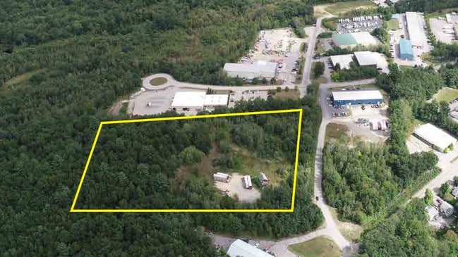
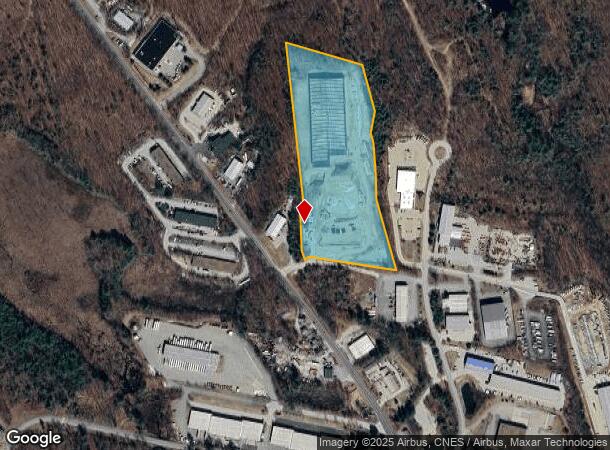
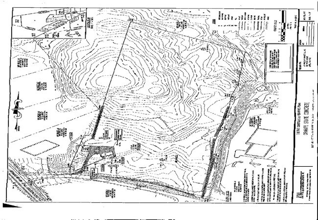
Property Record
63 Londonderry Tpke, Hooksett, NH 03106
NEARBY LISTINGS FOR SALE OR LEASE
Property Detail
63 Londonderry Tpke
Warehouse
Merrimack
X
New Hampshire
33013C0695E
12.60 AC
2024
Manchester/New Hampshire South Area
2024
Other Market Areas
044200
Concord, NH
1,059 SF
HOOK-000049-000000-000002
DEMOGRAPHICS near 63 Londonderry Tpke
1 Mile
3 Mile
5 Mile
2024 Total Population
1,708
35,273
116,043
2029 Population
1,769
36,072
118,196
Pop Growth 2024-2029
+ 3.57%
+ 2.27%
+ 1.86%
Average Age
41
41
40
2024 Total Households
654
14,205
48,843
HH Growth 2024-2029
+ 3.52%
+ 2.19%
+ 1.87%
Median Household Inc
$124,394
$94,664
$73,880
Avg Household Size
2.50
2.40
2.30
2024 Avg HH Vehicles
2.00
2.00
2.00
Median Home Value
$373,232
$345,847
$322,910
Median Year Built
1986
1975
1968
Nearby Places
Map Layers
Map Styles
 Street
 Aerial
- Restaurants
- Banks
- Shops
- Fitness
- Groceries
PUBLIC TRANSPORTATION
AIRPORT
Manchester Boston Regional
DRIVE
WALK
Distance
Manchester Boston Regional
20 min
9.7 mi
Portsmouth International at Pease
DRIVE
WALK
Distance
Portsmouth International at Pease
57 min
38.5 mi
Freight Ports
Port of Boston
DRIVE
WALK
Distance
Port of Boston
82 min
53.7 mi
SALE & LEASE HISTORY
LISTING DATE
SALE/LEASE

Aug 23, 2019
For Lease
Aug 23, 2019
For Sale
Nearby Properties
Address
Land Use
TOTAL SIZE
Lot Size
Zoning
Address
Land Use
TOTAL SIZE
Lot Size
Zoning
6,830 SF
17.24 AC
Address
Land Use
TOTAL SIZE
Lot Size
Zoning
135,686 SF
30.23 AC
Address
Land Use
TOTAL SIZE
Lot Size
Zoning
36,070 SF
141.66 AC
MUD4
Address
Land Use
TOTAL SIZE
Lot Size
Zoning
24,064 SF
19.44 AC
Address
Land Use
TOTAL SIZE
Lot Size
Zoning
51.32 AC
MUD4
Address
Land Use
TOTAL SIZE
Lot Size
Zoning
211,525 SF
93.01 AC
Address
Land Use
TOTAL SIZE
Lot Size
Zoning
2,218 SF
17.11 AC
Address
Land Use
TOTAL SIZE
Lot Size
Zoning
109,034 SF
14.30 AC
RESIDE
Address
Land Use
TOTAL SIZE
Lot Size
Zoning
38,506 SF
9.88 AC
Address
Land Use
TOTAL SIZE
Lot Size
Zoning
1,998 SF
72.09 AC
MDR
Address
Land Use
TOTAL SIZE
Lot Size
Zoning
92,492 SF
85 AC
Address
Land Use
TOTAL SIZE
Lot Size
Zoning
131,003 SF
49.31 AC
Address
Land Use
TOTAL SIZE
Lot Size
Zoning
28,888 SF
5.50 AC
Address
Land Use
TOTAL SIZE
Lot Size
Zoning
16,000 SF
20.69 AC
Address
Land Use
TOTAL SIZE
Lot Size
Zoning
5,150 SF
13.50 AC
Address
Land Use
TOTAL SIZE
Lot Size
Zoning
56,033 SF
4.91 AC
Address
Land Use
TOTAL SIZE
Lot Size
Zoning
40,718 SF
3.42 AC
Address
Land Use
TOTAL SIZE
Lot Size
Zoning
26,555 SF
6.55 AC
Address
Land Use
TOTAL SIZE
Lot Size
Zoning
3,608 SF
133.83 AC
Address
Land Use
TOTAL SIZE
Lot Size
Zoning
71,748 SF
1.52 AC
Address
Land Use
TOTAL SIZE
Lot Size
Zoning
1,976 SF
40.02 AC
Address
Land Use
TOTAL SIZE
Lot Size
Zoning
35,478 SF
4.50 AC
Address
Land Use
TOTAL SIZE
Lot Size
Zoning
56,769 SF
20.09 AC
Address
Land Use
TOTAL SIZE
Lot Size
Zoning
282,303 SF
19.41 AC
Address
Land Use
TOTAL SIZE
Lot Size
Zoning
57,964 SF
13.85 AC
PZ
Address
Land Use
TOTAL SIZE
Lot Size
Zoning
144,966 SF
13.26 AC
PZ
Address
Land Use
TOTAL SIZE
Lot Size
Zoning
1,704 SF
76.35 AC
Address
Land Use
TOTAL SIZE
Lot Size
Zoning
58.87 AC
R9
Address
Land Use
TOTAL SIZE
Lot Size
Zoning
133,900 SF
Address
Land Use
TOTAL SIZE
Lot Size
Zoning
43,494 SF
9.60 AC
The World's #1 Commercial Real Estate Marketplace
Connect with us
© 2025 CoStar Group
The information above has been obtained from sources believed reliable. While we do not doubt its accuracy we have not verified it and make no guarantee, warranty or representation about it. It is your responsibility to independently confirm its accuracy and completeness. Any projections, opinions, assumptions, or estimates used are for example only and do not represent the current or future performance of the property. The value of this transaction to you depends on tax and other factors which should be evaluated by your tax, financial, and legal advisors. You and your advisors should conduct a careful, independent investigation of the property to determine to your satisfaction the suitability of the property for your needs.