Property Record
63 Shore Rd, Winchester, MA 01890

Save to a Folder
{{folder.Name}}
{{folder.ListingIds.length}} Properties
{{folder.ListingIds.length}} Property
Create a New Folder
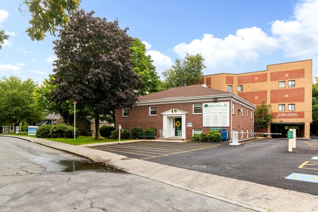
Property Detail
63 Shore Rd
WINC-000009-000251
Middlesex
Officecondo
Massachusetts
AE The base floodplain where base flood elevations are provided. AE Zones are now used on new format FIRMs instead of A1-A30 Zones.
0.69 AC
2025
Burlington/Woburn
2025
Boston
338500
Boston-Cambridge-Newton, MA-NH
1,090 SF
NEARBY LISTINGS FOR SALE OR LEASE
DEMOGRAPHICS near 63 Shore Rd
1 mile
3 mile
5 mile
2025 Total Population
15,208
122,803
441,519
2030 Population
15,892
127,117
454,620
Pop Growth 2025-2030
+ 4.50%
+ 3.51%
+ 2.97%
Average Age
41
42
41
2025 Total Households
5,302
48,811
177,688
HH Growth 2025-2030
+ 4.56%
+ 3.58%
+ 3.11%
Median Household Inc
$195,031
$132,587
$126,578
Avg Household Size
2.80
2.40
2.40
2025 Avg HH Vehicles
2.00
2.00
2.00
Median Home Value
$1,066,375
$823,462
$823,570
Median Year Built
1949
1954
1951
Nearby Places
Map Layers
Map Styles
 Street
 Aerial
Layers
 Traffic
 Biking
Places
Listings with unknown addresses are not visible on the map
- Restaurants
- Banks
- Shops
- Fitness
- Groceries
PUBLIC TRANSPORTATION
COMMUTER RAIL
Winchester Center (Lowell Line - MBTA)
Drive
Walk
Distance
Winchester Center (Lowell Line - MBTA)
3 min
1.1 mi
Wedgemere (Lowell Line - MBTA)
Drive
Walk
Distance
Wedgemere (Lowell Line - MBTA)
2 min
1.2 mi
AIRPORT
General Edward Lawrence Logan International
Drive
Walk
Distance
General Edward Lawrence Logan International
21 min
11.5 mi
Freight Ports
Port of Boston
Drive
Walk
Distance
Port of Boston
22 min
11.2 mi
SALE & LEASE HISTORY
LISTING DATE
SALE/LEASE

Sep 25, 2016
For Lease
Sep 15, 2025
For Sale
Oct 16, 2025
For Lease
Oct 02, 2017
For Sale
Jul 17, 2017
For Lease
Jan 26, 2026
For Sale
Aug 27, 2024
For Sale
Aug 01, 2017
For Lease
Nearby Properties
Address
Land Use
TOTAL SIZE
Lot Size
Zoning
Address
Land Use
TOTAL SIZE
Lot Size
Zoning
530,113 SF
29.43 AC
Address
Land Use
TOTAL SIZE
Lot Size
Zoning
169 AC
OS
Address
Land Use
TOTAL SIZE
Lot Size
Zoning
14.97 AC
C
Address
Land Use
TOTAL SIZE
Lot Size
Zoning
15.95 AC
BG
Address
Land Use
TOTAL SIZE
Lot Size
Zoning
153,732 SF
12.50 AC
SCI
Address
Land Use
TOTAL SIZE
Lot Size
Zoning
44.94 AC
R2
Address
Land Use
TOTAL SIZE
Lot Size
Zoning
208,852 SF
16.17 AC
MU
Address
Land Use
TOTAL SIZE
Lot Size
Zoning
11.72 AC
Address
Land Use
TOTAL SIZE
Lot Size
Zoning
12.02 AC
IG
Address
Land Use
TOTAL SIZE
Lot Size
Zoning
157,317 SF
3.87 AC
B2A
Address
Land Use
TOTAL SIZE
Lot Size
Zoning
55,217 SF
1.95 AC
I
Address
Land Use
TOTAL SIZE
Lot Size
Zoning
186,516 SF
40 AC
R-1
Address
Land Use
TOTAL SIZE
Lot Size
Zoning
7.90 AC
PD
Address
Land Use
TOTAL SIZE
Lot Size
Zoning
191,050 SF
3.15 AC
Address
Land Use
TOTAL SIZE
Lot Size
Zoning
134,932 SF
8.69 AC
ND
Address
Land Use
TOTAL SIZE
Lot Size
Zoning
9.50 AC
SCI
Address
Land Use
TOTAL SIZE
Lot Size
Zoning
300,720 SF
16.16 AC
IG
Address
Land Use
TOTAL SIZE
Lot Size
Zoning
71.34 AC
R-1
Address
Land Use
TOTAL SIZE
Lot Size
Zoning
127.30 AC
R-1
Address
Land Use
TOTAL SIZE
Lot Size
Zoning
187,798 SF
8.91 AC
IG
Address
Land Use
TOTAL SIZE
Lot Size
Zoning
157,305 SF
10.69 AC
RDB
Address
Land Use
TOTAL SIZE
Lot Size
Zoning
149 AC
OS
Address
Land Use
TOTAL SIZE
Lot Size
Zoning
83,227 SF
16.82 AC
RDA
Address
Land Use
TOTAL SIZE
Lot Size
Zoning
15.62 AC
PD
Address
Land Use
TOTAL SIZE
Lot Size
Zoning
19.66 AC
BG
Address
Land Use
TOTAL SIZE
Lot Size
Zoning
5.63 AC
C
Address
Land Use
TOTAL SIZE
Lot Size
Zoning
8.17 AC
RB
Address
Land Use
TOTAL SIZE
Lot Size
Zoning
68,876 SF
17.10 AC
R-1
Address
Land Use
TOTAL SIZE
Lot Size
Zoning
188,538 SF
6.78 AC
BG
Address
Land Use
TOTAL SIZE
Lot Size
Zoning
15.85 AC
R-3
The World's #1 Commercial Real Estate Marketplace
Connect with us
© 2026 CoStar Group
The information above has been obtained from sources believed reliable. While we do not doubt its accuracy we have not verified it and make no guarantee, warranty or representation about it. It is your responsibility to independently confirm its accuracy and completeness. Any projections, opinions, assumptions, or estimates used are for example only and do not represent the current or future performance of the property. The value of this transaction to you depends on tax and other factors which should be evaluated by your tax, financial, and legal advisors. You and your advisors should conduct a careful, independent investigation of the property to determine to your satisfaction the suitability of the property for your needs.