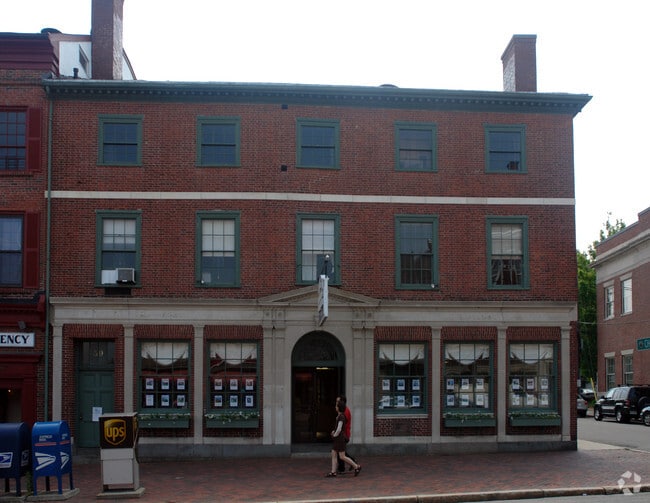
Property Record
63 State St, Newburyport, MA 01950
NEARBY LISTINGS FOR SALE OR LEASE
Property Detail
63 State St
Financialbuilding
Essex
X
Massachusetts
25009C0136G
0.39 AC
2025
Amesbury/Ipswich
2025
Boston
268300
Boston-Cambridge-Newton, MA-NH
22,414 SF
NEWP-000006-000036
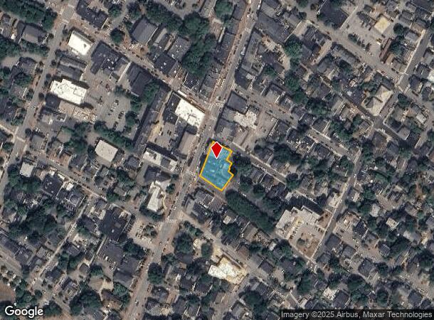
DEMOGRAPHICS near 63 State St
1 Mile
3 Mile
5 Mile
2024 Total Population
10,043
26,303
50,667
2029 Population
10,153
26,350
50,892
Pop Growth 2024-2029
+ 1.10%
+ 0.18%
+ 0.44%
Average Age
48
46
46
2024 Total Households
4,748
11,437
22,008
HH Growth 2024-2029
+ 0.72%
(0.05%)
+ 0.33%
Median Household Inc
$119,590
$114,333
$103,765
Avg Household Size
2.00
2.20
2.20
2024 Avg HH Vehicles
2.00
2.00
2.00
Median Home Value
$733,204
$698,318
$612,603
Median Year Built
1947
1956
1965
Nearby Places
Map Layers
Map Styles
 Street
 Aerial
- Restaurants
- Banks
- Shops
- Fitness
- Groceries
PUBLIC TRANSPORTATION
COMMUTER RAIL
Newburyport (Newburyport/Rockport Line - Massachusetts Bay Transportation Authority Commuter Rail (Purple Line))
DRIVE
WALK
Distance
Newburyport (Newburyport/Rockport Line - Massachusetts Bay Transportation Authority Commuter Rail (Purple Line))
3 min
1.3 mi
Rowley (Newburyport/Rockport Line - Massachusetts Bay Transportation Authority Commuter Rail (Purple Line))
DRIVE
WALK
Distance
Rowley (Newburyport/Rockport Line - Massachusetts Bay Transportation Authority Commuter Rail (Purple Line))
14 min
7.4 mi
AIRPORT
Portsmouth International at Pease
DRIVE
WALK
Distance
Portsmouth International at Pease
34 min
24.4 mi
General Edward Lawrence Logan International
DRIVE
WALK
Distance
General Edward Lawrence Logan International
53 min
36.6 mi
Manchester Boston Regional
DRIVE
WALK
Distance
Manchester Boston Regional
66 min
45.3 mi
Freight Ports
Port of Boston
DRIVE
WALK
Distance
Port of Boston
56 min
39.3 mi
SALE & LEASE HISTORY
LISTING DATE
SALE/LEASE

Jan 23, 2023
For Lease
Nearby Properties
Address
Land Use
TOTAL SIZE
Lot Size
Zoning
Address
Land Use
TOTAL SIZE
Lot Size
Zoning
207,982 SF
14.58 AC
Address
Land Use
TOTAL SIZE
Lot Size
Zoning
107,053 SF
17.51 AC
Address
Land Use
TOTAL SIZE
Lot Size
Zoning
170,444 SF
13.30 AC
Address
Land Use
TOTAL SIZE
Lot Size
Zoning
163,948 SF
20.31 AC
Address
Land Use
TOTAL SIZE
Lot Size
Zoning
1,109 AC
AR4
Address
Land Use
TOTAL SIZE
Lot Size
Zoning
2,362 SF
342.02 AC
Address
Land Use
TOTAL SIZE
Lot Size
Zoning
100,874 SF
2.10 AC
Address
Land Use
TOTAL SIZE
Lot Size
Zoning
441.30 AC
BC
Address
Land Use
TOTAL SIZE
Lot Size
Zoning
81,324 SF
2.01 AC
Address
Land Use
TOTAL SIZE
Lot Size
Zoning
191,775 SF
23.50 AC
C
Address
Land Use
TOTAL SIZE
Lot Size
Zoning
37,208 SF
1.83 AC
Address
Land Use
TOTAL SIZE
Lot Size
Zoning
106,820 SF
9.97 AC
Address
Land Use
TOTAL SIZE
Lot Size
Zoning
7,768 SF
3.98 AC
Address
Land Use
TOTAL SIZE
Lot Size
Zoning
44,661 SF
4.47 AC
Address
Land Use
TOTAL SIZE
Lot Size
Zoning
95,903 SF
1.64 AC
Address
Land Use
TOTAL SIZE
Lot Size
Zoning
93,090 SF
87 SF
Address
Land Use
TOTAL SIZE
Lot Size
Zoning
112,559 SF
11.27 AC
Address
Land Use
TOTAL SIZE
Lot Size
Zoning
57,754 SF
5.27 AC
Address
Land Use
TOTAL SIZE
Lot Size
Zoning
118,008 SF
11.04 AC
Address
Land Use
TOTAL SIZE
Lot Size
Zoning
148,744 SF
4.10 AC
Address
Land Use
TOTAL SIZE
Lot Size
Zoning
148,639 SF
24.60 AC
Address
Land Use
TOTAL SIZE
Lot Size
Zoning
65,124 SF
0.79 AC
Address
Land Use
TOTAL SIZE
Lot Size
Zoning
31,428 SF
10.61 AC
Address
Land Use
TOTAL SIZE
Lot Size
Zoning
92,907 SF
5.76 AC
Address
Land Use
TOTAL SIZE
Lot Size
Zoning
133,559 SF
10.31 AC
Address
Land Use
TOTAL SIZE
Lot Size
Zoning
78,027 SF
10.63 AC
Address
Land Use
TOTAL SIZE
Lot Size
Zoning
52.50 AC
Address
Land Use
TOTAL SIZE
Lot Size
Zoning
131,400 SF
13.80 AC
Address
Land Use
TOTAL SIZE
Lot Size
Zoning
3,394 SF
4 AC
Address
Land Use
TOTAL SIZE
Lot Size
Zoning
66,372 SF
4.08 AC
The World's #1 Commercial Real Estate Marketplace
Connect with us
© 2026 CoStar Group
The information above has been obtained from sources believed reliable. While we do not doubt its accuracy we have not verified it and make no guarantee, warranty or representation about it. It is your responsibility to independently confirm its accuracy and completeness. Any projections, opinions, assumptions, or estimates used are for example only and do not represent the current or future performance of the property. The value of this transaction to you depends on tax and other factors which should be evaluated by your tax, financial, and legal advisors. You and your advisors should conduct a careful, independent investigation of the property to determine to your satisfaction the suitability of the property for your needs.