Property Record
630 Route 539, New Egypt, NJ 08533


NEARBY LISTINGS FOR SALE OR LEASE
-
-
View all New Egypt listings for sale on LoopNet.com
Property Detail
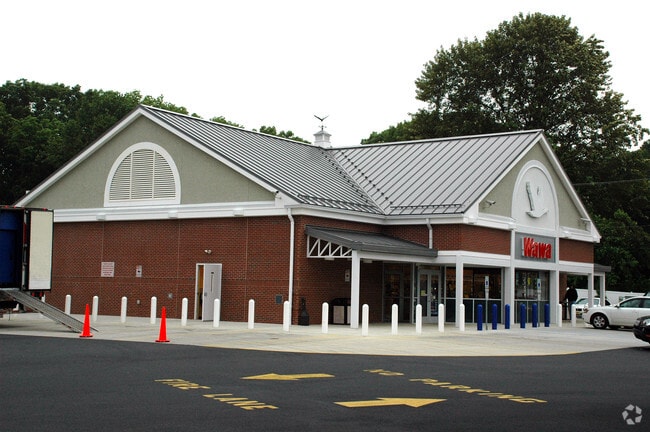
630 Route 539
New York-Jersey City-White Plains, NY-NJ
3.05AC
24-00076-0000-00026
Ocean
Commercialnec
New Jersey
X
26
34025C0405F
3.05 AC
2024
Ocean County
2025
Northern New Jersey
718000
DEMOGRAPHICS near 630 Route 539
1 Mile
3 Mile
5 Mile
2024 Total Population
1,274
7,352
13,959
2029 Population
1,336
7,688
14,595
Pop Growth 2024-2029
+ 4.87%
+ 4.57%
+ 4.56%
Average Age
41
41
41
2024 Total Households
442
2,597
4,984
HH Growth 2024-2029
+ 4.07%
+ 3.93%
+ 4.09%
Median Household Inc
$97,221
$95,687
$92,568
Avg Household Size
2.80
2.80
2.70
2024 Avg HH Vehicles
2.00
2.00
2.00
Median Home Value
$399,999
$387,142
$392,311
Median Year Built
1989
1987
1985
Nearby Places
Map Layers
Map Styles
 Street
 Aerial
- Restaurants
- Banks
- Shops
- Fitness
- Groceries
PUBLIC TRANSPORTATION
AIRPORT
Trenton Mercer
DRIVE
WALK
Distance
Trenton Mercer
43 min
28.1 mi
Freight Ports
Port of Philadelphia
DRIVE
WALK
Distance
Port of Philadelphia
59 min
40.5 mi
Nearby Properties
Address
Land Use
TOTAL SIZE
Lot Size
Zoning
Address
Land Use
TOTAL SIZE
Lot Size
Zoning
2,600 SF
10.90 AC
Address
Land Use
TOTAL SIZE
Lot Size
Zoning
131.54 AC
L1
Address
Land Use
TOTAL SIZE
Lot Size
Zoning
9,277.54 AC
RD
Address
Land Use
TOTAL SIZE
Lot Size
Zoning
1,115.09 AC
ROS
Address
Land Use
TOTAL SIZE
Lot Size
Zoning
861.77 AC
ROS
Address
Land Use
TOTAL SIZE
Lot Size
Zoning
2,619 SF
50.30 AC
R3
Address
Land Use
TOTAL SIZE
Lot Size
Zoning
680 SF
10 AC
C4
Address
Land Use
TOTAL SIZE
Lot Size
Zoning
2,160 SF
23.10 AC
HD
Address
Land Use
TOTAL SIZE
Lot Size
Zoning
15.01 AC
L1
Address
Land Use
TOTAL SIZE
Lot Size
Zoning
24.11 AC
L1
Address
Land Use
TOTAL SIZE
Lot Size
Zoning
1,650 SF
7.04 AC
LI
Address
Land Use
TOTAL SIZE
Lot Size
Zoning
20,703 SF
0.43 AC
VB
Address
Land Use
TOTAL SIZE
Lot Size
Zoning
36.21 AC
MHP
Address
Land Use
TOTAL SIZE
Lot Size
Zoning
1.88 AC
C2
Address
Land Use
TOTAL SIZE
Lot Size
Zoning
3,088 SF
1.80 AC
C4
Address
Land Use
TOTAL SIZE
Lot Size
Zoning
40.49 AC
MHP
Address
Land Use
TOTAL SIZE
Lot Size
Zoning
12,171 SF
1.99 AC
HD
Address
Land Use
TOTAL SIZE
Lot Size
Zoning
1,525 SF
31.50 AC
R40
Address
Land Use
TOTAL SIZE
Lot Size
Zoning
3.14 AC
L1
Address
Land Use
TOTAL SIZE
Lot Size
Zoning
8,880 SF
1 AC
R5
Address
Land Use
TOTAL SIZE
Lot Size
Zoning
136.02 AC
ROS
Address
Land Use
TOTAL SIZE
Lot Size
Zoning
2.32 AC
Address
Land Use
TOTAL SIZE
Lot Size
Zoning
6,320 SF
1.05 AC
R5
Address
Land Use
TOTAL SIZE
Lot Size
Zoning
7,196 SF
1.40 AC
HD
Address
Land Use
TOTAL SIZE
Lot Size
Zoning
2,100 SF
6.25 AC
R5
Address
Land Use
TOTAL SIZE
Lot Size
Zoning
2.29 AC
C2
Address
Land Use
TOTAL SIZE
Lot Size
Zoning
4,928 SF
2.54 AC
R10
Address
Land Use
TOTAL SIZE
Lot Size
Zoning
35.76 AC
RD1
Address
Land Use
TOTAL SIZE
Lot Size
Zoning
3,265 SF
11.55 AC
C4
Address
Land Use
TOTAL SIZE
Lot Size
Zoning
2.86 AC
C3
The World's #1 Commercial Real Estate Marketplace
Connect with us
© 2025 CoStar Group
The information above has been obtained from sources believed reliable. While we do not doubt its accuracy we have not verified it and make no guarantee, warranty or representation about it. It is your responsibility to independently confirm its accuracy and completeness. Any projections, opinions, assumptions, or estimates used are for example only and do not represent the current or future performance of the property. The value of this transaction to you depends on tax and other factors which should be evaluated by your tax, financial, and legal advisors. You and your advisors should conduct a careful, independent investigation of the property to determine to your satisfaction the suitability of the property for your needs.