Property Record
630 S Komas Dr, Salt Lake City, UT 84108


NEARBY LISTINGS FOR SALE OR LEASE
Property Detail
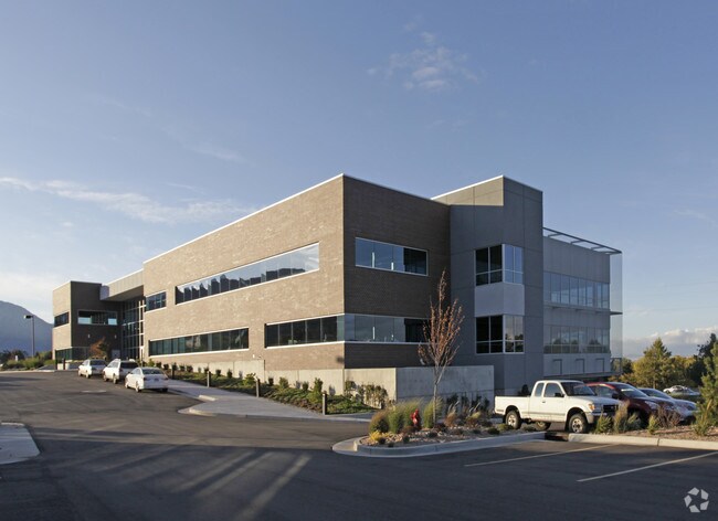
630 S Komas Dr
16-10-126-005-2003
IMPS ON NEW PRIVATELY OWNED OFFICE BUILDING: BEG N 895950E 58.16 FT & N 58.2 FT & N 895950 E 168.16 FT FRCITY MONUMENT OF THE INTERSECTION OF 2100 E ST & SUNNYSIDE AVE SITUATED IN NW 1/4 OF SEC 10, T1S, R1E, SLM; N 895804E 921.17 FT; N 1320 FT; E 132
Officebuilding
Salt Lake
X
Utah
49029C0475C
0.01 AC
2024
Research Park
2025
Salt Lake City
101402
Salt Lake City-Murray, UT
83,882 SF
DEMOGRAPHICS near 630 S Komas Dr
1 Mile
3 Mile
5 Mile
2024 Total Population
10,574
102,849
220,874
2029 Population
10,469
104,007
224,440
Pop Growth 2024-2029
(0.99%)
+ 1.13%
+ 1.61%
Average Age
32
37
38
2024 Total Households
2,996
46,424
97,378
HH Growth 2024-2029
(1.57%)
+ 1.44%
+ 1.97%
Median Household Inc
$64,695
$72,681
$69,399
Avg Household Size
2.50
2.10
2.10
2024 Avg HH Vehicles
2.00
2.00
2.00
Median Home Value
$796,386
$650,937
$562,865
Median Year Built
1962
1956
1965
Nearby Places
Map Layers
Map Styles
 Street
 Aerial
- Restaurants
- Banks
- Shops
- Fitness
- Groceries
PUBLIC TRANSPORTATION
TRANSIT/SUBWAY
University South Campus (TRAX Murray/Midvale/University Line - Utah Transit Authority (UTA), TRAX University Line - Utah Transit Authority (UTA))
DRIVE
WALK
Distance
University South Campus (TRAX Murray/Midvale/University Line - Utah Transit Authority (UTA), TRAX University Line - Utah Transit Authority (UTA))
4 min
18 min
1.0 mi
Fort Douglas (TRAX Murray/Midvale/University Line - Utah Transit Authority (UTA), TRAX University Line - Utah Transit Authority (UTA))
DRIVE
WALK
Distance
Fort Douglas (TRAX Murray/Midvale/University Line - Utah Transit Authority (UTA), TRAX University Line - Utah Transit Authority (UTA))
4 min
20 min
1.1 mi
COMMUTER RAIL
DRIVE
WALK
Distance
14 min
5.2 mi
DRIVE
WALK
Distance
17 min
6.5 mi
AIRPORT
Salt Lake City International
DRIVE
WALK
Distance
Salt Lake City International
20 min
10.3 mi
SALE & LEASE HISTORY
LISTING DATE
SALE/LEASE

Apr 18, 2024
For Lease
Nearby Properties
Address
Land Use
TOTAL SIZE
Lot Size
Zoning
Address
Land Use
TOTAL SIZE
Lot Size
Zoning
2,287,331 SF
137 AC
I
Address
Land Use
TOTAL SIZE
Lot Size
Zoning
1,260,285 SF
59.07 AC
I
Address
Land Use
TOTAL SIZE
Lot Size
Zoning
591,924 SF
80.77 AC
I
Address
Land Use
TOTAL SIZE
Lot Size
Zoning
298,342 SF
13.71 AC
I
Address
Land Use
TOTAL SIZE
Lot Size
Zoning
1,262,865 SF
44.15 AC
I
Address
Land Use
TOTAL SIZE
Lot Size
Zoning
530,605 SF
127 AC
RP
Address
Land Use
TOTAL SIZE
Lot Size
Zoning
365,253 SF
33.64 AC
I
Address
Land Use
TOTAL SIZE
Lot Size
Zoning
295,047 SF
113.27 AC
RP
Address
Land Use
TOTAL SIZE
Lot Size
Zoning
185,202 SF
51.07 AC
J
Address
Land Use
TOTAL SIZE
Lot Size
Zoning
298,628 SF
27.30 AC
I
Address
Land Use
TOTAL SIZE
Lot Size
Zoning
299,535 SF
38 AC
I
Address
Land Use
TOTAL SIZE
Lot Size
Zoning
254,939 SF
34.68 AC
I
Address
Land Use
TOTAL SIZE
Lot Size
Zoning
82,851 SF
9.76 AC
PL2
Address
Land Use
TOTAL SIZE
Lot Size
Zoning
440,898 SF
0.01 AC
RP
Address
Land Use
TOTAL SIZE
Lot Size
Zoning
588,291 SF
1.28 AC
D-1
Address
Land Use
TOTAL SIZE
Lot Size
Zoning
497,018 SF
13.11 AC
I
Address
Land Use
TOTAL SIZE
Lot Size
Zoning
95,666 SF
52.19 AC
I
Address
Land Use
TOTAL SIZE
Lot Size
Zoning
8,042 SF
64.58 AC
RP
Address
Land Use
TOTAL SIZE
Lot Size
Zoning
37,536 SF
10 AC
PL
Address
Land Use
TOTAL SIZE
Lot Size
Zoning
183,600 SF
10.70 AC
RMF-35
Address
Land Use
TOTAL SIZE
Lot Size
Zoning
249,796 SF
49.02 AC
I
Address
Land Use
TOTAL SIZE
Lot Size
Zoning
115,169 SF
119.06 AC
RP
Address
Land Use
TOTAL SIZE
Lot Size
Zoning
297,476 SF
1.62 AC
CSHBD2
Address
Land Use
TOTAL SIZE
Lot Size
Zoning
728,665 SF
0.01 AC
RP
Address
Land Use
TOTAL SIZE
Lot Size
Zoning
40,825 SF
48.09 AC
OS
Address
Land Use
TOTAL SIZE
Lot Size
Zoning
152,660 SF
5.40 AC
I
Address
Land Use
TOTAL SIZE
Lot Size
Zoning
680,751 SF
1.45 AC
TSA-UC
Address
Land Use
TOTAL SIZE
Lot Size
Zoning
371,963 SF
1.81 AC
R-MU
Address
Land Use
TOTAL SIZE
Lot Size
Zoning
369,377 SF
1.65 AC
Address
Land Use
TOTAL SIZE
Lot Size
Zoning
152,579 SF
25.45 AC
I
The World's #1 Commercial Real Estate Marketplace
Connect with us
© 2026 CoStar Group
The information above has been obtained from sources believed reliable. While we do not doubt its accuracy we have not verified it and make no guarantee, warranty or representation about it. It is your responsibility to independently confirm its accuracy and completeness. Any projections, opinions, assumptions, or estimates used are for example only and do not represent the current or future performance of the property. The value of this transaction to you depends on tax and other factors which should be evaluated by your tax, financial, and legal advisors. You and your advisors should conduct a careful, independent investigation of the property to determine to your satisfaction the suitability of the property for your needs.