Property Record
630 Village Trce Ne, Marietta, GA 30067


NEARBY LISTINGS FOR SALE OR LEASE
Property Detail
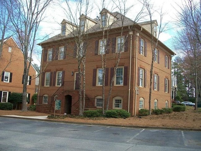
630 Village Trce Ne
01-0073-0-038-0
Paper Mill Village Ph 04
Officecondo
Cobb
X
Georgia
13121C0133G
15e
2025
0.05 AC
2025
Cumberland/Galleria
030352
Atlanta
1,989 SF
Atlanta-Sandy Springs-Roswell, GA
DEMOGRAPHICS near 630 Village Trce Ne
1 Mile
3 Mile
5 Mile
2024 Total Population
6,516
62,227
220,273
2029 Population
6,549
62,996
223,047
Pop Growth 2024-2029
+ 0.51%
+ 1.24%
+ 1.26%
Average Age
43
42
39
2024 Total Households
2,365
23,876
93,491
HH Growth 2024-2029
+ 0.47%
+ 1.25%
+ 1.30%
Median Household Inc
$129,344
$135,649
$99,877
Avg Household Size
2.70
2.50
2.30
2024 Avg HH Vehicles
2.00
2.00
2.00
Median Home Value
$750,882
$590,287
$514,707
Median Year Built
1985
1981
1984
Nearby Places
Map Layers
Map Styles
 Street
 Aerial
- Restaurants
- Banks
- Shops
- Fitness
- Groceries
PUBLIC TRANSPORTATION
AIRPORT
Hartsfield - Jackson Atlanta International
DRIVE
WALK
Distance
Hartsfield - Jackson Atlanta International
41 min
27.4 mi
SALE & LEASE HISTORY
LISTING DATE
SALE/LEASE

Sep 26, 2018
For Lease
Oct 02, 2024
For Sale
Dec 05, 2022
For Lease
Apr 23, 2024
For Lease
Nearby Properties
Address
Land Use
TOTAL SIZE
Lot Size
Zoning
Address
Land Use
TOTAL SIZE
Lot Size
Zoning
12,342,500 SF
125.51 AC
AC
Address
Land Use
TOTAL SIZE
Lot Size
Zoning
258,955 SF
29.70 AC
CRC/LRO
Address
Land Use
TOTAL SIZE
Lot Size
Zoning
620,201 SF
3.54 AC
C1
Address
Land Use
TOTAL SIZE
Lot Size
Zoning
416,113 SF
28.12 AC
RM-12
Address
Land Use
TOTAL SIZE
Lot Size
Zoning
279,518 SF
7.70 AC
C1
Address
Land Use
TOTAL SIZE
Lot Size
Zoning
287,388 SF
44.90 AC
ACOND
Address
Land Use
TOTAL SIZE
Lot Size
Zoning
4,124,136 SF
19.85 AC
AC
Address
Land Use
TOTAL SIZE
Lot Size
Zoning
269,200 SF
18.70 AC
A0
Address
Land Use
TOTAL SIZE
Lot Size
Zoning
2,928,960 SF
22.67 AC
AC
Address
Land Use
TOTAL SIZE
Lot Size
Zoning
2,557,920 SF
14.04 AC
AC
Address
Land Use
TOTAL SIZE
Lot Size
Zoning
212,969 SF
1.94 AC
C1C
Address
Land Use
TOTAL SIZE
Lot Size
Zoning
3,406 SF
23.20 AC
R20
Address
Land Use
TOTAL SIZE
Lot Size
Zoning
237,891 SF
1.73 AC
C1C
Address
Land Use
TOTAL SIZE
Lot Size
Zoning
175,648 SF
12.56 AC
C1
Address
Land Use
TOTAL SIZE
Lot Size
Zoning
79,435 SF
8.36 AC
C1
Address
Land Use
TOTAL SIZE
Lot Size
Zoning
166,048 SF
20.29 AC
GC
Address
Land Use
TOTAL SIZE
Lot Size
Zoning
194,453 SF
17.71 AC
CRC/WS
Address
Land Use
TOTAL SIZE
Lot Size
Zoning
140,617 SF
9.87 AC
R3
Address
Land Use
TOTAL SIZE
Lot Size
Zoning
24.85 AC
R3
Address
Land Use
TOTAL SIZE
Lot Size
Zoning
2,317,668 SF
12.23 AC
AC
Address
Land Use
TOTAL SIZE
Lot Size
Zoning
149,187 SF
13.69 AC
C1
Address
Land Use
TOTAL SIZE
Lot Size
Zoning
16.09 AC
R1
Address
Land Use
TOTAL SIZE
Lot Size
Zoning
443,264 SF
38.63 AC
OIC
Address
Land Use
TOTAL SIZE
Lot Size
Zoning
2,325,104 SF
13.50 AC
AO
Address
Land Use
TOTAL SIZE
Lot Size
Zoning
102.57 AC
R3
Address
Land Use
TOTAL SIZE
Lot Size
Zoning
152,191 SF
9.63 AC
RSL
Address
Land Use
TOTAL SIZE
Lot Size
Zoning
127,240 SF
8.27 AC
Address
Land Use
TOTAL SIZE
Lot Size
Zoning
119,776 SF
11.17 AC
NS/WS
Address
Land Use
TOTAL SIZE
Lot Size
Zoning
2,354 SF
15.13 AC
R3
Address
Land Use
TOTAL SIZE
Lot Size
Zoning
92,787 SF
11.69 AC
CRC/NS
The World's #1 Commercial Real Estate Marketplace
Connect with us
© 2026 CoStar Group
The information above has been obtained from sources believed reliable. While we do not doubt its accuracy we have not verified it and make no guarantee, warranty or representation about it. It is your responsibility to independently confirm its accuracy and completeness. Any projections, opinions, assumptions, or estimates used are for example only and do not represent the current or future performance of the property. The value of this transaction to you depends on tax and other factors which should be evaluated by your tax, financial, and legal advisors. You and your advisors should conduct a careful, independent investigation of the property to determine to your satisfaction the suitability of the property for your needs.