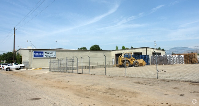
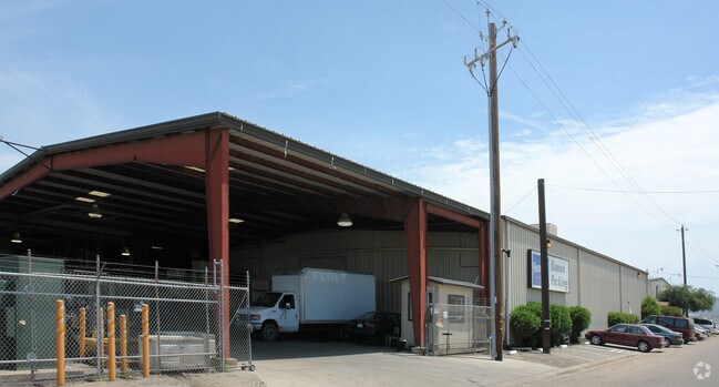
Property Record
630 E Railroad Ave, Orange Cove, CA 93646

NEARBY LISTINGS FOR SALE OR LEASE
Property Detail
630 E Railroad Ave
378-230-22S
Orange Cove
Packing
2.04 AC SUR RT IN S1/2 SEC 13 T15R24 ORANGE COVE
X
Fresno
06107C0330E
California
2025
2.04 AC
2025
Outlying Fresno Cnty
006502
Fresno
33,536 SF
Fresno, CA
DEMOGRAPHICS near 630 E Railroad Ave
1 Mile
3 Mile
5 Mile
2024 Total Population
9,584
10,462
12,686
2029 Population
9,722
10,600
12,796
Pop Growth 2024-2029
+ 1.44%
+ 1.32%
+ 0.87%
Average Age
32
32
33
2024 Total Households
2,416
2,651
3,255
HH Growth 2024-2029
+ 1.41%
+ 1.32%
+ 0.80%
Median Household Inc
$31,756
$32,056
$34,247
Avg Household Size
4.00
3.90
3.90
2024 Avg HH Vehicles
2.00
2.00
2.00
Median Home Value
$246,052
$251,015
$270,533
Median Year Built
1976
1976
1975
Nearby Places
Map Layers
Map Styles
 Street
 Aerial
- Restaurants
- Banks
- Shops
- Fitness
- Groceries
PUBLIC TRANSPORTATION
AIRPORT
Fresno Yosemite International
DRIVE
WALK
Distance
Fresno Yosemite International
55 min
35.1 mi
Freight Ports
Port of Stockton
DRIVE
WALK
Distance
Port of Stockton
197 min
159.4 mi
Nearby Properties
Address
Land Use
TOTAL SIZE
Lot Size
Zoning
Address
Land Use
TOTAL SIZE
Lot Size
Zoning
209,435 SF
11.64 AC
M1C2
Address
Land Use
TOTAL SIZE
Lot Size
Zoning
110,663 SF
10.32 AC
M1
Address
Land Use
TOTAL SIZE
Lot Size
Zoning
83,914 SF
7.07 AC
R3
Address
Land Use
TOTAL SIZE
Lot Size
Zoning
88,243 SF
5.22 AC
R1
Address
Land Use
TOTAL SIZE
Lot Size
Zoning
79,874 SF
5.38 AC
R3
Address
Land Use
TOTAL SIZE
Lot Size
Zoning
40,104 SF
4.71 AC
R3
Address
Land Use
TOTAL SIZE
Lot Size
Zoning
86,979 SF
6.82 AC
R3
Address
Land Use
TOTAL SIZE
Lot Size
Zoning
42.15 AC
AE20
Address
Land Use
TOTAL SIZE
Lot Size
Zoning
174,840 SF
12.95 AC
AE20
Address
Land Use
TOTAL SIZE
Lot Size
Zoning
51,275 SF
4.36 AC
R3
Address
Land Use
TOTAL SIZE
Lot Size
Zoning
104,763 SF
9.55 AC
AE-20
Address
Land Use
TOTAL SIZE
Lot Size
Zoning
2,812 SF
0.96 AC
C2
Address
Land Use
TOTAL SIZE
Lot Size
Zoning
14,623 SF
2.18 AC
M1
Address
Land Use
TOTAL SIZE
Lot Size
Zoning
864 SF
232.55 AC
Address
Land Use
TOTAL SIZE
Lot Size
Zoning
134.96 AC
AE20
Address
Land Use
TOTAL SIZE
Lot Size
Zoning
50,094 SF
2.91 AC
R3
Address
Land Use
TOTAL SIZE
Lot Size
Zoning
55,564 SF
3.91 AC
Address
Land Use
TOTAL SIZE
Lot Size
Zoning
37,238 SF
40 AC
AE20
Address
Land Use
TOTAL SIZE
Lot Size
Zoning
3,040 SF
160 AC
AE20
Address
Land Use
TOTAL SIZE
Lot Size
Zoning
10,000 SF
1.28 AC
C2
Address
Land Use
TOTAL SIZE
Lot Size
Zoning
59.85 AC
AE20
Address
Land Use
TOTAL SIZE
Lot Size
Zoning
23,160 SF
2.04 AC
C1
Address
Land Use
TOTAL SIZE
Lot Size
Zoning
1,464 SF
119.46 AC
AE20
Address
Land Use
TOTAL SIZE
Lot Size
Zoning
2,204 SF
157.75 AC
AE20
Address
Land Use
TOTAL SIZE
Lot Size
Zoning
9,984 SF
1 AC
C2
Address
Land Use
TOTAL SIZE
Lot Size
Zoning
1,387 SF
45.14 AC
AE20
Address
Land Use
TOTAL SIZE
Lot Size
Zoning
9.91 AC
AE20
Address
Land Use
TOTAL SIZE
Lot Size
Zoning
25,806 SF
1.23 AC
C3
The World's #1 Commercial Real Estate Marketplace
Connect with us
© 2025 CoStar Group
The information above has been obtained from sources believed reliable. While we do not doubt its accuracy we have not verified it and make no guarantee, warranty or representation about it. It is your responsibility to independently confirm its accuracy and completeness. Any projections, opinions, assumptions, or estimates used are for example only and do not represent the current or future performance of the property. The value of this transaction to you depends on tax and other factors which should be evaluated by your tax, financial, and legal advisors. You and your advisors should conduct a careful, independent investigation of the property to determine to your satisfaction the suitability of the property for your needs.