Property Record
630 Water St S, Northfield, MN 55057


Save to a Folder
{{folder.Name}}
{{folder.ListingIds.length}} Properties
{{folder.ListingIds.length}} Property
Create a New Folder
Property Detail
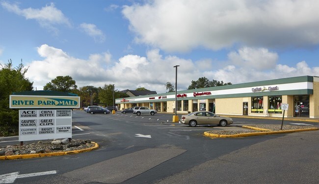
630 Water St S
Faribault-Northfield, MN
LOT 1 BLOCK 46 OF NORTHFIELD ORIG TOWN PART OF L1 B46 B61 & VAC 6TH ST LYING BETWEEN B46 & B61 ORIG TOWN DAF BEG NE COR L1
22.01.1.00.021
RICE
Stripcommercialcenter
Minnesota
AE The base floodplain where base flood elevations are provided. AE Zones are now used on new format FIRMs instead of A1-A30 Zones.
1
2026
2.87 AC
2026
Minnesota South Area
070501
Other Market Areas
42,523 SF
NEARBY LISTINGS FOR SALE OR LEASE
DEMOGRAPHICS near 630 Water St S
1 mile
3 mile
5 mile
2025 Total Population
11,782
24,575
26,205
2030 Population
11,964
25,100
26,773
Pop Growth 2025-2030
+ 1.54%
+ 2.14%
+ 2.17%
Average Age
35
38
38
2025 Total Households
3,238
7,975
8,562
HH Growth 2025-2030
+ 1.67%
+ 2.43%
+ 2.46%
Median Household Inc
$83,832
$93,070
$94,739
Avg Household Size
2.30
2.40
2.40
2025 Avg HH Vehicles
2.00
2.00
2.00
Median Home Value
$294,012
$329,680
$337,837
Median Year Built
1964
1983
1983
Nearby Places
Map Layers
Map Styles
 Street
 Aerial
Layers
 Traffic
 Biking
Places
Listings with unknown addresses are not visible on the map
- Restaurants
- Banks
- Shops
- Fitness
- Groceries
PUBLIC TRANSPORTATION
AIRPORT
Minneapolis-St Paul International/Wold-Chamberlain
Drive
Walk
Distance
Minneapolis-St Paul International/Wold-Chamberlain
51 min
39.6 mi
SALE & LEASE HISTORY
LISTING DATE
SALE/LEASE

Dec 07, 2018
For Lease
Nearby Properties
Address
Land Use
TOTAL SIZE
Lot Size
Zoning
Address
Land Use
TOTAL SIZE
Lot Size
Zoning
132,425 SF
3.05 AC
Address
Land Use
TOTAL SIZE
Lot Size
Zoning
88,775 SF
8.63 AC
Address
Land Use
TOTAL SIZE
Lot Size
Zoning
66,106 SF
14.60 AC
Address
Land Use
TOTAL SIZE
Lot Size
Zoning
144,375 SF
61.10 AC
Address
Land Use
TOTAL SIZE
Lot Size
Zoning
32,479 SF
1.86 AC
Address
Land Use
TOTAL SIZE
Lot Size
Zoning
227,549 SF
36 AC
Address
Land Use
TOTAL SIZE
Lot Size
Zoning
105,082 SF
30.10 AC
Address
Land Use
TOTAL SIZE
Lot Size
Zoning
169,869 SF
31.01 AC
Address
Land Use
TOTAL SIZE
Lot Size
Zoning
88,282 SF
13.50 AC
Address
Land Use
TOTAL SIZE
Lot Size
Zoning
3,080 SF
41.80 AC
Address
Land Use
TOTAL SIZE
Lot Size
Zoning
105,105 SF
2.98 AC
Address
Land Use
TOTAL SIZE
Lot Size
Zoning
104,445 SF
27.13 AC
Address
Land Use
TOTAL SIZE
Lot Size
Zoning
341,651 SF
16.90 AC
Address
Land Use
TOTAL SIZE
Lot Size
Zoning
8,316 SF
3.20 AC
Address
Land Use
TOTAL SIZE
Lot Size
Zoning
85,410 SF
15.50 AC
Address
Land Use
TOTAL SIZE
Lot Size
Zoning
82,848 SF
0.75 AC
Address
Land Use
TOTAL SIZE
Lot Size
Zoning
39,409 SF
6.70 AC
Address
Land Use
TOTAL SIZE
Lot Size
Zoning
771,318 SF
10.80 AC
Address
Land Use
TOTAL SIZE
Lot Size
Zoning
11,194 SF
3.76 AC
Address
Land Use
TOTAL SIZE
Lot Size
Zoning
12,617 SF
2 AC
Address
Land Use
TOTAL SIZE
Lot Size
Zoning
318,600 SF
15.20 AC
Address
Land Use
TOTAL SIZE
Lot Size
Zoning
52,397 SF
6.95 AC
Address
Land Use
TOTAL SIZE
Lot Size
Zoning
162,343 SF
15.14 AC
Address
Land Use
TOTAL SIZE
Lot Size
Zoning
74,292 SF
5.30 AC
Address
Land Use
TOTAL SIZE
Lot Size
Zoning
111,932 SF
3.11 AC
Address
Land Use
TOTAL SIZE
Lot Size
Zoning
29,992 SF
5.10 AC
Address
Land Use
TOTAL SIZE
Lot Size
Zoning
4,400 SF
2.50 AC
Address
Land Use
TOTAL SIZE
Lot Size
Zoning
209,595 SF
24.60 AC
Address
Land Use
TOTAL SIZE
Lot Size
Zoning
126,240 SF
12.18 AC
Address
Land Use
TOTAL SIZE
Lot Size
Zoning
46,215 SF
6.50 AC
The World's #1 Commercial Real Estate Marketplace
Connect with us
© 2026 CoStar Group
The information above has been obtained from sources believed reliable. While we do not doubt its accuracy we have not verified it and make no guarantee, warranty or representation about it. It is your responsibility to independently confirm its accuracy and completeness. Any projections, opinions, assumptions, or estimates used are for example only and do not represent the current or future performance of the property. The value of this transaction to you depends on tax and other factors which should be evaluated by your tax, financial, and legal advisors. You and your advisors should conduct a careful, independent investigation of the property to determine to your satisfaction the suitability of the property for your needs.