Property Record
6300 Interfirst Dr, Ann Arbor, MI 48108
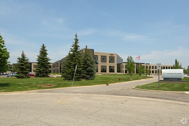

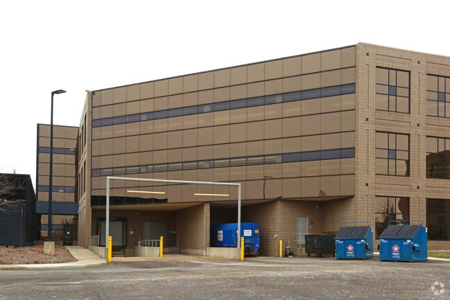

Property Detail
6300 Interfirst Dr
12-28-210-011
WASHTENAW COUNTY CONDO SUB PLAN #344
Officebuilding
WASHTENAW
B and X Area of moderate flood hazard, usually the area between the limits of the 100-year and 500-year floods.
Michigan
2025
30.23 AC
2025
Washtenaw W of 23
415400
Detroit
253,702 SF
Ann Arbor, MI
NEARBY LISTINGS FOR SALE OR LEASE
DEMOGRAPHICS near 6300 Interfirst Dr
1 mile
3 mile
5 mile
2025 Total Population
2,735
24,136
88,547
2030 Population
2,807
24,221
89,140
Pop Growth 2025-2030
+ 2.63%
+ 0.35%
+ 0.67%
Average Age
40
41
41
2025 Total Households
954
8,878
36,967
HH Growth 2025-2030
+ 2.83%
+ 0.37%
+ 0.64%
Median Household Inc
$150,714
$103,425
$97,936
Avg Household Size
2.80
2.50
2.30
2025 Avg HH Vehicles
2.00
2.00
2.00
Median Home Value
$493,103
$413,456
$382,780
Median Year Built
2000
1991
1982
Nearby Places
Map Layers
Map Styles
 Street
 Aerial
Layers
 Traffic
 Biking
Places
Listings with unknown addresses are not visible on the map
- Restaurants
- Banks
- Shops
- Fitness
- Groceries
PUBLIC TRANSPORTATION
COMMUTER RAIL
Ann Arbor Amtrak Station (Wolverine - Amtrak)
Drive
Walk
Distance
Ann Arbor Amtrak Station (Wolverine - Amtrak)
17 min
7.0 mi
AIRPORT
Detroit Metro Wayne County
Drive
Walk
Distance
Detroit Metro Wayne County
34 min
25.1 mi
Freight Ports
Port of Toledo
Drive
Walk
Distance
Port of Toledo
74 min
55.6 mi
SALE & LEASE HISTORY
LISTING DATE
SALE/LEASE

Jan 19, 2017
For Sale
Nearby Properties
Address
Land Use
TOTAL SIZE
Lot Size
Zoning
Address
Land Use
TOTAL SIZE
Lot Size
Zoning
282,382 SF
305.53 AC
RPD
Address
Land Use
TOTAL SIZE
Lot Size
Zoning
112,994 SF
45.12 AC
IH
Address
Land Use
TOTAL SIZE
Lot Size
Zoning
140,039 SF
Address
Land Use
TOTAL SIZE
Lot Size
Zoning
139,500 SF
A-1
Address
Land Use
TOTAL SIZE
Lot Size
Zoning
111,435 SF
21.38 AC
R4B
Address
Land Use
TOTAL SIZE
Lot Size
Zoning
317,872 SF
11.79 AC
M1
Address
Land Use
TOTAL SIZE
Lot Size
Zoning
18,148 SF
21.62 AC
BI
Address
Land Use
TOTAL SIZE
Lot Size
Zoning
167,294 SF
40.67 AC
Address
Land Use
TOTAL SIZE
Lot Size
Zoning
74,481 SF
3.40 AC
R5
Address
Land Use
TOTAL SIZE
Lot Size
Zoning
159,947 SF
14.19 AC
Address
Land Use
TOTAL SIZE
Lot Size
Zoning
132,937 SF
13.92 AC
R4A
Address
Land Use
TOTAL SIZE
Lot Size
Zoning
105,615 SF
26.31 AC
Address
Land Use
TOTAL SIZE
Lot Size
Zoning
Address
Land Use
TOTAL SIZE
Lot Size
Zoning
136,968 SF
10.53 AC
R4A
Address
Land Use
TOTAL SIZE
Lot Size
Zoning
64,989 SF
9.03 AC
R4A
Address
Land Use
TOTAL SIZE
Lot Size
Zoning
125,740 SF
11.89 AC
M1
Address
Land Use
TOTAL SIZE
Lot Size
Zoning
1,562,480 SF
189.08 AC
I-4
Address
Land Use
TOTAL SIZE
Lot Size
Zoning
191,215 SF
30.23 AC
Address
Land Use
TOTAL SIZE
Lot Size
Zoning
100,136 SF
3.47 AC
C2B
Address
Land Use
TOTAL SIZE
Lot Size
Zoning
17,228 SF
8.40 AC
Address
Land Use
TOTAL SIZE
Lot Size
Zoning
99,663 SF
6.89 AC
R-1A
Address
Land Use
TOTAL SIZE
Lot Size
Zoning
24,000 SF
21.97 AC
Address
Land Use
TOTAL SIZE
Lot Size
Zoning
154,987 SF
17.08 AC
II
Address
Land Use
TOTAL SIZE
Lot Size
Zoning
4,964 SF
5.86 AC
Address
Land Use
TOTAL SIZE
Lot Size
Zoning
88,657 SF
14.98 AC
Address
Land Use
TOTAL SIZE
Lot Size
Zoning
63,702 SF
2.30 AC
O
Address
Land Use
TOTAL SIZE
Lot Size
Zoning
67,220 SF
9 AC
Address
Land Use
TOTAL SIZE
Lot Size
Zoning
255,838 SF
31.64 AC
II
Address
Land Use
TOTAL SIZE
Lot Size
Zoning
99,000 SF
12.22 AC
I-2
The World's #1 Commercial Real Estate Marketplace
Connect with us
© 2026 CoStar Group
The information above has been obtained from sources believed reliable. While we do not doubt its accuracy we have not verified it and make no guarantee, warranty or representation about it. It is your responsibility to independently confirm its accuracy and completeness. Any projections, opinions, assumptions, or estimates used are for example only and do not represent the current or future performance of the property. The value of this transaction to you depends on tax and other factors which should be evaluated by your tax, financial, and legal advisors. You and your advisors should conduct a careful, independent investigation of the property to determine to your satisfaction the suitability of the property for your needs.