Property Record
6300 Maple Ave, Dallas, TX 75235


Current Lease Availabilities
NEARBY LISTINGS FOR SALE OR LEASE
Property Detail
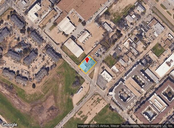
6300 Maple Ave
Dallas-Fort Worth-Arlington, TX
Maple View
00000217030000000
MAPLE VIEW BLK 2/2451 LTS 1-3 ACS 0.505 INT202500064796 DD03312025 CO-DC 2451 002 00100 1002451 002
Warehouse
Dallas
X
Texas
48113C0330J
1-3
2024
0.51 AC
2025
East Brookhollow
000409
Dallas/Ft Worth
13,374 SF
DEMOGRAPHICS near 6300 Maple Ave
1 Mile
3 Mile
5 Mile
2024 Total Population
14,353
119,486
345,982
2029 Population
14,623
120,256
349,228
Pop Growth 2024-2029
+ 1.88%
+ 0.64%
+ 0.94%
Average Age
35
38
37
2024 Total Households
7,009
60,568
164,910
HH Growth 2024-2029
+ 1.98%
+ 0.62%
+ 1.12%
Median Household Inc
$44,800
$73,923
$76,589
Avg Household Size
1.90
1.90
2.00
2024 Avg HH Vehicles
1.00
1.00
2.00
Median Home Value
$269,396
$487,000
$498,902
Median Year Built
2006
1995
1993
Nearby Places
Map Layers
Map Styles
 Street
 Aerial
- Restaurants
- Banks
- Shops
- Fitness
- Groceries
PUBLIC TRANSPORTATION
TRANSIT/SUBWAY
Inwood/Love Field Station (Green Line - Dallas Area Rapid Transit (DART), Orange Line - Dallas Area Rapid Transit (DART))
DRIVE
WALK
Distance
Inwood/Love Field Station (Green Line - Dallas Area Rapid Transit (DART), Orange Line - Dallas Area Rapid Transit (DART))
3 min
14 min
0.7 mi
COMMUTER RAIL
Medical/Market Center (Trinity Railway Express - Dallas Area Rapid Transit (DART))
DRIVE
WALK
Distance
Medical/Market Center (Trinity Railway Express - Dallas Area Rapid Transit (DART))
5 min
1.8 mi
DRIVE
WALK
Distance
5 min
1.9 mi
AIRPORT
Dallas Love Field
DRIVE
WALK
Distance
Dallas Love Field
5 min
1.7 mi
Dallas-Fort Worth International
DRIVE
WALK
Distance
Dallas-Fort Worth International
25 min
17.9 mi
Nearby Properties
Address
Land Use
TOTAL SIZE
Lot Size
Zoning
Address
Land Use
TOTAL SIZE
Lot Size
Zoning
2,658,374 SF
37.70 AC
Z116
Address
Land Use
TOTAL SIZE
Lot Size
Zoning
2,476 SF
1,203.03 AC
Z116
Address
Land Use
TOTAL SIZE
Lot Size
Zoning
2,271,924 SF
Address
Land Use
TOTAL SIZE
Lot Size
Zoning
4,407,366 SF
1,300 AC
IR
Address
Land Use
TOTAL SIZE
Lot Size
Zoning
1,003,498 SF
22.15 AC
Z116
Address
Land Use
TOTAL SIZE
Lot Size
Zoning
299,170 SF
9.71 AC
Z97
Address
Land Use
TOTAL SIZE
Lot Size
Zoning
1,896,570 SF
18.08 AC
Z151
Address
Land Use
TOTAL SIZE
Lot Size
Zoning
1,291,660 SF
2.56 AC
Z248
Address
Land Use
TOTAL SIZE
Lot Size
Zoning
504,533 SF
9.95 AC
Z151
Address
Land Use
TOTAL SIZE
Lot Size
Zoning
1,228,418 SF
24.51 AC
Z151
Address
Land Use
TOTAL SIZE
Lot Size
Zoning
724,979 SF
1.05 AC
Z239
Address
Land Use
TOTAL SIZE
Lot Size
Zoning
602,716 SF
11.21 AC
Z239
Address
Land Use
TOTAL SIZE
Lot Size
Zoning
906,627 SF
3.83 AC
Z239
Address
Land Use
TOTAL SIZE
Lot Size
Zoning
525,016 SF
6.51 AC
Z151
Address
Land Use
TOTAL SIZE
Lot Size
Zoning
512,667 SF
16.10 AC
Z151
Address
Land Use
TOTAL SIZE
Lot Size
Zoning
818,188 SF
2.89 AC
Z239
Address
Land Use
TOTAL SIZE
Lot Size
Zoning
1,870,348 SF
12.70 AC
Z151
Address
Land Use
TOTAL SIZE
Lot Size
Zoning
806,107 SF
0.40 AC
Z239
Address
Land Use
TOTAL SIZE
Lot Size
Zoning
584,652 SF
22.90 AC
Z150
Address
Land Use
TOTAL SIZE
Lot Size
Zoning
446,593 SF
0.93 AC
Address
Land Use
TOTAL SIZE
Lot Size
Zoning
146,302 SF
5.66 AC
Z60
Address
Land Use
TOTAL SIZE
Lot Size
Zoning
446,367 SF
3.35 AC
Z151
Address
Land Use
TOTAL SIZE
Lot Size
Zoning
569,836 SF
2.18 AC
Z239
Address
Land Use
TOTAL SIZE
Lot Size
Zoning
615,910 SF
2.31 AC
Z239
Address
Land Use
TOTAL SIZE
Lot Size
Zoning
352,834 SF
Address
Land Use
TOTAL SIZE
Lot Size
Zoning
502,134 SF
1.05 AC
Address
Land Use
TOTAL SIZE
Lot Size
Zoning
1,898,977 SF
42.38 AC
Z239
Address
Land Use
TOTAL SIZE
Lot Size
Zoning
723,546 SF
16.98 AC
Z46
Address
Land Use
TOTAL SIZE
Lot Size
Zoning
83,309 SF
13.37 AC
Z164
Address
Land Use
TOTAL SIZE
Lot Size
Zoning
240,205 SF
1.24 AC
The World's #1 Commercial Real Estate Marketplace
Connect with us
© 2026 CoStar Group
The information above has been obtained from sources believed reliable. While we do not doubt its accuracy we have not verified it and make no guarantee, warranty or representation about it. It is your responsibility to independently confirm its accuracy and completeness. Any projections, opinions, assumptions, or estimates used are for example only and do not represent the current or future performance of the property. The value of this transaction to you depends on tax and other factors which should be evaluated by your tax, financial, and legal advisors. You and your advisors should conduct a careful, independent investigation of the property to determine to your satisfaction the suitability of the property for your needs.