Property Record
6300 Providence Rd, Charlotte, NC 28226


NEARBY LISTINGS FOR SALE OR LEASE
Property Detail
6300 Providence Rd
Charlotte-Concord-Gastonia, NC-SC
Property/Charles E Bradshaw&Mi
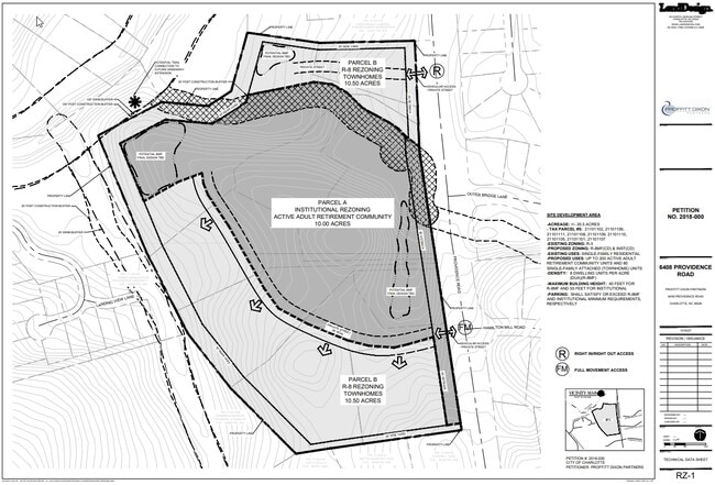
211-011-02
L1 M69-935
Multifamilydwelling
Mecklenburg
X
North Carolina
3710456000K
1
2024
12.73 AC
2025
South Charlotte
003013
Charlotte
287,611 SF
DEMOGRAPHICS near 6300 Providence Rd
1 Mile
3 Mile
5 Mile
2024 Total Population
10,022
72,521
221,646
2029 Population
10,529
76,106
233,367
Pop Growth 2024-2029
+ 5.06%
+ 4.94%
+ 5.29%
Average Age
40
41
40
2024 Total Households
3,991
29,227
91,963
HH Growth 2024-2029
+ 5.06%
+ 5.03%
+ 5.42%
Median Household Inc
$105,455
$117,911
$98,881
Avg Household Size
2.40
2.40
2.40
2024 Avg HH Vehicles
2.00
2.00
2.00
Median Home Value
$467,097
$491,927
$451,502
Median Year Built
1985
1985
1987
Nearby Places
Map Layers
Map Styles
 Street
 Aerial
- Restaurants
- Banks
- Shops
- Fitness
- Groceries
PUBLIC TRANSPORTATION
AIRPORT
Charlotte/Douglas International
DRIVE
WALK
Distance
Charlotte/Douglas International
29 min
14.0 mi
Concord-Padgett Regional
DRIVE
WALK
Distance
Concord-Padgett Regional
39 min
23.6 mi
Freight Ports
North Charleston Terminal
DRIVE
WALK
Distance
North Charleston Terminal
232 min
198.8 mi
SALE & LEASE HISTORY
LISTING DATE
SALE/LEASE

Feb 24, 2017
For Sale
Nearby Properties
Address
Land Use
TOTAL SIZE
Lot Size
Zoning
Address
Land Use
TOTAL SIZE
Lot Size
Zoning
442,934 SF
40.80 AC
R12MFCD
Address
Land Use
TOTAL SIZE
Lot Size
Zoning
501,350 SF
6.82 AC
Address
Land Use
TOTAL SIZE
Lot Size
Zoning
586,989 SF
6.50 AC
Address
Land Use
TOTAL SIZE
Lot Size
Zoning
422,653 SF
58.70 AC
R3
Address
Land Use
TOTAL SIZE
Lot Size
Zoning
191,929 SF
26.85 AC
B1SCD
Address
Land Use
TOTAL SIZE
Lot Size
Zoning
750,813 SF
56.11 AC
C
Address
Land Use
TOTAL SIZE
Lot Size
Zoning
304,043 SF
19.40 AC
R17MFCD
Address
Land Use
TOTAL SIZE
Lot Size
Zoning
268,545 SF
26.83 AC
R15MFCD
Address
Land Use
TOTAL SIZE
Lot Size
Zoning
288,495 SF
22.35 AC
R9PUD
Address
Land Use
TOTAL SIZE
Lot Size
Zoning
292,066 SF
2.67 AC
R15MF
Address
Land Use
TOTAL SIZE
Lot Size
Zoning
288,504 SF
30.19 AC
RI
Address
Land Use
TOTAL SIZE
Lot Size
Zoning
232,858 SF
21.74 AC
R15MF
Address
Land Use
TOTAL SIZE
Lot Size
Zoning
366,288 SF
45.44 AC
INSTCD
Address
Land Use
TOTAL SIZE
Lot Size
Zoning
185,878 SF
18.24 AC
CC
Address
Land Use
TOTAL SIZE
Lot Size
Zoning
193,391 SF
24.77 AC
R12MF
Address
Land Use
TOTAL SIZE
Lot Size
Zoning
177,643 SF
25 AC
R3
Address
Land Use
TOTAL SIZE
Lot Size
Zoning
232,878 SF
33.77 AC
MX2INNOV
Address
Land Use
TOTAL SIZE
Lot Size
Zoning
208,960 SF
7.33 AC
MUDDO
Address
Land Use
TOTAL SIZE
Lot Size
Zoning
215,246 SF
14.49 AC
R3
Address
Land Use
TOTAL SIZE
Lot Size
Zoning
264,132 SF
58.71 AC
R3
Address
Land Use
TOTAL SIZE
Lot Size
Zoning
147,460 SF
40.12 AC
R3
Address
Land Use
TOTAL SIZE
Lot Size
Zoning
150,112 SF
0.95 AC
Address
Land Use
TOTAL SIZE
Lot Size
Zoning
21.45 AC
Address
Land Use
TOTAL SIZE
Lot Size
Zoning
142,300 SF
5.50 AC
Address
Land Use
TOTAL SIZE
Lot Size
Zoning
144,987 SF
17.55 AC
R15MFCD
Address
Land Use
TOTAL SIZE
Lot Size
Zoning
195,923 SF
7.76 AC
R3
Address
Land Use
TOTAL SIZE
Lot Size
Zoning
214,422 SF
20.85 AC
R12MF
Address
Land Use
TOTAL SIZE
Lot Size
Zoning
160,078 SF
14.95 AC
R17MF
Address
Land Use
TOTAL SIZE
Lot Size
Zoning
96,733 SF
10.01 AC
NS
The World's #1 Commercial Real Estate Marketplace
Connect with us
© 2025 CoStar Group
The information above has been obtained from sources believed reliable. While we do not doubt its accuracy we have not verified it and make no guarantee, warranty or representation about it. It is your responsibility to independently confirm its accuracy and completeness. Any projections, opinions, assumptions, or estimates used are for example only and do not represent the current or future performance of the property. The value of this transaction to you depends on tax and other factors which should be evaluated by your tax, financial, and legal advisors. You and your advisors should conduct a careful, independent investigation of the property to determine to your satisfaction the suitability of the property for your needs.