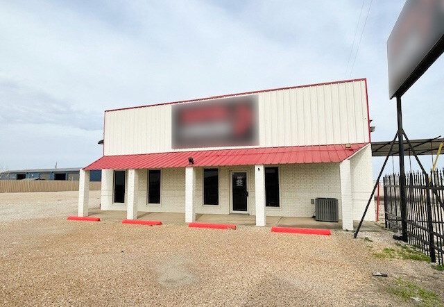
Property Record
6300 S I 45, Ferris, TX 75125

NEARBY LISTINGS FOR SALE OR LEASE
Property Detail
6300 S I 45
Dallas-Fort Worth-Arlington, TX
J H Holloway
65062828510010600
J H HOLLOWAY ABST 628 PG 285 TR 1.6 ACS 3.6875 INT202300129641 DD06272023 CO-DC 0628285100103 4NT06282851
Commercialacreage
Dallas
X
Texas
48113C0660K
3.69 AC
2024
SE Dallas/I-45
2025
Dallas/Ft Worth
060104
DEMOGRAPHICS near 6300 S I 45
1 Mile
3 Mile
5 Mile
2024 Total Population
730
10,574
17,659
2029 Population
782
11,746
19,808
Pop Growth 2024-2029
+ 7.12%
+ 11.08%
+ 12.17%
Average Age
32
34
35
2024 Total Households
219
3,286
5,529
HH Growth 2024-2029
+ 6.85%
+ 11.50%
+ 12.53%
Median Household Inc
$54,687
$52,749
$55,000
Avg Household Size
3.30
3.10
3.20
2024 Avg HH Vehicles
2.00
2.00
2.00
Median Home Value
$117,500
$118,927
$137,267
Median Year Built
2007
1994
1995
Nearby Places
Map Layers
Map Styles
 Street
 Aerial
- Restaurants
- Banks
- Shops
- Fitness
- Groceries
PUBLIC TRANSPORTATION
AIRPORT
Dallas Love Field
DRIVE
WALK
Distance
Dallas Love Field
31 min
22.2 mi
Freight Ports
Port of Shreveport
DRIVE
WALK
Distance
Port of Shreveport
212 min
198.2 mi
SALE & LEASE HISTORY
LISTING DATE
SALE/LEASE

Sep 25, 2016
For Lease
Sep 23, 2016
For Sale
Mar 12, 2025
For Sale
Nearby Properties
Address
Land Use
TOTAL SIZE
Lot Size
Zoning
Address
Land Use
TOTAL SIZE
Lot Size
Zoning
62.41 AC
Z31
Address
Land Use
TOTAL SIZE
Lot Size
Zoning
36.33 AC
Z31
Address
Land Use
TOTAL SIZE
Lot Size
Zoning
1,409,184 SF
75.72 AC
Z31
Address
Land Use
TOTAL SIZE
Lot Size
Zoning
1,358,690 SF
94.91 AC
Z268
Address
Land Use
TOTAL SIZE
Lot Size
Zoning
1,021,601 SF
79.42 AC
Z268
Address
Land Use
TOTAL SIZE
Lot Size
Zoning
1,020,000 SF
56.30 AC
Z31
Address
Land Use
TOTAL SIZE
Lot Size
Zoning
660,000 SF
39.24 AC
Z31
Address
Land Use
TOTAL SIZE
Lot Size
Zoning
750,000 SF
37.12 AC
Z31
Address
Land Use
TOTAL SIZE
Lot Size
Zoning
570,000 SF
30.48 AC
Z251
Address
Land Use
TOTAL SIZE
Lot Size
Zoning
565,259 SF
38.69 AC
Z123
Address
Land Use
TOTAL SIZE
Lot Size
Zoning
826,620 SF
39.67 AC
Z123
Address
Land Use
TOTAL SIZE
Lot Size
Zoning
132,780 SF
64.84 AC
Z05
Address
Land Use
TOTAL SIZE
Lot Size
Zoning
416,000 SF
28.69 AC
Z123
Address
Land Use
TOTAL SIZE
Lot Size
Zoning
611,040 SF
39.98 AC
Z251
Address
Land Use
TOTAL SIZE
Lot Size
Zoning
481,520 SF
26.82 AC
Z31
Address
Land Use
TOTAL SIZE
Lot Size
Zoning
431,190 SF
46.46 AC
Z251
Address
Land Use
TOTAL SIZE
Lot Size
Zoning
472,836 SF
31.34 AC
Z123
Address
Land Use
TOTAL SIZE
Lot Size
Zoning
202,439 SF
12.48 AC
Z31
Address
Land Use
TOTAL SIZE
Lot Size
Zoning
422,644 SF
28.43 AC
Z268
Address
Land Use
TOTAL SIZE
Lot Size
Zoning
392,066 SF
23.52 AC
Address
Land Use
TOTAL SIZE
Lot Size
Zoning
334,800 SF
18.16 AC
Z251
Address
Land Use
TOTAL SIZE
Lot Size
Zoning
370,139 SF
15.42 AC
Z268
Address
Land Use
TOTAL SIZE
Lot Size
Zoning
376,368 SF
19.42 AC
Z31
Address
Land Use
TOTAL SIZE
Lot Size
Zoning
80,980 SF
15.18 AC
AG
Address
Land Use
TOTAL SIZE
Lot Size
Zoning
293,570 SF
14.36 AC
Z251
Address
Land Use
TOTAL SIZE
Lot Size
Zoning
272,800 SF
16.89 AC
Z31
Address
Land Use
TOTAL SIZE
Lot Size
Zoning
379 SF
74.05 AC
Address
Land Use
TOTAL SIZE
Lot Size
Zoning
174,802 SF
8.67 AC
Address
Land Use
TOTAL SIZE
Lot Size
Zoning
262.87 AC
Z31
Address
Land Use
TOTAL SIZE
Lot Size
Zoning
235,368 SF
21.03 AC
Z05
The World's #1 Commercial Real Estate Marketplace
Connect with us
© 2025 CoStar Group
The information above has been obtained from sources believed reliable. While we do not doubt its accuracy we have not verified it and make no guarantee, warranty or representation about it. It is your responsibility to independently confirm its accuracy and completeness. Any projections, opinions, assumptions, or estimates used are for example only and do not represent the current or future performance of the property. The value of this transaction to you depends on tax and other factors which should be evaluated by your tax, financial, and legal advisors. You and your advisors should conduct a careful, independent investigation of the property to determine to your satisfaction the suitability of the property for your needs.