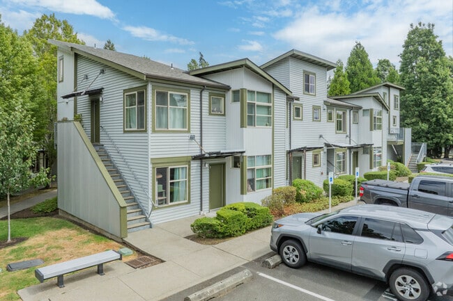
Property Record
6301 65Th Ave Ne, Seattle, WA 98115


NEARBY LISTINGS FOR SALE OR LEASE
Property Detail
6301 65Th Ave Ne
Seattle-Tacoma-Bellevue, WA
Sand Point Homes Add
753480-0005
SAND POINT HOMES ADD ALL OF CORRECTION PLAT OF SAND POINT HOMES (INCLUDING ALL VACATED STREETS AS DELINEATED ON SD PLAT); TGW PORTIONS OF TRACT IN GILMORE'S ADDITION & EVERGREEN ADDITION & OF VACATED NE 65TH ST DESCRIBED AS FOLLOWS: BEGINNING AT SE C
Apartment
King
X
Washington
53033C0345G
all
2021
22.34 AC
2024
Windermere
004102
Seattle/Puget Sound
309,469 SF
DEMOGRAPHICS near 6301 65Th Ave Ne
1 Mile
3 Mile
5 Mile
2024 Total Population
9,445
120,270
439,179
2029 Population
9,311
120,563
440,679
Pop Growth 2024-2029
(1.42%)
+ 0.24%
+ 0.34%
Average Age
40
38
38
2024 Total Households
3,883
50,074
198,755
HH Growth 2024-2029
(1.75%)
+ 0.29%
+ 0.34%
Median Household Inc
$169,926
$132,475
$130,161
Avg Household Size
2.40
2.20
2.10
2024 Avg HH Vehicles
2.00
2.00
1.00
Median Home Value
$1,108,009
$1,084,050
$1,041,041
Median Year Built
1959
1973
1977
Nearby Places
Map Layers
Map Styles
 Street
 Aerial
- Restaurants
- Banks
- Shops
- Fitness
- Groceries
PUBLIC TRANSPORTATION
COMMUTER RAIL
King Street (Seattle) Station (Everett - Seattle - Sound Transit, Seattle - Tacoma/Lakewood - Sound Transit, Sounder South Line - Sound Transit)
DRIVE
WALK
Distance
King Street (Seattle) Station (Everett - Seattle - Sound Transit, Seattle - Tacoma/Lakewood - Sound Transit, Sounder South Line - Sound Transit)
18 min
8.0 mi
AIRPORT
Seattle-Tacoma International
DRIVE
WALK
Distance
Seattle-Tacoma International
37 min
21.2 mi
Seattle Paine Field International
DRIVE
WALK
Distance
Seattle Paine Field International
38 min
21.9 mi
Freight Ports
Port of Seattle
DRIVE
WALK
Distance
Port of Seattle
24 min
11.7 mi
Nearby Properties
Address
Land Use
TOTAL SIZE
Lot Size
Zoning
Address
Land Use
TOTAL SIZE
Lot Size
Zoning
471.20 AC
MIO-37-LR1
Address
Land Use
TOTAL SIZE
Lot Size
Zoning
26,850 SF
194.66 AC
NR2
Address
Land Use
TOTAL SIZE
Lot Size
Zoning
107.86 AC
NR2
Address
Land Use
TOTAL SIZE
Lot Size
Zoning
50,060 SF
96.12 AC
NR2
Address
Land Use
TOTAL SIZE
Lot Size
Zoning
612,844 SF
0.09 AC
SM-U/R 75-
Address
Land Use
TOTAL SIZE
Lot Size
Zoning
90,184 SF
16.66 AC
C1-75 (M)
Address
Land Use
TOTAL SIZE
Lot Size
Zoning
105,056 SF
15.92 AC
PLA 15A
Address
Land Use
TOTAL SIZE
Lot Size
Zoning
25,735 SF
1.56 AC
C1-75 (M)
Address
Land Use
TOTAL SIZE
Lot Size
Zoning
572,539 SF
2.50 AC
CBD 5A
Address
Land Use
TOTAL SIZE
Lot Size
Zoning
285,140 SF
0.90 AC
NC2-75 (M1
Address
Land Use
TOTAL SIZE
Lot Size
Zoning
131,790 SF
0.37 AC
SM-U 75-24
Address
Land Use
TOTAL SIZE
Lot Size
Zoning
126,394 SF
8.80 AC
C2-75 (M)
Address
Land Use
TOTAL SIZE
Lot Size
Zoning
382,762 SF
7.14 AC
NR3
Address
Land Use
TOTAL SIZE
Lot Size
Zoning
0.31 AC
SM-U 95-32
Address
Land Use
TOTAL SIZE
Lot Size
Zoning
132,183 SF
0.76 AC
NC2-65
Address
Land Use
TOTAL SIZE
Lot Size
Zoning
205,000 SF
13.89 AC
NR3
Address
Land Use
TOTAL SIZE
Lot Size
Zoning
215,468 SF
0.60 AC
NC2-75 (M1
Address
Land Use
TOTAL SIZE
Lot Size
Zoning
2,874 SF
21.94 AC
NR3
Address
Land Use
TOTAL SIZE
Lot Size
Zoning
7,381 SF
1.30 AC
CBD 1B
Address
Land Use
TOTAL SIZE
Lot Size
Zoning
184,251 SF
10.02 AC
LR3 (M)
Address
Land Use
TOTAL SIZE
Lot Size
Zoning
118,341 SF
0.55 AC
C2-75 (M)
Address
Land Use
TOTAL SIZE
Lot Size
Zoning
133,896 SF
0.82 AC
SM-U 95-32
Address
Land Use
TOTAL SIZE
Lot Size
Zoning
444,618 SF
4.78 AC
PLA 6G
Address
Land Use
TOTAL SIZE
Lot Size
Zoning
100,736 SF
0.96 AC
CBD 1B
Address
Land Use
TOTAL SIZE
Lot Size
Zoning
0.75 AC
SM-U 95-32
Address
Land Use
TOTAL SIZE
Lot Size
Zoning
336,254 SF
0.45 AC
SM-U 95-32
Address
Land Use
TOTAL SIZE
Lot Size
Zoning
65,622 SF
6.20 AC
LIT
The World's #1 Commercial Real Estate Marketplace
Connect with us
© 2025 CoStar Group
The information above has been obtained from sources believed reliable. While we do not doubt its accuracy we have not verified it and make no guarantee, warranty or representation about it. It is your responsibility to independently confirm its accuracy and completeness. Any projections, opinions, assumptions, or estimates used are for example only and do not represent the current or future performance of the property. The value of this transaction to you depends on tax and other factors which should be evaluated by your tax, financial, and legal advisors. You and your advisors should conduct a careful, independent investigation of the property to determine to your satisfaction the suitability of the property for your needs.