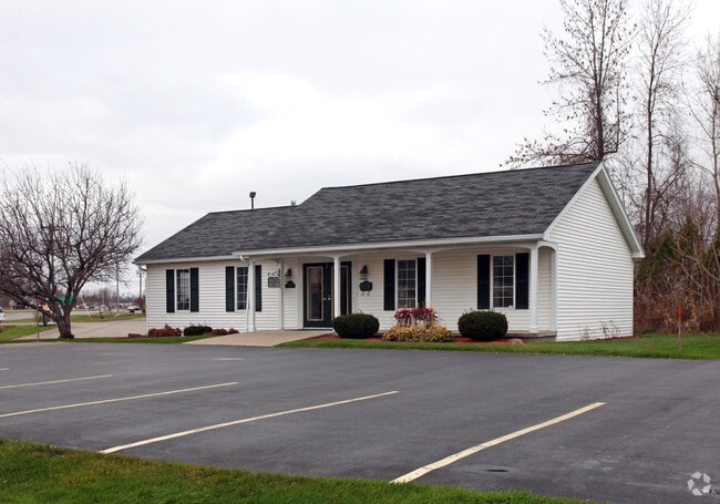
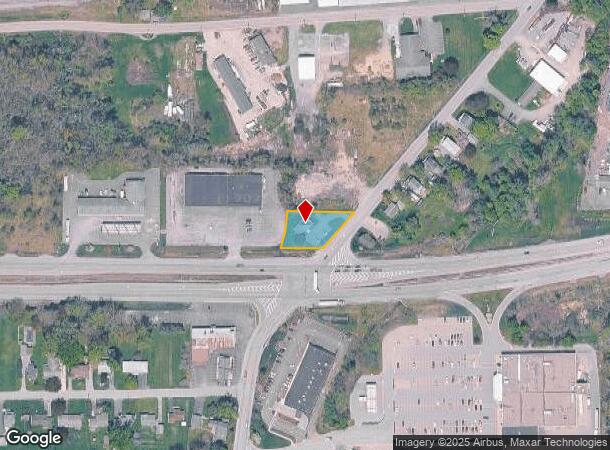
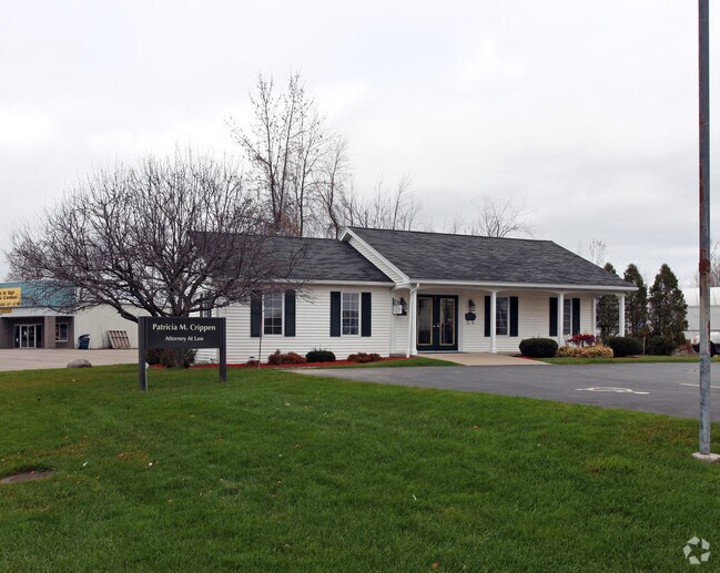
Property Record
6301 Furnace Rd, Ontario, NY 14519
NEARBY LISTINGS FOR SALE OR LEASE
-
-
View all Ontario listings for lease on LoopNet.com
Property Detail
6301 Furnace Rd
Rochester, NY
31117-10-374683
543400-063-117-0010-401-687-0000
Wayne
Storesoffices
New York
2025
401.687
2024
0.49 AC
020106
Wayne County
1,200 SF
Rochester
DEMOGRAPHICS near 6301 Furnace Rd
1 Mile
3 Mile
5 Mile
2024 Total Population
2,132
7,747
16,968
2029 Population
2,129
7,685
16,793
Pop Growth 2024-2029
(0.14%)
(0.80%)
(1.03%)
Average Age
41
43
43
2024 Total Households
902
3,196
6,885
HH Growth 2024-2029
(0.22%)
(0.84%)
(1.09%)
Median Household Inc
$50,812
$74,287
$78,868
Avg Household Size
2.30
2.40
2.40
2024 Avg HH Vehicles
2.00
2.00
2.00
Median Home Value
$167,130
$177,523
$180,447
Median Year Built
1966
1974
1974
Nearby Places
- Restaurants
- Banks
- Shops
- Fitness
- Groceries
PUBLIC TRANSPORTATION
AIRPORT
Frederick Douglass/Greater Rochester International
DRIVE
WALK
Distance
Frederick Douglass/Greater Rochester International
35 min
24.3 mi
Freight Ports
Albany, NY Port
DRIVE
WALK
Distance
Albany, NY Port
254 min
207.0 mi
SALE & LEASE HISTORY
LISTING DATE
SALE/LEASE

May 01, 2023
For Lease
Nearby Properties
Address
Land Use
TOTAL SIZE
Lot Size
Zoning
Address
Land Use
TOTAL SIZE
Lot Size
Zoning
150,432 SF
27.02 AC
SR
Address
Land Use
TOTAL SIZE
Lot Size
Zoning
0.01 AC
R
Address
Land Use
TOTAL SIZE
Lot Size
Zoning
4,602 SF
92.65 AC
UR
Address
Land Use
TOTAL SIZE
Lot Size
Zoning
73,600 SF
50.33 AC
SR
Address
Land Use
TOTAL SIZE
Lot Size
Zoning
0.01 AC
Address
Land Use
TOTAL SIZE
Lot Size
Zoning
71,459 SF
10.19 AC
B
Address
Land Use
TOTAL SIZE
Lot Size
Zoning
55,100 SF
6.98 AC
B
Address
Land Use
TOTAL SIZE
Lot Size
Zoning
9.18 AC
SR
Address
Land Use
TOTAL SIZE
Lot Size
Zoning
34,000 SF
23.51 AC
SR
Address
Land Use
TOTAL SIZE
Lot Size
Zoning
8.19 AC
PD
Address
Land Use
TOTAL SIZE
Lot Size
Zoning
86,188 SF
14.89 AC
B
Address
Land Use
TOTAL SIZE
Lot Size
Zoning
3,714 SF
39.97 AC
CON
Address
Land Use
TOTAL SIZE
Lot Size
Zoning
45,839 SF
5.71 AC
UR
Address
Land Use
TOTAL SIZE
Lot Size
Zoning
14,074 SF
1.70 AC
B
Address
Land Use
TOTAL SIZE
Lot Size
Zoning
23,920 SF
18.92 AC
SR
Address
Land Use
TOTAL SIZE
Lot Size
Zoning
24,246 SF
12.83 AC
I
Address
Land Use
TOTAL SIZE
Lot Size
Zoning
16 AC
SR
Address
Land Use
TOTAL SIZE
Lot Size
Zoning
0.52 AC
BT
Address
Land Use
TOTAL SIZE
Lot Size
Zoning
10,976 SF
8.77 AC
SR
Address
Land Use
TOTAL SIZE
Lot Size
Zoning
6,134 SF
4.88 AC
B
Address
Land Use
TOTAL SIZE
Lot Size
Zoning
20,000 SF
15.05 AC
B
Address
Land Use
TOTAL SIZE
Lot Size
Zoning
1,568 SF
16.25 AC
CON
Address
Land Use
TOTAL SIZE
Lot Size
Zoning
14,140 SF
161.25 AC
SR
Address
Land Use
TOTAL SIZE
Lot Size
Zoning
46,395 SF
4.25 AC
BT
Address
Land Use
TOTAL SIZE
Lot Size
Zoning
1,695 SF
7.61 AC
SR
Address
Land Use
TOTAL SIZE
Lot Size
Zoning
11,130 SF
1.79 AC
B
Address
Land Use
TOTAL SIZE
Lot Size
Zoning
7,976 SF
25.80 AC
PL
Address
Land Use
TOTAL SIZE
Lot Size
Zoning
15,604 SF
6.04 AC
BT
Address
Land Use
TOTAL SIZE
Lot Size
Zoning
7,832 SF
2.16 AC
UR
Address
Land Use
TOTAL SIZE
Lot Size
Zoning
11,150 SF
1.65 AC
B
The World's #1 Commercial Real Estate Marketplace
Connect with us
© 2025 CoStar Group
The information above has been obtained from sources believed reliable. While we do not doubt its accuracy we have not verified it and make no guarantee, warranty or representation about it. It is your responsibility to independently confirm its accuracy and completeness. Any projections, opinions, assumptions, or estimates used are for example only and do not represent the current or future performance of the property. The value of this transaction to you depends on tax and other factors which should be evaluated by your tax, financial, and legal advisors. You and your advisors should conduct a careful, independent investigation of the property to determine to your satisfaction the suitability of the property for your needs.