Property Record
6305 Glenn Carlson Dr, Saint Cloud, MN 56301
NEARBY LISTINGS FOR SALE OR LEASE
-
-
View all Saint Cloud listings for sale on LoopNet.com
Property Detail
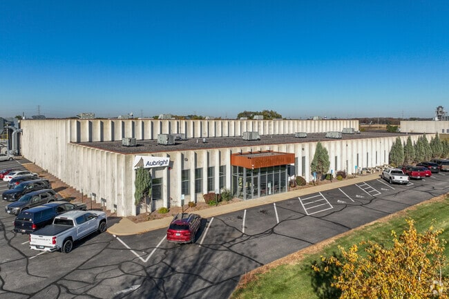
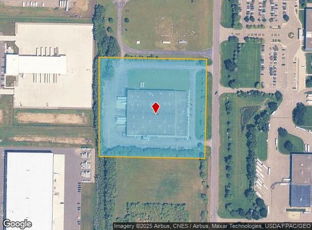
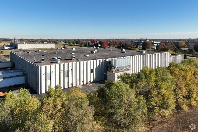
6305 Glenn Carlson Dr
St. Cloud, MN
St Cloud I-94 Business Park 9
82.50617.0238
LOT 001 BLK 001 ST CLOUD I-94 BUSINESS PARK 9 SECTION 18 TOWNSHIP 123 RANGE 027 SECTION 18 TOWNSHIP 123 RANGE 027
Industrialgeneral
Stearns
X
Minnesota
27145C0880E
1
2025
7.06 AC
2025
Stearns County
011400
Minneapolis/St Paul
DEMOGRAPHICS near 6305 Glenn Carlson Dr
1 Mile
3 Mile
5 Mile
2024 Total Population
127
4,702
16,123
2029 Population
131
4,915
17,001
Pop Growth 2024-2029
+ 3.15%
+ 4.53%
+ 5.45%
Average Age
36
39
40
2024 Total Households
55
1,905
6,118
HH Growth 2024-2029
+ 5.45%
+ 4.57%
+ 5.33%
Median Household Inc
$63,750
$76,405
$80,764
Avg Household Size
2.30
2.40
2.50
2024 Avg HH Vehicles
2.00
2.00
2.00
Median Home Value
$279,999
$295,475
$275,282
Median Year Built
2001
1995
1994
Nearby Places
Map Layers
Map Styles
 Street
 Aerial
- Restaurants
- Banks
- Shops
- Fitness
- Groceries
PUBLIC TRANSPORTATION
COMMUTER RAIL
DRIVE
WALK
Distance
19 min
9.2 mi
Nearby Properties
Address
Land Use
TOTAL SIZE
Lot Size
Zoning
Address
Land Use
TOTAL SIZE
Lot Size
Zoning
278,850 SF
20.83 AC
Address
Land Use
TOTAL SIZE
Lot Size
Zoning
41.05 AC
Address
Land Use
TOTAL SIZE
Lot Size
Zoning
357,302 SF
59.30 AC
I3
Address
Land Use
TOTAL SIZE
Lot Size
Zoning
101,460 SF
54.63 AC
I3
Address
Land Use
TOTAL SIZE
Lot Size
Zoning
314,315 SF
49.58 AC
I3
Address
Land Use
TOTAL SIZE
Lot Size
Zoning
75,620 SF
16.80 AC
I3
Address
Land Use
TOTAL SIZE
Lot Size
Zoning
79,223 SF
15.58 AC
C5
Address
Land Use
TOTAL SIZE
Lot Size
Zoning
249,445 SF
25.13 AC
I3
Address
Land Use
TOTAL SIZE
Lot Size
Zoning
77,434 SF
7.21 AC
C5
Address
Land Use
TOTAL SIZE
Lot Size
Zoning
15.35 AC
Address
Land Use
TOTAL SIZE
Lot Size
Zoning
43,250 SF
11.94 AC
Address
Land Use
TOTAL SIZE
Lot Size
Zoning
55,641 SF
18.77 AC
Address
Land Use
TOTAL SIZE
Lot Size
Zoning
169,920 SF
11.19 AC
PUD15
Address
Land Use
TOTAL SIZE
Lot Size
Zoning
74,354 SF
8.71 AC
I3
Address
Land Use
TOTAL SIZE
Lot Size
Zoning
87,813 SF
3.73 AC
PUD14
Address
Land Use
TOTAL SIZE
Lot Size
Zoning
Address
Land Use
TOTAL SIZE
Lot Size
Zoning
85,251 SF
50.85 AC
I3
Address
Land Use
TOTAL SIZE
Lot Size
Zoning
137,685 SF
8.82 AC
I3
Address
Land Use
TOTAL SIZE
Lot Size
Zoning
79,625 SF
2.19 AC
PUD14
Address
Land Use
TOTAL SIZE
Lot Size
Zoning
73,150 SF
3.01 AC
R5
Address
Land Use
TOTAL SIZE
Lot Size
Zoning
71,544 SF
2.29 AC
R5
Address
Land Use
TOTAL SIZE
Lot Size
Zoning
Address
Land Use
TOTAL SIZE
Lot Size
Zoning
70,677 SF
2.68 AC
R5
Address
Land Use
TOTAL SIZE
Lot Size
Zoning
71,487 SF
8.20 AC
R5
Address
Land Use
TOTAL SIZE
Lot Size
Zoning
121,660 SF
13.78 AC
PUD15
Address
Land Use
TOTAL SIZE
Lot Size
Zoning
26,561 SF
20 AC
Address
Land Use
TOTAL SIZE
Lot Size
Zoning
77,376 SF
15 AC
I3
Address
Land Use
TOTAL SIZE
Lot Size
Zoning
66,982 SF
3.10 AC
PUD14
Address
Land Use
TOTAL SIZE
Lot Size
Zoning
59.66 AC
Address
Land Use
TOTAL SIZE
Lot Size
Zoning
34,488 SF
7.24 AC
I1
The World's #1 Commercial Real Estate Marketplace
Connect with us
© 2026 CoStar Group
The information above has been obtained from sources believed reliable. While we do not doubt its accuracy we have not verified it and make no guarantee, warranty or representation about it. It is your responsibility to independently confirm its accuracy and completeness. Any projections, opinions, assumptions, or estimates used are for example only and do not represent the current or future performance of the property. The value of this transaction to you depends on tax and other factors which should be evaluated by your tax, financial, and legal advisors. You and your advisors should conduct a careful, independent investigation of the property to determine to your satisfaction the suitability of the property for your needs.