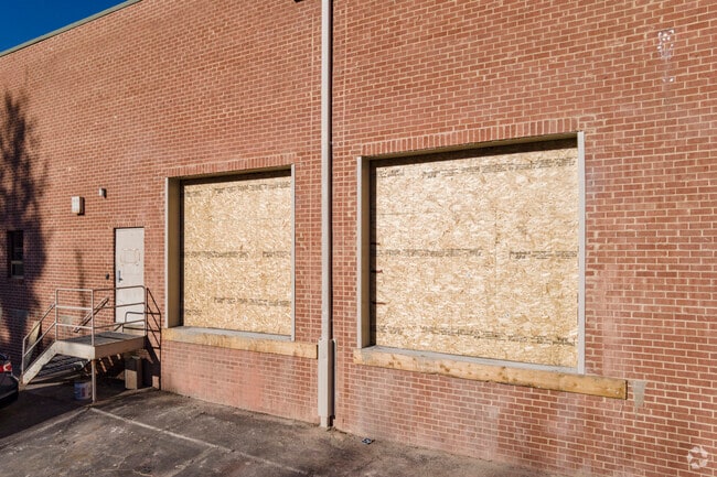
Property Record
6305 Gravel Ave, Alexandria, VA 22310


NEARBY LISTINGS FOR SALE OR LEASE
Property Detail
6305 Gravel Ave
Washington-Arlington-Alexandria, DC-VA-MD-WV
Division Of Land Of Gt Warehousing
0911-01-0032A
DIVISION OF LAND OF GT WAREHOUSING PCL B
Wholesaleoutletdiscountstore
Fairfax
X
Virginia
5100540050D
32a
2024
9.70 AC
2025
Springfield
421001
Washington, DC
135,600 SF
DEMOGRAPHICS near 6305 Gravel Ave
1 Mile
3 Mile
5 Mile
2024 Total Population
18,737
105,702
351,483
2029 Population
18,418
103,887
345,096
Pop Growth 2024-2029
(1.70%)
(1.72%)
(1.82%)
Average Age
40
40
39
2024 Total Households
7,495
39,677
130,124
HH Growth 2024-2029
(1.83%)
(1.92%)
(1.99%)
Median Household Inc
$125,627
$125,240
$111,010
Avg Household Size
2.40
2.60
2.60
2024 Avg HH Vehicles
2.00
2.00
2.00
Median Home Value
$541,049
$580,911
$580,437
Median Year Built
1988
1983
1976
Nearby Places
Map Layers
Map Styles
 Street
 Aerial
- Restaurants
- Banks
- Shops
- Fitness
- Groceries
PUBLIC TRANSPORTATION
COMMUTER RAIL
Franconia-Springfield (Fredericksburg Line - Virginia Railway Express)
DRIVE
WALK
Distance
Franconia-Springfield (Fredericksburg Line - Virginia Railway Express)
5 min
1.7 mi
Backlick Road (Manassas Line - Virginia Railway Express)
DRIVE
WALK
Distance
Backlick Road (Manassas Line - Virginia Railway Express)
9 min
3.7 mi
AIRPORT
Ronald Reagan Washington Ntl
DRIVE
WALK
Distance
Ronald Reagan Washington Ntl
22 min
10.8 mi
Washington Dulles International
DRIVE
WALK
Distance
Washington Dulles International
47 min
29.0 mi
Freight Ports
Port of Baltimore
DRIVE
WALK
Distance
Port of Baltimore
80 min
52.0 mi
SALE & LEASE HISTORY
LISTING DATE
SALE/LEASE

Sep 25, 2016
For Lease
Sep 20, 2017
For Lease
May 31, 2024
For Lease
Nearby Properties
Address
Land Use
TOTAL SIZE
Lot Size
Zoning
Address
Land Use
TOTAL SIZE
Lot Size
Zoning
717,618 SF
16.81 AC
340
Address
Land Use
TOTAL SIZE
Lot Size
Zoning
824,193 SF
16.06 AC
400
Address
Land Use
TOTAL SIZE
Lot Size
Zoning
631,189 SF
9.48 AC
497
Address
Land Use
TOTAL SIZE
Lot Size
Zoning
2,239,442 SF
58.08 AC
130
Address
Land Use
TOTAL SIZE
Lot Size
Zoning
480,165 SF
21.23 AC
304
Address
Land Use
TOTAL SIZE
Lot Size
Zoning
73,835 SF
27.26 AC
540
Address
Land Use
TOTAL SIZE
Lot Size
Zoning
1,286,047 SF
69.60 AC
540
Address
Land Use
TOTAL SIZE
Lot Size
Zoning
429,735 SF
20 AC
560
Address
Land Use
TOTAL SIZE
Lot Size
Zoning
328,506 SF
2.47 AC
CDD#17
Address
Land Use
TOTAL SIZE
Lot Size
Zoning
329,637 SF
23.39 AC
316
Address
Land Use
TOTAL SIZE
Lot Size
Zoning
338,106 SF
26.50 AC
304
Address
Land Use
TOTAL SIZE
Lot Size
Zoning
226,270 SF
21.98 AC
400
Address
Land Use
TOTAL SIZE
Lot Size
Zoning
187,773 SF
23.18 AC
304
Address
Land Use
TOTAL SIZE
Lot Size
Zoning
452,682 SF
20.74 AC
220
Address
Land Use
TOTAL SIZE
Lot Size
Zoning
394,657 SF
10.47 AC
340
Address
Land Use
TOTAL SIZE
Lot Size
Zoning
357,064 SF
19.14 AC
540
Address
Land Use
TOTAL SIZE
Lot Size
Zoning
511,000 SF
34.16 AC
596
Address
Land Use
TOTAL SIZE
Lot Size
Zoning
1,000 SF
23.41 AC
550
Address
Land Use
TOTAL SIZE
Lot Size
Zoning
327,600 SF
12.31 AC
304
Address
Land Use
TOTAL SIZE
Lot Size
Zoning
726,779 SF
57.50 AC
130
Address
Land Use
TOTAL SIZE
Lot Size
Zoning
173,702 SF
6.72 AC
316
Address
Land Use
TOTAL SIZE
Lot Size
Zoning
263,550 SF
1.78 AC
I
Address
Land Use
TOTAL SIZE
Lot Size
Zoning
5.17 AC
OCM(100)
Address
Land Use
TOTAL SIZE
Lot Size
Zoning
5.10 AC
RC
Address
Land Use
TOTAL SIZE
Lot Size
Zoning
374,125 SF
2.84 AC
400
Address
Land Use
TOTAL SIZE
Lot Size
Zoning
505,632 SF
22.11 AC
RA
Address
Land Use
TOTAL SIZE
Lot Size
Zoning
114,205 SF
14.06 AC
497
Address
Land Use
TOTAL SIZE
Lot Size
Zoning
82,335 SF
4.46 AC
OCM(100)
Address
Land Use
TOTAL SIZE
Lot Size
Zoning
281,630 SF
16.07 AC
540
The World's #1 Commercial Real Estate Marketplace
Connect with us
© 2025 CoStar Group
The information above has been obtained from sources believed reliable. While we do not doubt its accuracy we have not verified it and make no guarantee, warranty or representation about it. It is your responsibility to independently confirm its accuracy and completeness. Any projections, opinions, assumptions, or estimates used are for example only and do not represent the current or future performance of the property. The value of this transaction to you depends on tax and other factors which should be evaluated by your tax, financial, and legal advisors. You and your advisors should conduct a careful, independent investigation of the property to determine to your satisfaction the suitability of the property for your needs.